TopoQuest Logo
Do you find TopoQuest useful?
Help keep TopoQuest running and adding new maps/features by donating!
Bitcoin:  19c7KJd3qBynnjoSw5npx9KScwjBe4ifkT
Litecoin:  LXs6TkuXGGXo1vDsWCkWVdjQX94eUKd6ui
Home View Maps Find Maps Find Places Resources & Links


Mount Hope, Wisconsin Topographic Map

USGS Map Title: Mount Hope, WI
USGS Map MRC: 42090H7
DRG (GeoTIFF) Download: o42090h7.tif


Neighboring USGS Topographic Map Quads:


  Wauzeka West, WI  
43090A8
 

  Wauzeka East, WI  
43090A7
 

  Long Hollow, WI  
43090A6
 

  Bloomington, WI  
42090H8
 

  Mount Hope, WI  
42090H7
 

  Fennimore, WI  
42090H6
 

  Beetown, WI  
42090G8
 

  Hurricane, WI  
42090G7
 

  Lancaster, WI  
42090G6


Map MRC Location:

N43°
W91°
N43°
W90°
H8 H7 H6 H5 H4 H3 H2 H1
G8 G7 G6 G5 G4 G3 G2 G1
F8 F7 F6 F5 F4 F3 F2 F1
E8 E7 E6 E5 E4 E3 E2 E1
D8 D7 D6 D5 D4 D3 D2 D1
C8 C7 C6 C5 C4 C3 C2 C1
B8 B7 B6 B5 B4 B3 B2 B1
A8 A7 A6 A5 A4 A3 A2 A1
N42°
W91°
N42°
W90°

Mount Hope, WI USGS 1:24K Topographic Map Preview:
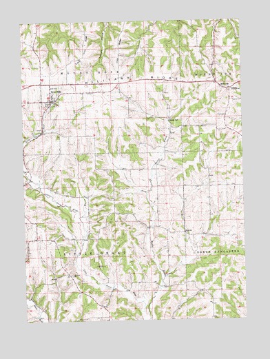
Mount Hope, WI USGS Topographic Map
Click on map above to begin viewing in our Map Viewer.

This topographic map contains these locations and features:
Feature Name Type Latitude Longitude GNIS ID View Map
0.37 ReservoirReservoirN42.8767°W90.7518°1792556View Map
Badger SchoolSchoolN42.9117°W90.7840°1561074View Map
Borah CemeteryCemeteryN42.9605°W90.7598°1562075View Map
C Jeidy Farms AirportAirportN42.8952°W90.8641°1581893View Map
Casler CemeteryCemeteryN42.9705°W90.8337°1562774View Map
Fennimore Community SchoolSchoolN42.9714°W90.7562°1564907View Map
Hidden Valley FarmLocaleN42.9231°W90.7603°2709129View Map
Hutchinson FarmLocaleN42.9767°W90.8064°2709183View Map
Irish RidgeRidgeN42.9975°W90.8154°1566955View Map
Jam DairyLocaleN42.9692°W90.8144°2709186View Map
Little Grant CemeteryCemeteryN42.8941°W90.8485°1568265View Map
Little Grant FarmsLocaleN42.8886°W90.8161°2709145View Map
Little Irish RidgeRidgeN42.9953°W90.8382°1568284View Map
Mount HopePopulated PlaceN42.9672°W90.8590°1569807View Map
Mount Hope Volunteer Fire DepartmentBuildingN42.9669°W90.8580°2697920View Map
Mount IdaPopulated PlaceN42.9719°W90.7610°1569818View Map
Pleasant Valley FarmsLocaleN42.9361°W90.7972°2709185View Map
Pluemer G8020 DamDamN42.8767°W90.7518°1792555View Map
Shady DellPopulated PlaceN42.9589°W90.7912°1577819View Map
Town of Little GrantCivilN42.9016°W90.8433°1583583View Map
Town of Mount HopeCivilN42.9816°W90.8435°1583762View Map
Village of Mount HopeCivilN42.9696°W90.8591°1583761View Map

Note: Coordinates in the location and feature list above are referenced to NAD83 datum.


Copyright (C) 2008-2025 Ryan Niemi / Sunset Dynamics ... All Rights Reserved