TopoQuest Logo
Do you find TopoQuest useful?
Help keep TopoQuest running and adding new maps/features by donating!
Bitcoin:  19c7KJd3qBynnjoSw5npx9KScwjBe4ifkT
Litecoin:  LXs6TkuXGGXo1vDsWCkWVdjQX94eUKd6ui
Home View Maps Find Maps Find Places Resources & Links


Lanett North, Alabama Topographic Map

USGS Map Title: Lanett North, AL
USGS Map MRC: 32085H2
DRG (GeoTIFF) Download: o32085h2.tif


Neighboring USGS Topographic Map Quads:


  Five Points, AL  
33085A3
 

  Abbottsford, GA  
33085A2
 

  La Grange, GA  
33085A1
 

  Fredonia, AL  
32085H3
 

  Lanett North, AL  
32085H2
 

  Cannonville, GA  
32085H1
 

  Cusseta, AL  
32085G3
 

  Lanett South, AL  
32085G2
 

  Whitesville, GA  
32085G1


Map MRC Location:

N33°
W86°
N33°
W85°
H8 H7 H6 H5 H4 H3 H2 H1
G8 G7 G6 G5 G4 G3 G2 G1
F8 F7 F6 F5 F4 F3 F2 F1
E8 E7 E6 E5 E4 E3 E2 E1
D8 D7 D6 D5 D4 D3 D2 D1
C8 C7 C6 C5 C4 C3 C2 C1
B8 B7 B6 B5 B4 B3 B2 B1
A8 A7 A6 A5 A4 A3 A2 A1
N32°
W86°
N32°
W85°

Lanett North, AL USGS 1:24K Topographic Map Preview:
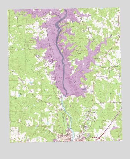
Lanett North, AL USGS Topographic Map
Click on map above to begin viewing in our Map Viewer.

This topographic map contains these locations and features:
Feature Name Type Latitude Longitude GNIS ID View Map
Amity ParkParkN32.9765°W85.2138°136010View Map
Barrow CreekStreamN32.9035°W85.2288°113515View Map
Bethel ChurchChurchN32.8979°W85.1624°311187View Map
Bethlehem Baptist ChurchChurchN32.8760°W85.1697°1673176View Map
Bird Creek Recreation AreaParkN32.9851°W85.1836°1673177View Map
Burnt Village MarinaLocaleN32.9507°W85.2033°163374View Map
Burnt Village ParkParkN32.9501°W85.2083°136017View Map
Center SchoolSchoolN32.9732°W85.1261°355087View Map
City of West PointCivilN32.8949°W85.1458°2405716View Map
Earl Cook Recreation AreaParkN32.9918°W85.1727°1673190View Map
Ebernezer Baptist ChurchChurchN32.8754°W85.1966°155385View Map
Emmanuel Chapel Methodist ChurchChurchN32.8757°W85.1683°1673191View Map
Evening Spring ChurchChurchN32.8779°W85.2447°118076View Map
Exit 1CrossingN32.8779°W85.1516°1673192View Map
First Baptist ChurchChurchN32.8757°W85.1772°1673200View Map
First Christian ChurchChurchN32.8776°W85.1822°1673201View Map
Forty Tyler CemeteryCemeteryN32.8832°W85.1869°314301View Map
Friendship CemeteryCemeteryN32.9357°W85.1266°314388View Map
Friendship ChurchChurchN32.9429°W85.1311°314414View Map
GabbettvillePopulated PlaceN32.9446°W85.1333°331781View Map
Grace DamDamN32.9985°W85.1466°340463View Map
Grace LakeReservoirN32.9998°W85.1452°340464View Map
Hairston IslandIslandN32.9935°W85.1861°315012View Map
Hardley CreekStreamN32.9123°W85.1924°164065View Map
Hardley Creek Recreation AreaParkN32.9168°W85.1927°1673213View Map
Harrell LakeReservoirN32.8870°W85.1337°337568View Map
Harrell Lake DamDamN32.8868°W85.1366°337567View Map
Hawkes Childrens Library of West PointBuildingN32.8768°W85.1816°1673215View Map
Hill LakeReservoirN32.9189°W85.2383°120106View Map
Hillcrest GardenCemeteryN32.8765°W85.2294°120122View Map
Jones DamDamN32.9318°W85.2233°131104View Map
Jones LakeReservoirN32.9313°W85.2254°131105View Map
Lakeview Fire and RescueBuildingN32.9107°W85.2054°2691484View Map
Lanier Baptist ChurchChurchN32.9118°W85.2083°151990View Map
Lanier DamDamN32.8935°W85.2066°131084View Map
Lanier LakeReservoirN32.8929°W85.2073°131085View Map
Lanier Memorial ChurchChurchN32.8998°W85.1644°316646View Map
Long CanePopulated PlaceN32.9565°W85.1408°326374View Map
Long Cane Baptist ChurchChurchN32.9604°W85.1349°1673239View Map
Long Cane CemeteryCemeteryN32.9607°W85.1377°1673240View Map
Long Cane Elementary SchoolSchoolN32.9594°W85.1290°2545676View Map
Long Cane Methodist ChurchChurchN32.9607°W85.1380°1673241View Map
Long Cane Middle SchoolSchoolN32.9588°W85.1258°2545675View Map
Long Game Recreation AreaParkN32.9537°W85.1513°1673242View Map
Lovelace CemeteryCemeteryN32.9098°W85.1560°317442View Map
Maple CreekStreamN32.9201°W85.1847°317675View Map
Maple Creek ParkParkN32.9598°W85.1708°1673245View Map
North West PointPopulated PlaceN32.9032°W85.1599°332517View Map
Oakland Recreation ParkParkN32.9987°W85.2208°136077View Map
Old Atkinson CrossingPopulated PlaceN32.9635°W85.2349°156828View Map
Oseligee CreekStreamN32.8890°W85.1833°152824View Map
Piedmont HeightsPopulated PlaceN32.9915°W85.2077°326468View Map
Pine Grove School (historical)SchoolN32.9135°W85.1574°1673259View Map
Pinewood CemeteryCemeteryN32.8801°W85.1713°320686View Map
Potts Road Recreation AreaParkN32.9710°W85.1808°1673268View Map
R Shaefer Heard ParkParkN32.9273°W85.1638°1673269View Map
Reeds ChapelChurchN32.9135°W85.1569°321435View Map
Rocky Point Recreation AreaParkN32.9904°W85.2091°136083View Map
Rocky Point Recreational AreaParkN32.9904°W85.2091°1673274View Map
Saint John ChurchChurchN32.9285°W85.2011°164183View Map
Saint Paul African Methodist Episcopal ChurchChurchN32.8787°W85.1913°150879View Map
Saint Paul ChurchChurchN32.9593°W85.1466°1673276View Map
Sardis ChurchChurchN32.8937°W85.2386°126412View Map
Simmons DamDamN32.8907°W85.2197°131081View Map
Simmons LakeReservoirN32.8892°W85.2206°136087View Map
Tenth Street SchoolSchoolN32.8765°W85.1702°324006View Map
Timmons DamDamN32.9201°W85.2333°131096View Map
Timmons LakeReservoirN32.9201°W85.2333°131095View Map
Traylor CemeteryCemeteryN32.9398°W85.1508°324281View Map
Troup County Fire Department Station 6BuildingN32.9182°W85.1542°2604923View Map
Tyler EstatesPopulated PlaceN32.9548°W85.1497°1673303View Map
Valley HospitalHospitalN32.8860°W85.1838°324655View Map
Veasey Creek Recreation AreaParkN32.9971°W85.2333°164184View Map
Veasey Park Picnic AreaParkN32.9890°W85.2348°2647133View Map
WCJM-FM (West Point)TowerN32.8951°W85.1588°352825View Map
Webb DamDamN32.9185°W85.1283°340461View Map
Webb LakeReservoirN32.9184°W85.1273°340462View Map
Wehadkee CreekStreamN32.9901°W85.1913°154501View Map
West Lake Recreation AreaParkN32.9690°W85.2249°136107View Map
West Over Look AreaParkN32.9348°W85.2013°136108View Map
West PointPopulated PlaceN32.8779°W85.1833°333394View Map
West Point BridgeBridgeN32.8765°W85.1811°1673311View Map
West Point City HallBuildingN32.8779°W85.1827°1673312View Map
West Point City Police DepartmentBuildingN32.8763°W85.1820°2733615View Map
West Point DamDamN32.9182°W85.1877°337181View Map
West Point Elementary SchoolSchoolN32.8806°W85.1628°315208View Map
West Point Fire DepartmentBuildingN32.8875°W85.1438°2603544View Map
West Point First Christian ChurchChurchN32.8851°W85.2055°136109View Map
West Point High SchoolSchoolN32.8787°W85.1741°1673314View Map
West Point Post OfficePost OfficeN32.8773°W85.1852°1673315View Map
West Point Presbyterian ChurchChurchN32.8798°W85.1849°1673316View Map
West Point WaterworksLocaleN32.8876°W85.1841°1673317View Map
WPLV-AM (West Point)TowerN32.8951°W85.1588°352595View Map

Note: Coordinates in the location and feature list above are referenced to NAD83 datum.


Copyright (C) 2008-2024 Ryan Niemi / Sunset Dynamics ... All Rights Reserved