TopoQuest Logo
Do you find TopoQuest useful?
Help keep TopoQuest running and adding new maps/features by donating!
Bitcoin:  19c7KJd3qBynnjoSw5npx9KScwjBe4ifkT
Litecoin:  LXs6TkuXGGXo1vDsWCkWVdjQX94eUKd6ui
Home View Maps Find Maps Find Places Resources & Links


Five Points, Alabama Topographic Map

USGS Map Title: Five Points, AL
USGS Map MRC: 33085A3
DRG (GeoTIFF) Download: o33085a3.tif


Neighboring USGS Topographic Map Quads:


  Roanoke West, AL  
33085B4
 

  Roanoke East, AL  
33085B3
 

  Glenn, GA  
33085B2
 

  Milltown, AL  
33085A4
 

  Five Points, AL  
33085A3
 

  Abbottsford, GA  
33085A2
 

  Lafayette, AL  
32085H4
 

  Fredonia, AL  
32085H3
 

  Lanett North, AL  
32085H2


Map MRC Location:

N34°
W86°
N34°
W85°
H8 H7 H6 H5 H4 H3 H2 H1
G8 G7 G6 G5 G4 G3 G2 G1
F8 F7 F6 F5 F4 F3 F2 F1
E8 E7 E6 E5 E4 E3 E2 E1
D8 D7 D6 D5 D4 D3 D2 D1
C8 C7 C6 C5 C4 C3 C2 C1
B8 B7 B6 B5 B4 B3 B2 B1
A8 A7 A6 A5 A4 A3 A2 A1
N33°
W86°
N33°
W85°

Five Points, AL USGS 1:24K Topographic Map Preview:
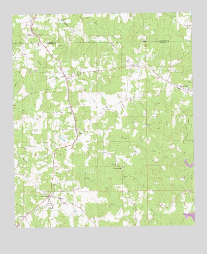
Five Points, AL USGS Topographic Map
Click on map above to begin viewing in our Map Viewer.

This topographic map contains these locations and features:
Feature Name Type Latitude Longitude GNIS ID View Map
Baker DamDamN33.0918°W85.2699°131200View Map
Baker LakeReservoirN33.0916°W85.2718°131199View Map
Belcher CreekStreamN33.0687°W85.3622°113838View Map
Bethel Baptist ChurchChurchN33.0879°W85.3472°114060View Map
Bethel CemeteryCemeteryN33.0873°W85.3463°147434View Map
Byron (historical)LocaleN33.1154°W85.3294°163253View Map
Cannan ChurchChurchN33.0910°W85.3180°164036View Map
Cedric (historical)LocaleN33.1071°W85.2866°164181View Map
Cumbee MillPopulated PlaceN33.0687°W85.3141°156239View Map
Dawson Day DamDamN33.0051°W85.3333°131143View Map
Days LakeReservoirN33.0051°W85.3333°131144View Map
FinleyPopulated PlaceN33.0596°W85.2830°156346View Map
Finley CreekStreamN33.0376°W85.2561°118289View Map
Finney CemeteryCemeteryN33.0312°W85.3691°136044View Map
Five PointsPopulated PlaceN33.0182°W85.3502°118333View Map
Five Points Baptist ChurchChurchN33.0196°W85.3538°151022View Map
Five Points DivisionCivilN33.0377°W85.3235°165680View Map
Five Points High SchoolSchoolN33.0173°W85.3433°136052View Map
Five Points Post OfficePost OfficeN33.0181°W85.3510°169220View Map
Five Points Volunteer Fire DepartmentBuildingN33.0182°W85.3509°2691490View Map
Friendship ChurchChurchN33.1160°W85.2527°118689View Map
Gay CreekStreamN33.0132°W85.3022°118878View Map
Gladney Mill BranchStreamN33.1226°W85.3213°119017View Map
Grady LakeReservoirN33.0519°W85.3411°119206View Map
Gross BranchStreamN33.0696°W85.2966°119437View Map
Hickory FlatLocaleN33.0943°W85.2883°155097View Map
Hornyhead BranchStreamN33.1223°W85.3213°120401View Map
Lanes ChapelChurchN33.1129°W85.3647°121376View Map
Langley DamDamN33.0635°W85.2749°131183View Map
Langley LakeReservoirN33.0637°W85.2765°131184View Map
Lee BranchStreamN33.0465°W85.2566°121459View Map
Meacham CreekStreamN33.1165°W85.3122°122609View Map
Mount Pisgah ChurchChurchN33.0671°W85.3352°123342View Map
Phillips High SchoolSchoolN33.0115°W85.3488°124691View Map
Post Oak ForkLocaleN33.0340°W85.3008°125200View Map
Robinson DamDamN33.0518°W85.3433°131182View Map
Rock SpringSpringN33.0401°W85.2583°136082View Map
Saint Pauls ChurchChurchN33.0137°W85.3497°126189View Map
Sky View Memorial CemeteryCemeteryN33.0732°W85.3369°163389View Map
Spencer DamDamN33.1001°W85.2783°131209View Map
Spencer LakeReservoirN33.1001°W85.2783°131210View Map
Standing RockPopulated PlaceN33.0798°W85.2530°127300View Map
Standing Rock CemeteryCemeteryN33.0787°W85.2519°1805655View Map
Standing Rock ChurchChurchN33.0815°W85.2583°136090View Map
Standing Rock ChurchChurchN33.0790°W85.2519°163390View Map
Standing Rock Volunteer Fire Department Station 1BuildingN33.0798°W85.2533°2691485View Map
Standing Rock Volunteer Fire Department Station 2BuildingN33.0933°W85.2876°2691294View Map
Stricklands LakeReservoirN33.0986°W85.2774°136091View Map
Stricklands Lake DamDamN33.0996°W85.2763°131213View Map
StroudPopulated PlaceN33.0548°W85.3308°127474View Map
Sweet Home ChurchChurchN33.0360°W85.3044°127583View Map
Town of Five PointsCivilN33.0173°W85.3516°2406498View Map
WelchPopulated PlaceN33.0882°W85.3394°128716View Map

Note: Coordinates in the location and feature list above are referenced to NAD83 datum.


Copyright (C) 2008-2024 Ryan Niemi / Sunset Dynamics ... All Rights Reserved