TopoQuest Logo
Do you find TopoQuest useful?
Help keep TopoQuest running and adding new maps/features by donating!
Bitcoin:  19c7KJd3qBynnjoSw5npx9KScwjBe4ifkT
Litecoin:  LXs6TkuXGGXo1vDsWCkWVdjQX94eUKd6ui
Home View Maps Find Maps Find Places Resources & Links


Abbottsford, Georgia Topographic Map

USGS Map Title: Abbottsford, GA
USGS Map MRC: 33085A2
DRG (GeoTIFF) Download: o33085a2.tif


Neighboring USGS Topographic Map Quads:


  Roanoke East, AL  
33085B3
 

  Glenn, GA  
33085B2
 

  Hillcrest, GA  
33085B1
 

  Five Points, AL  
33085A3
 

  Abbottsford, GA  
33085A2
 

  La Grange, GA  
33085A1
 

  Fredonia, AL  
32085H3
 

  Lanett North, AL  
32085H2
 

  Cannonville, GA  
32085H1


Map MRC Location:

N34°
W86°
N34°
W85°
H8 H7 H6 H5 H4 H3 H2 H1
G8 G7 G6 G5 G4 G3 G2 G1
F8 F7 F6 F5 F4 F3 F2 F1
E8 E7 E6 E5 E4 E3 E2 E1
D8 D7 D6 D5 D4 D3 D2 D1
C8 C7 C6 C5 C4 C3 C2 C1
B8 B7 B6 B5 B4 B3 B2 B1
A8 A7 A6 A5 A4 A3 A2 A1
N33°
W86°
N33°
W85°

Abbottsford, GA USGS 1:24K Topographic Map Preview:
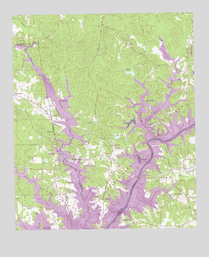
Abbottsford, GA USGS Topographic Map
Click on map above to begin viewing in our Map Viewer.

This topographic map contains these locations and features:
Feature Name Type Latitude Longitude GNIS ID View Map
AbbottsfordPopulated PlaceN33.0473°W85.1797°330994View Map
Abbottsford DivisionCivilN33.1007°W85.1524°1936065View Map
AntiochPopulated PlaceN33.1076°W85.1699°310549View Map
Antioch CemeteryCemeteryN33.1062°W85.1724°1673033View Map
Autry Day Use ParkParkN33.0673°W85.1391°1673038View Map
Bethlehem ChurchChurchN33.0576°W85.2233°114131View Map
Birdsong BridgeBridgeN33.0596°W85.1258°354737View Map
Birdsongs Store (historical)LocaleN33.0651°W85.1272°1673170View Map
Briarcreek EstatesPopulated PlaceN33.0476°W85.1638°1673042View Map
Caney CreekStreamN33.0679°W85.2149°312307View Map
Caney Creek Recreational AreaParkN33.0773°W85.2166°1673047View Map
Chattahoochee Boy Scout ReservationParkN33.0921°W85.1461°1955129View Map
Cofield DamDamN33.0535°W85.1772°340178View Map
Cofield LakeReservoirN33.0536°W85.1795°312800View Map
Colony HeightsPopulated PlaceN33.0043°W85.1336°1673058View Map
Covered BridgePopulated PlaceN33.0865°W85.1524°1673060View Map
Crowder (historical)Populated PlaceN33.0121°W85.1791°1673062View Map
Cunningham DamDamN33.0385°W85.2283°131169View Map
Cunningham LakeReservoirN33.0401°W85.2281°131170View Map
Cuss CreekStreamN33.1065°W85.2397°119516View Map
Darden DamDamN33.0018°W85.1283°340176View Map
Darden LakeReservoirN33.0022°W85.1283°340177View Map
Dewberry Recreation AreaParkN33.0432°W85.2208°136034View Map
EvansvillePopulated PlaceN33.0662°W85.2241°331675View Map
Evansville Recreation AreaParkN33.0693°W85.2213°1673072View Map
Fellowship LakeLakeN33.0612°W85.1697°314100View Map
Freeman CemeteryCemeteryN33.0798°W85.1960°1673080View Map
Garrett Family CemeteryCemeteryN33.0978°W85.2228°2761009View Map
Glass BridgeBridgeN33.0082°W85.1794°314634View Map
Glass Bridge Recreation AreaParkN33.0048°W85.1719°1673082View Map
Hagedon Lake DamDamN33.0907°W85.1672°340609View Map
Hagedons LakeLakeN33.0906°W85.1687°315008View Map
Harmony CemeteryCemeteryN33.0412°W85.1969°1673087View Map
Harmony ChurchChurchN33.0412°W85.1969°356182View Map
Hawthorn Ferry (historical)LocaleN33.0596°W85.1261°1673216View Map
HeatherbrookPopulated PlaceN33.0215°W85.1399°1673089View Map
Heritage HillsPopulated PlaceN33.0043°W85.1402°1673090View Map
Holiday ParkParkN33.0262°W85.1788°1673097View Map
Hudson DamDamN33.0768°W85.2299°131189View Map
Hudson LakeReservoirN33.0768°W85.2299°131190View Map
HuntingtonPopulated PlaceN33.0223°W85.1288°1673099View Map
Lakeshore EstatesPopulated PlaceN33.0401°W85.1386°1673103View Map
Lanier Lake (historical)LakeN33.0401°W85.1636°316645View Map
Lewis LakeReservoirN33.0251°W85.1283°337576View Map
Lewis Lake DamDamN33.0251°W85.1283°337575View Map
Liberty Hill Recreation AreaParkN33.1035°W85.1258°1673169View Map
Loyd Chapel CemeteryCemeteryN33.0048°W85.1260°1673106View Map
Loyd ChurchChurchN33.0048°W85.1266°317469View Map
McCosh MillPopulated PlaceN33.1079°W85.2358°156680View Map
McGee Bridge (historical)BridgeN33.0596°W85.1263°1673107View Map
Midway ChurchChurchN33.1243°W85.1297°318127View Map
North LakePopulated PlaceN33.0421°W85.1349°1673112View Map
OaklandPopulated PlaceN33.0137°W85.2388°156819View Map
Pleasant Grove ChurchChurchN33.0204°W85.1352°320822View Map
Pleasant Grove School (historical)SchoolN33.0204°W85.1349°1673117View Map
PynePopulated PlaceN33.0340°W85.1261°332769View Map
Pyne ParkParkN33.0293°W85.1516°1673119View Map
River TracePopulated PlaceN33.0179°W85.1477°1673122View Map
RivercrestPopulated PlaceN33.0090°W85.1541°1673123View Map
RiverridgePopulated PlaceN33.0510°W85.1702°1673124View Map
RiversidePopulated PlaceN33.0446°W85.1299°1673125View Map
RiverviewPopulated PlaceN33.0523°W85.1624°1673126View Map
Rocky Mount CemeteryCemeteryN33.1102°W85.2259°2631065View Map
RosamondPopulated PlaceN33.0015°W85.1572°1673127View Map
Shady OaksPopulated PlaceN33.0118°W85.1330°1673134View Map
Smiths PondReservoirN33.0049°W85.1610°1673135View Map
Standing Rock Census Designated PlaceCensusN33.0863°W85.2450°2582701View Map
State Line ChurchChurchN33.0460°W85.2233°127327View Map
State Line ParkParkN33.0154°W85.2138°1673138View Map
Stroud CreekStreamN33.0007°W85.2069°127476View Map
Timber RidgePopulated PlaceN33.0123°W85.1441°1673139View Map
Troup County Fire Department Station 10BuildingN33.0414°W85.1853°2604590View Map
Turkey PointPopulated PlaceN33.0657°W85.1702°1673144View Map
Veasey CreekStreamN33.0004°W85.2033°153837View Map
VernonPopulated PlaceN33.0601°W85.1580°333324View Map
Vernon (historical)Populated PlaceN33.0571°W85.1616°1673151View Map
Vernon Ferry EstatesPopulated PlaceN33.0368°W85.1333°1673153View Map
Wehadkee CemeteryCemeteryN33.0173°W85.1880°1673157View Map
Wehadkee ChurchChurchN33.0173°W85.1883°324968View Map
Wehadkee ChurchChurchN33.0465°W85.1741°1673158View Map
Wehadkee Creek Recreation AreaParkN33.0401°W85.2066°1673159View Map
West Lake VillagePopulated PlaceN33.0173°W85.1313°1673161View Map
Whatley CemeteryCemeteryN33.1026°W85.1866°1673162View Map
Whitewater CreekStreamN33.0521°W85.1547°325229View Map
Whitewater EstatesPopulated PlaceN33.1012°W85.1583°1673164View Map
Whitewater Recreation AreaParkN33.0737°W85.1555°1673165View Map
Whitewater WoodsPopulated PlaceN33.0565°W85.1636°1673166View Map
Wilson CreekStreamN33.0160°W85.1708°325434View Map

Note: Coordinates in the location and feature list above are referenced to NAD83 datum.


Copyright (C) 2008-2025 Ryan Niemi / Sunset Dynamics ... All Rights Reserved