TopoQuest Logo
Do you find TopoQuest useful?
Help keep TopoQuest running and adding new maps/features by donating!
Bitcoin:  19c7KJd3qBynnjoSw5npx9KScwjBe4ifkT
Litecoin:  LXs6TkuXGGXo1vDsWCkWVdjQX94eUKd6ui
Home View Maps Find Maps Find Places Resources & Links


Langford, New York Topographic Map

USGS Map Title: Langford, NY
USGS Map MRC: 42078E7
DRG (GeoTIFF) Download: o42078e7.tif


Neighboring USGS Topographic Map Quads:


  Eden, NY  
42078F8
 

  Hamburg, NY  
42078F7
 

  Colden, NY  
42078F6
 

  North Collins, NY  
42078E8
 

  Langford, NY  
42078E7
 

  Springville, NY  
42078E6
 

  Gowanda, NY  
42078D8
 

  Collins Center, NY  
42078D7
 

  Ashford Hollow, NY  
42078D6


Map MRC Location:

N43°
W79°
N43°
W78°
H8 H7 H6 H5 H4 H3 H2 H1
G8 G7 G6 G5 G4 G3 G2 G1
F8 F7 F6 F5 F4 F3 F2 F1
E8 E7 E6 E5 E4 E3 E2 E1
D8 D7 D6 D5 D4 D3 D2 D1
C8 C7 C6 C5 C4 C3 C2 C1
B8 B7 B6 B5 B4 B3 B2 B1
A8 A7 A6 A5 A4 A3 A2 A1
N42°
W79°
N42°
W78°

Langford, NY USGS 1:24K Topographic Map Preview:
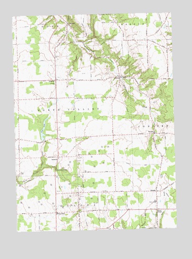
Langford, NY USGS Topographic Map
Click on map above to begin viewing in our Map Viewer.

This topographic map contains these locations and features:
Feature Name Type Latitude Longitude GNIS ID View Map
Boston Volunteer Fire Company Station 2BuildingN42.6115°W78.7696°2735243View Map
Camp Hemlock RidgeLocaleN42.5353°W78.8439°945593View Map
ClarksburgPopulated PlaceN42.6198°W78.8314°946788View Map
Clear LakeReservoirN42.5534°W78.8520°946820View Map
Dittman CemeteryCemeteryN42.6009°W78.8423°948489View Map
Eden Valley Golf CourseLocaleN42.6021°W78.8349°2715024View Map
Jennings CreekStreamN42.6078°W78.8236°953993View Map
LangfordPopulated PlaceN42.5876°W78.8420°955036View Map
Langford - New Oregon Volunteer Fire CompanyBuildingN42.5870°W78.8397°2735260View Map
MarshfieldPopulated PlaceN42.5428°W78.8417°956574View Map
Morton CornersPopulated PlaceN42.5112°W78.7650°957718View Map
Mortons Corners Baptist ChurchChurchN42.5154°W78.7656°957720View Map
Mortons Corners Volunteer Fire DepartmentBuildingN42.5149°W78.7649°2735262View Map
New OregonPopulated PlaceN42.5884°W78.7917°958442View Map
Richmond Farms DairyLocaleN42.5900°W78.8694°2703291View Map
Saint Martins ChurchChurchN42.5851°W78.8423°963858View Map
Saint Marys ChurchChurchN42.5884°W78.7923°963941View Map
Town of North CollinsCivilN42.5708°W78.8638°979283View Map
Whites CornersLocaleN42.5106°W78.8442°971158View Map
WoodsidePopulated PlaceN42.5217°W78.7650°973293View Map
WyandalePopulated PlaceN42.5553°W78.7656°971768View Map

Note: Coordinates in the location and feature list above are referenced to NAD83 datum.


Copyright (C) 2008-2025 Ryan Niemi / Sunset Dynamics ... All Rights Reserved