TopoQuest Logo
Do you find TopoQuest useful?
Help keep TopoQuest running and adding new maps/features by donating!
Bitcoin:  19c7KJd3qBynnjoSw5npx9KScwjBe4ifkT
Litecoin:  LXs6TkuXGGXo1vDsWCkWVdjQX94eUKd6ui
Home View Maps Find Maps Find Places Resources & Links


Langston, Louisiana Topographic Map

USGS Map Title: Langston, LA
USGS Map MRC: 32093F2
DRG (GeoTIFF) Download: o32093f2.tif


Neighboring USGS Topographic Map Quads:


  Leton, LA  
32093G3
 

  Blackburn, LA  
32093G2
 

  Homer, LA  
32093G1
 

  Minden North, LA  
32093F3
 

  Langston, LA  
32093F2
 

  Athens, LA  
32093F1
 

  Minden South, LA  
32093E3
 

  Ada, LA  
32093E2
 

  Gibsland, LA  
32093E1


Map MRC Location:

N33°
W94°
N33°
W93°
H8 H7 H6 H5 H4 H3 H2 H1
G8 G7 G6 G5 G4 G3 G2 G1
F8 F7 F6 F5 F4 F3 F2 F1
E8 E7 E6 E5 E4 E3 E2 E1
D8 D7 D6 D5 D4 D3 D2 D1
C8 C7 C6 C5 C4 C3 C2 C1
B8 B7 B6 B5 B4 B3 B2 B1
A8 A7 A6 A5 A4 A3 A2 A1
N32°
W94°
N32°
W93°

Langston, LA USGS 1:24K Topographic Map Preview:
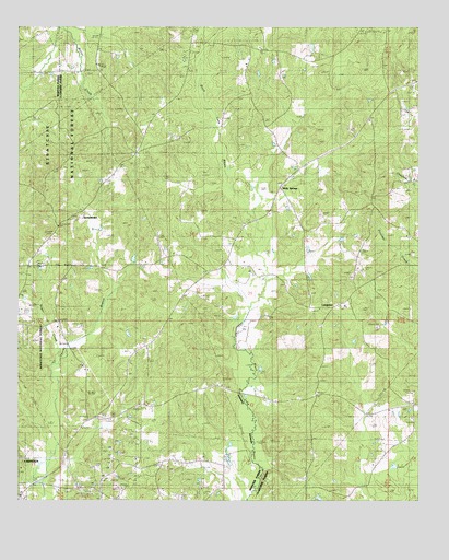
Langston, LA USGS Topographic Map
Click on map above to begin viewing in our Map Viewer.

This topographic map contains these locations and features:
Feature Name Type Latitude Longitude GNIS ID View Map
Alexander #2 CemeteryCemeteryN32.6499°W93.1257°532102View Map
Alexander CemeteryCemeteryN32.6999°W93.1827°546957View Map
Antioch SchoolSchoolN32.6690°W93.2074°546978View Map
Carter CemeteryCemeteryN32.7440°W93.2129°547195View Map
Dutchtown Lookout TowerTowerN32.6957°W93.2393°544515View Map
GermantownPopulated PlaceN32.7001°W93.2310°540798View Map
Germantown Baptist ChurchChurchN32.6876°W93.2441°554524View Map
Germantown CemeteryCemeteryN32.6999°W93.2327°547392View Map
Germantown Lookout TowerTowerN32.6957°W93.2391°1630039View Map
Harris SchoolSchoolN32.6765°W93.1485°547444View Map
Holly SpringsPopulated PlaceN32.7079°W93.1685°540779View Map
Holly Springs Baptist ChurchChurchN32.7082°W93.1685°554737View Map
Holly Springs CemeteryCemeteryN32.7085°W93.1688°544134View Map
LangstonPopulated PlaceN32.6763°W93.1524°547563View Map
Mayflower SchoolSchoolN32.6282°W93.1599°547657View Map
Miller CemeteryCemeteryN32.7366°W93.1681°547719View Map
Miller ChapelChurchN32.7013°W93.2371°547720View Map
Miller Family CemeteryCemeteryN32.7190°W93.1811°547718View Map
Minden Oil and Gas FieldOilfieldN32.6279°W93.2054°544517View Map
Mount Zion CemeteryCemeteryN32.6472°W93.2216°547760View Map
Oil Field ChurchChurchN32.7343°W93.1363°547793View Map
Pine Grove SchoolSchoolN32.6793°W93.1593°547844View Map
Rocky Comfort School (historical)SchoolN32.6726°W93.2374°544516View Map
Rocky Ridge SchoolSchoolN32.7340°W93.1304°547909View Map
Sanctified ChurchChurchN32.7238°W93.1946°547952View Map
Springhill CemeteryCemeteryN32.7452°W93.1951°547654View Map
Springhill ChurchChurchN32.7415°W93.2104°548026View Map
Sugar CreekStreamN32.6610°W93.2393°548044View Map
Ward FourCivilN32.7426°W93.1716°544984View Map
Webster Parish Fire District 10BuildingN32.6868°W93.2471°2672770View Map

Note: Coordinates in the location and feature list above are referenced to NAD83 datum.


Copyright (C) 2008-2025 Ryan Niemi / Sunset Dynamics ... All Rights Reserved