TopoQuest Logo
Do you find TopoQuest useful?
Help keep TopoQuest running and adding new maps/features by donating!
Bitcoin:  19c7KJd3qBynnjoSw5npx9KScwjBe4ifkT
Litecoin:  LXs6TkuXGGXo1vDsWCkWVdjQX94eUKd6ui
Home View Maps Find Maps Find Places Resources & Links


Leton, Louisiana Topographic Map

USGS Map Title: Leton, LA
USGS Map MRC: 32093G3
DRG (GeoTIFF) Download: o32093g3.tif


Neighboring USGS Topographic Map Quads:


  Cullen, LA  
32093H4
 

  Shongaloo, LA  
32093H3
 

  Haynesville West, LA  
32093H2
 

  Cotton Valley, LA  
32093G4
 

  Leton, LA  
32093G3
 

  Blackburn, LA  
32093G2
 

  Hortman, LA  
32093F4
 

  Minden North, LA  
32093F3
 

  Langston, LA  
32093F2


Map MRC Location:

N33°
W94°
N33°
W93°
H8 H7 H6 H5 H4 H3 H2 H1
G8 G7 G6 G5 G4 G3 G2 G1
F8 F7 F6 F5 F4 F3 F2 F1
E8 E7 E6 E5 E4 E3 E2 E1
D8 D7 D6 D5 D4 D3 D2 D1
C8 C7 C6 C5 C4 C3 C2 C1
B8 B7 B6 B5 B4 B3 B2 B1
A8 A7 A6 A5 A4 A3 A2 A1
N32°
W94°
N32°
W93°

Leton, LA USGS 1:24K Topographic Map Preview:
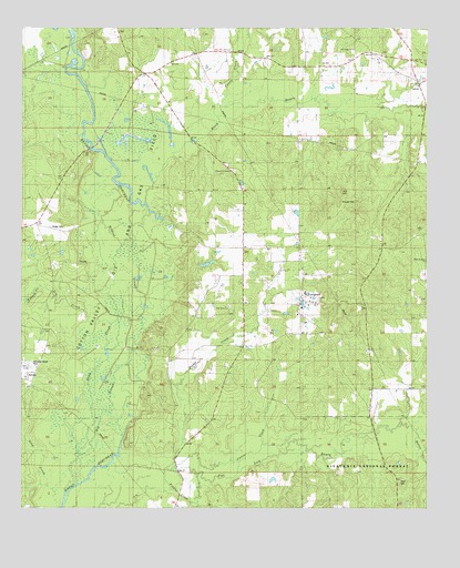
Leton, LA USGS Topographic Map
Click on map above to begin viewing in our Map Viewer.

This topographic map contains these locations and features:
Feature Name Type Latitude Longitude GNIS ID View Map
Alexandria Mill (historical)LocaleN32.7918°W93.3604°544486View Map
Beulahs Mount Church (historical)ChurchN32.7813°W93.2674°544492View Map
Big MoundSummitN32.8307°W93.3443°544568View Map
Big SloughGutN32.7779°W93.3499°533107View Map
Black BayouStreamN32.8290°W93.3377°553672View Map
Bull HillSummitN32.8321°W93.2766°543042View Map
Butler CreekStreamN32.7696°W93.2524°547284View Map
Caney CreekStreamN32.8460°W93.3266°533749View Map
Canon CreekStreamN32.7574°W93.3191°533758View Map
Church of ChristChurchN32.8379°W93.3110°540877View Map
Cotton Valley Oil and Gas FieldOilfieldN32.8218°W93.3532°554096View Map
Crow CemeteryCemeteryN32.7576°W93.2577°540878View Map
Davis School (historical)SchoolN32.8088°W93.3657°544487View Map
Davis SloughGutN32.7799°W93.3549°534412View Map
Dorcheat Lodge (historical)LocaleN32.8451°W93.2904°544495View Map
Dry CreekStreamN32.7904°W93.3493°534615View Map
Evergreen ChurchChurchN32.8004°W93.2907°534869View Map
Evergreen Fire DepartmentBuildingN32.8068°W93.2884°2672958View Map
Fiddler CreekStreamN32.7596°W93.3307°547255View Map
Flat Lick BayouStreamN32.7518°W93.3213°554433View Map
French CreekStreamN32.8074°W93.3702°535100View Map
Gleason Store (historical)LocaleN32.8335°W93.2941°544491View Map
Gray CreekStreamN32.7549°W93.3610°554602View Map
Hodge CemeteryCemeteryN32.8229°W93.3668°535685View Map
Holder CreekStreamN32.7615°W93.3474°535712View Map
Hope Youth Ranch Alternative Center SchoolSchoolN32.8061°W93.2878°534873View Map
LetonPopulated PlaceN32.8601°W93.2527°536410View Map
Lindsey School (historical)SchoolN32.8110°W93.3124°544490View Map
New Saint Luke Church (historical)ChurchN32.8029°W93.2616°544493View Map
New Zion ChurchChurchN32.8018°W93.3121°537654View Map
Old Union ChurchChurchN32.8696°W93.2735°556297View Map
Parish Governing Authority District 4CivilN32.8496°W93.3012°1930044View Map
Pilgrims Rest ChurchChurchN32.8143°W93.2504°538149View Map
Rosenwald SchoolSchoolN32.7504°W93.3274°538725View Map
Saint Luke CemeteryCemeteryN32.8299°W93.2768°538942View Map
Saint Luke Church (historical)ChurchN32.8265°W93.2710°544494View Map
Sims School (historical)SchoolN32.7779°W93.3068°544489View Map
Union Grove Church (historical)ChurchN32.7507°W93.3274°544488View Map
Wildcat SloughLakeN32.8099°W93.3397°540404View Map

Note: Coordinates in the location and feature list above are referenced to NAD83 datum.


Copyright (C) 2008-2025 Ryan Niemi / Sunset Dynamics ... All Rights Reserved