TopoQuest Logo
Do you find TopoQuest useful?
Help keep TopoQuest running and adding new maps/features by donating!
Bitcoin:  19c7KJd3qBynnjoSw5npx9KScwjBe4ifkT
Litecoin:  LXs6TkuXGGXo1vDsWCkWVdjQX94eUKd6ui
Home View Maps Find Maps Find Places Resources & Links


Tan Oak Park, California Topographic Map

USGS Map Title: Tan Oak Park, CA
USGS Map MRC: 39123G5
DRG (GeoTIFF) Download: o39123g5.tif


Neighboring USGS Topographic Map Quads:


  Noble Butte, CA  
39123H6
 

  Bell Springs, CA  
39123H5
 

  Updegraff Ridge, CA  
39123H4
 

  Leggett, CA  
39123G6
 

  Tan Oak Park, CA  
39123G5
 

  Iron Peak, CA  
39123G4
 

  Lincoln Ridge, CA  
39123F6
 

  Cahto Peak, CA  
39123F5
 

  Laytonville, CA  
39123F4


Map MRC Location:

N40°
W124°
N40°
W123°
H8 H7 H6 H5 H4 H3 H2 H1
G8 G7 G6 G5 G4 G3 G2 G1
F8 F7 F6 F5 F4 F3 F2 F1
E8 E7 E6 E5 E4 E3 E2 E1
D8 D7 D6 D5 D4 D3 D2 D1
C8 C7 C6 C5 C4 C3 C2 C1
B8 B7 B6 B5 B4 B3 B2 B1
A8 A7 A6 A5 A4 A3 A2 A1
N39°
W124°
N39°
W123°

Tan Oak Park, CA USGS 1:24K Topographic Map Preview:
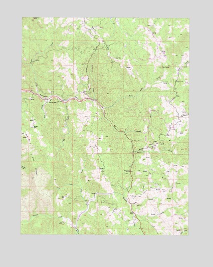
Tan Oak Park, CA USGS Topographic Map
Click on map above to begin viewing in our Map Viewer.

This topographic map contains these locations and features:
Feature Name Type Latitude Longitude GNIS ID View Map
Bald MountainSummitN39.8024°W123.6206°218594View Map
Bald Mountain RanchLocaleN39.8118°W123.6172°218603View Map
Bowman PlacePopulated PlaceN39.7893°W123.5628°1658119View Map
Brush MountainSummitN39.7957°W123.6195°219935View Map
Burns FlatFlatN39.7757°W123.5214°220214View Map
Camp SeabowLocaleN39.7565°W123.5942°220487View Map
Chimney RockSummitN39.8746°W123.6170°1658271View Map
Cold CreekStreamN39.7777°W123.5803°221316View Map
Cow MountainSummitN39.8515°W123.5556°1658331View Map
Cummings CreekStreamN39.8271°W123.5711°221909View Map
Elk CreekStreamN39.8265°W123.5925°223105View Map
Empire (historical)Populated PlaceN39.8260°W123.5942°1666471View Map
Empire Roadside RestParkN39.8268°W123.5942°223204View Map
Foster CreekStreamN39.8310°W123.6142°233894View Map
Grapewine CreekStreamN39.8085°W123.5478°224462View Map
Grub CreekStreamN39.7674°W123.5756°224683View Map
Mad CreekStreamN39.8285°W123.6067°227894View Map
Peterson CreekStreamN39.7543°W123.5853°230570View Map
Rattlesnake SummitSummitN39.7854°W123.5481°231277View Map
Redwine RanchLocaleN39.8088°W123.5081°231407View Map
Spring CreekStreamN39.7674°W123.5436°235237View Map
Spy Rock Elementary SchoolSchoolN39.8126°W123.5130°1724135View Map
Steep GulchValleyN39.7613°W123.5414°235430View Map
Tan Oak ParkPopulated PlaceN39.8277°W123.6042°1659955View Map
Twin RocksSummitN39.8471°W123.5150°1660059View Map
Twin RocksPopulated PlaceN39.8227°W123.5653°1724141View Map
Twin Rocks CreekStreamN39.8232°W123.5659°236716View Map

Note: Coordinates in the location and feature list above are referenced to NAD83 datum.


Copyright (C) 2008-2024 Ryan Niemi / Sunset Dynamics ... All Rights Reserved