TopoQuest Logo
Do you find TopoQuest useful?
Help keep TopoQuest running and adding new maps/features by donating!
Bitcoin:  19c7KJd3qBynnjoSw5npx9KScwjBe4ifkT
Litecoin:  LXs6TkuXGGXo1vDsWCkWVdjQX94eUKd6ui
Home View Maps Find Maps Find Places Resources & Links


Cahto Peak, California Topographic Map

USGS Map Title: Cahto Peak, CA
USGS Map MRC: 39123F5
DRG (GeoTIFF) Download: o39123f5.tif


Neighboring USGS Topographic Map Quads:


  Leggett, CA  
39123G6
 

  Tan Oak Park, CA  
39123G5
 

  Iron Peak, CA  
39123G4
 

  Lincoln Ridge, CA  
39123F6
 

  Cahto Peak, CA  
39123F5
 

  Laytonville, CA  
39123F4
 

  Dutchmans Knoll, CA  
39123E6
 

  Sherwood Peak, CA  
39123E5
 

  Longvale, CA  
39123E4


Map MRC Location:

N40°
W124°
N40°
W123°
H8 H7 H6 H5 H4 H3 H2 H1
G8 G7 G6 G5 G4 G3 G2 G1
F8 F7 F6 F5 F4 F3 F2 F1
E8 E7 E6 E5 E4 E3 E2 E1
D8 D7 D6 D5 D4 D3 D2 D1
C8 C7 C6 C5 C4 C3 C2 C1
B8 B7 B6 B5 B4 B3 B2 B1
A8 A7 A6 A5 A4 A3 A2 A1
N39°
W124°
N39°
W123°

Cahto Peak, CA USGS 1:24K Topographic Map Preview:
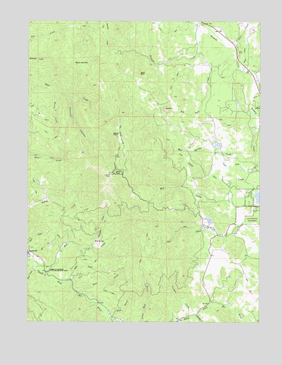
Cahto Peak, CA USGS Topographic Map
Click on map above to begin viewing in our Map Viewer.

This topographic map contains these locations and features:
Feature Name Type Latitude Longitude GNIS ID View Map
Admiral William Standley State Recreation AreaParkN39.6465°W123.6147°217985View Map
Bear CreekStreamN39.6363°W123.5956°218810View Map
Big RockSummitN39.7140°W123.5522°219239View Map
Big Rock CreekStreamN39.7363°W123.5150°219241View Map
Black Oak MountainSummitN39.7324°W123.6011°219389View Map
Branscomb CemeteryCemeteryN39.6571°W123.6147°2755379View Map
Cahto PeakSummitN39.6868°W123.5792°220370View Map
Cahto Peak Lookout TowerLocaleN39.6863°W123.5822°1724069View Map
Grapevine CreekStreamN39.6563°W123.5914°224447View Map
Haun CreekStreamN39.6471°W123.6236°225021View Map
KFWU-TV (Fort Bragg)TowerN39.6938°W123.5797°1663165View Map
Laytonville RancheriaCivilN39.6693°W123.5007°226975View Map
Laytonville Rancheria CemeteryCemeteryN39.6710°W123.5039°2755388View Map
Lewis CreekStreamN39.7393°W123.5153°227041View Map
Little Case CreekStreamN39.6910°W123.5031°227216View Map
Mast 1380 DamDamN39.6665°W123.5261°1664302View Map
Mast MillLocaleN39.6643°W123.5281°1724111View Map
Middleton CreekStreamN39.6277°W123.5356°228625View Map
Mill CreekStreamN39.6838°W123.5122°228673View Map
Misery CreekStreamN39.7202°W123.6117°228828View Map
Mud CreekStreamN39.6449°W123.6161°229223View Map
Mud Creek CemeteryCemeteryN39.6546°W123.6085°2755380View Map
Mud SpringsSpringN39.6576°W123.5880°229269View Map
Mud Springs CreekStreamN39.6940°W123.5045°229273View Map
Paralyze CanyonValleyN39.7179°W123.6039°230333View Map
Ranch PrimeroLocaleN39.7418°W123.5142°1724124View Map
Sand RockSummitN39.7285°W123.5653°232510View Map
Signal PeakSummitN39.7032°W123.5803°233112View Map
Stapp CreekStreamN39.7321°W123.5122°235381View Map
Stoten OpeningFlatN39.7004°W123.5764°235511View Map
Streeter CreekStreamN39.7457°W123.5289°235591View Map
Taylor CreekStreamN39.6418°W123.6036°236042View Map
Tuttle CreekStreamN39.6877°W123.5075°236675View Map
Wilson CreekStreamN39.7182°W123.5050°237967View Map
Windem CreekStreamN39.6274°W123.5392°238006View Map
Wise GulchValleyN39.6265°W123.5817°238073View Map

Note: Coordinates in the location and feature list above are referenced to NAD83 datum.


Copyright (C) 2008-2025 Ryan Niemi / Sunset Dynamics ... All Rights Reserved