TopoQuest Logo
Do you find TopoQuest useful?
Help keep TopoQuest running and adding new maps/features by donating!
Bitcoin:  19c7KJd3qBynnjoSw5npx9KScwjBe4ifkT
Litecoin:  LXs6TkuXGGXo1vDsWCkWVdjQX94eUKd6ui
Home View Maps Find Maps Find Places Resources & Links


Lee Center, New York Topographic Map

USGS Map Title: Lee Center, NY
USGS Map MRC: 43075C5
DRG (GeoTIFF) Download: o43075c5.tif


Neighboring USGS Topographic Map Quads:


  Florence, NY  
43075D6
 

  Point Rock, NY  
43075D5
 

  West Leyden, NY  
43075D4
 

  Camden East, NY  
43075C6
 

  Lee Center, NY  
43075C5
 

  Westernville, NY  
43075C4
 

  Sylvan Beach, NY  
43075B6
 

  Verona, NY  
43075B5
 

  Rome, NY  
43075B4


Map MRC Location:

N44°
W76°
N44°
W75°
H8 H7 H6 H5 H4 H3 H2 H1
G8 G7 G6 G5 G4 G3 G2 G1
F8 F7 F6 F5 F4 F3 F2 F1
E8 E7 E6 E5 E4 E3 E2 E1
D8 D7 D6 D5 D4 D3 D2 D1
C8 C7 C6 C5 C4 C3 C2 C1
B8 B7 B6 B5 B4 B3 B2 B1
A8 A7 A6 A5 A4 A3 A2 A1
N43°
W76°
N43°
W75°

Lee Center, NY USGS 1:24K Topographic Map Preview:
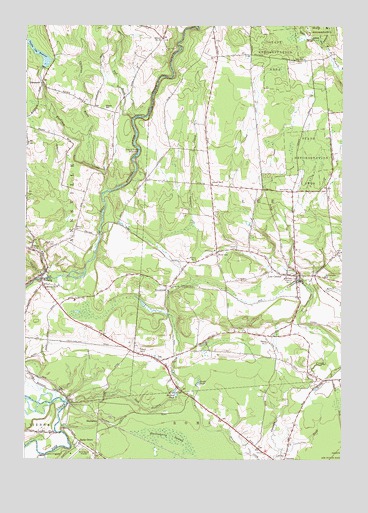
Lee Center, NY USGS Topographic Map
Click on map above to begin viewing in our Map Viewer.

This topographic map contains these locations and features:
Feature Name Type Latitude Longitude GNIS ID View Map
Beaver Creek Golf ClubLocaleN43.2593°W75.5387°2615344View Map
Becks GrovePopulated PlaceN43.2553°W75.6038°943476View Map
Becks Grove AirportAirportN43.2527°W75.6028°978268View Map
BrookfieldPopulated PlaceN43.3001°W75.5693°944833View Map
Burk CreekStreamN43.2528°W75.5243°969930View Map
Christian BrookStreamN43.3345°W75.5993°946625View Map
City of Rome ReservoirReservoirN43.3373°W75.5821°946709View Map
Collins Mobile Home ParkPopulated PlaceN43.2939°W75.6064°2485837View Map
Eames CemeteryCemeteryN43.3106°W75.5419°948952View Map
Egger BrookStreamN43.3701°W75.5080°949422View Map
Evergreen Hills Mobile Home CommunityPopulated PlaceN43.2717°W75.5669°2485853View Map
Fall BrookStreamN43.3484°W75.5832°949872View Map
Florence CreekStreamN43.3267°W75.5952°950300View Map
Furnace CreekStreamN43.3023°W75.6180°950815View Map
GlenmorePopulated PlaceN43.3590°W75.6185°951218View Map
Huckleberry SwampSwampN43.2551°W75.5691°953379View Map
HumastonPopulated PlaceN43.2612°W75.5957°972637View Map
Hyde Pond (historical)ReservoirN43.2750°W75.5661°2108552View Map
LeePopulated PlaceN43.2784°W75.5716°955162View Map
Lee CenterPopulated PlaceN43.3034°W75.5180°955164View Map
Lee Center Fire DepartmentBuildingN43.3035°W75.5142°2734842View Map
Lee Center Post OfficePost OfficeN43.3026°W75.5199°2617998View Map
Lee Valley ChurchChurchN43.2867°W75.5382°955167View Map
Leisure VillagePopulated PlaceN43.2922°W75.6078°2485829View Map
Link CemeteryCemeteryN43.2508°W75.5232°955419View Map
Lyman BrookStreamN43.3701°W75.5080°956168View Map
Main Street BridgeBridgeN43.3020°W75.6181°2614949View Map
Maple Hill CemeteryCemeteryN43.3113°W75.6160°956426View Map
Oneida City ReservoirReservoirN43.3685°W75.6225°959365View Map
Oneida County Water Treatment PlantLocaleN43.3531°W75.6195°2617778View Map
Portner PondReservoirN43.2681°W75.5649°961004View Map
Rapke PondReservoirN43.2718°W75.5566°962192View Map
Rome Country ClubLocaleN43.2509°W75.5374°2615466View Map
Saint Josephs ChurchChurchN43.3028°W75.5068°963749View Map
Saint Patrick's Catholic ChurchChurchN43.3051°W75.6159°2616992View Map
Sash Factory CreekStreamN43.2667°W75.6077°964498View Map
School Number 1 (historical)SchoolN43.3020°W75.5224°974922View Map
School Number 11 (historical)SchoolN43.3276°W75.5202°975003View Map
School Number 12 (historical)SchoolN43.3497°W75.5903°2108555View Map
School Number 12 (historical)SchoolN43.3653°W75.5075°2108556View Map
School Number 15 (historical)SchoolN43.3090°W75.5010°975113View Map
School Number 15 (historical)SchoolN43.3715°W75.5716°975114View Map
School Number 16 (historical)SchoolN43.3308°W75.5778°2108557View Map
School Number 17 (historical)SchoolN43.3569°W75.6161°2108558View Map
School Number 2 (historical)SchoolN43.2840°W75.5291°975209View Map
School Number 3 (historical)SchoolN43.3109°W75.6230°975288View Map
School Number 4 (historical)SchoolN43.2508°W75.5950°2108553View Map
School Number 4 (historical)SchoolN43.2803°W75.5782°975370View Map
School Number 4 (historical)SchoolN43.3453°W75.6246°975372View Map
School Number 5 (historical)SchoolN43.3295°W75.5521°975446View Map
School Number 7 (historical)SchoolN43.3073°W75.5577°975565View Map
School Number 7 (historical)SchoolN43.3162°W75.6057°975566View Map
School Number 8 (historical)SchoolN43.3001°W75.6174°975609View Map
School Number 9 (historical)SchoolN43.3661°W75.5408°2108554View Map
Smith CemeteryCemeteryN43.3653°W75.5152°965468View Map
Stace HillSummitN43.3515°W75.5946°966189View Map
TabergPopulated PlaceN43.3037°W75.6168°966977View Map
Taberg Sewer District Wastewater Treatment PlantLocaleN43.3036°W75.6149°2617763View Map
Taberg United Methodist ChurchChurchN43.3041°W75.6164°2616301View Map
Taberg Volunteer Fire CompanyBuildingN43.2996°W75.6183°2734847View Map
Town of AnnsvilleCivilN43.3492°W75.6227°978683View Map
Town of LeeCivilN43.3257°W75.5175°979137View Map
West LeePopulated PlaceN43.3095°W75.5496°970783View Map

Note: Coordinates in the location and feature list above are referenced to NAD83 datum.


Copyright (C) 2008-2024 Ryan Niemi / Sunset Dynamics ... All Rights Reserved