TopoQuest Logo
Do you find TopoQuest useful?
Help keep TopoQuest running and adding new maps/features by donating!
Bitcoin:  19c7KJd3qBynnjoSw5npx9KScwjBe4ifkT
Litecoin:  LXs6TkuXGGXo1vDsWCkWVdjQX94eUKd6ui
Home View Maps Find Maps Find Places Resources & Links


Point Rock, New York Topographic Map

USGS Map Title: Point Rock, NY
USGS Map MRC: 43075D5
DRG (GeoTIFF) Download: o43075d5.tif


Neighboring USGS Topographic Map Quads:


  North Osceola, NY  
43075E6
 

  High Market, NY  
43075E5
 

  Constableville, NY  
43075E4
 

  Florence, NY  
43075D6
 

  Point Rock, NY  
43075D5
 

  West Leyden, NY  
43075D4
 

  Camden East, NY  
43075C6
 

  Lee Center, NY  
43075C5
 

  Westernville, NY  
43075C4


Map MRC Location:

N44°
W76°
N44°
W75°
H8 H7 H6 H5 H4 H3 H2 H1
G8 G7 G6 G5 G4 G3 G2 G1
F8 F7 F6 F5 F4 F3 F2 F1
E8 E7 E6 E5 E4 E3 E2 E1
D8 D7 D6 D5 D4 D3 D2 D1
C8 C7 C6 C5 C4 C3 C2 C1
B8 B7 B6 B5 B4 B3 B2 B1
A8 A7 A6 A5 A4 A3 A2 A1
N43°
W76°
N43°
W75°

Point Rock, NY USGS 1:24K Topographic Map Preview:
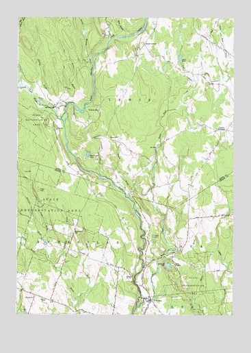
Point Rock, NY USGS Topographic Map
Click on map above to begin viewing in our Map Viewer.

This topographic map contains these locations and features:
Feature Name Type Latitude Longitude GNIS ID View Map
Ava CemeteryCemeteryN43.4176°W75.5008°942722View Map
Beaver Meadow BrookStreamN43.4795°W75.5813°943406View Map
Bloodsucker LakeLakeN43.4422°W75.5842°944273View Map
Bowman HillSummitN43.4098°W75.5918°944528View Map
Broad BrookStreamN43.4898°W75.5730°944777View Map
Bullhead LakeLakeN43.3958°W75.5376°945146View Map
Camp KingsleyLocaleN43.3959°W75.5335°945610View Map
Cody BrookStreamN43.3953°W75.6035°970018View Map
Fey MillPopulated PlaceN43.4453°W75.5446°972466View Map
Finn BrookStreamN43.4062°W75.6102°950073View Map
Finn HillSummitN43.4276°W75.6127°950074View Map
Freeman MillPopulated PlaceN43.4609°W75.5785°972510View Map
Harger CreekStreamN43.3951°W75.5027°952228View Map
Hennesey BrookStreamN43.3953°W75.6035°952602View Map
Heron BrookStreamN43.4562°W75.5982°952633View Map
Mack BrookStreamN43.3820°W75.5880°956232View Map
Mud BrookStreamN43.4923°W75.5685°957985View Map
Mud LakeLakeN43.4829°W75.5310°958035View Map
Parson MillPopulated PlaceN43.4495°W75.5666°972919View Map
Pigeon BrookStreamN43.4242°W75.5599°960370View Map
Point RockPopulated PlaceN43.3806°W75.5471°960838View Map
Point Rock CreekStreamN43.3781°W75.5549°960839View Map
Pond BrookStreamN43.4734°W75.5224°960886View Map
Powlish Pond BrookStreamN43.4548°W75.5982°961084View Map
Prussian SettlementPopulated PlaceN43.4526°W75.5074°972974View Map
Saint Anns CemeteryCemeteryN43.3975°W75.5976°963303View Map
Saint Anns ChurchChurchN43.3817°W75.6149°963311View Map
School Number 10 (historical)SchoolN43.4089°W75.5914°2357015View Map
School Number 14 (historical)SchoolN43.3915°W75.5580°975094View Map
School Number 2 (historical)SchoolN43.4628°W75.6033°2357013View Map
School Number 3 (historical)SchoolN43.4153°W75.5225°2357014View Map
School Number 6 (historical)SchoolN43.3812°W75.6077°975509View Map
School Number 8 (historical)SchoolN43.3820°W75.5480°975610View Map
Searles BrookStreamN43.4606°W75.6049°964743View Map
Smith LakeLakeN43.4078°W75.5457°965492View Map
Sullivan BrookStreamN43.3998°W75.6082°966744View Map
Sunset CornersLocaleN43.4890°W75.5518°966834View Map
Swancott MillPopulated PlaceN43.4623°W75.6030°973130View Map
Swancott Mill CemeteryCemeteryN43.4529°W75.6033°966891View Map
Town of LewisCivilN43.4793°W75.5610°979144View Map
Whiffin CemeteryCemeteryN43.3756°W75.6199°971227View Map

Note: Coordinates in the location and feature list above are referenced to NAD83 datum.


Copyright (C) 2008-2024 Ryan Niemi / Sunset Dynamics ... All Rights Reserved