TopoQuest Logo
Do you find TopoQuest useful?
Help keep TopoQuest running and adding new maps/features by donating!
Bitcoin:  19c7KJd3qBynnjoSw5npx9KScwjBe4ifkT
Litecoin:  LXs6TkuXGGXo1vDsWCkWVdjQX94eUKd6ui
Home View Maps Find Maps Find Places Resources & Links


Buck Rock, California Topographic Map

USGS Map Title: Buck Rock, CA
USGS Map MRC: 39122H8
DRG (GeoTIFF) Download: o39122h8.tif


Neighboring USGS Topographic Map Quads:


  Four Corners Rock, CA  
40123A1


  Leech Lake Mountain, CA  
39123H1
 

  Buck Rock, CA  
39122H8
 

  Ball Mountain, CA  
39122H7
 

  Newhouse Ridge, CA  
39123G1
 

  Mendocino Pass, CA  
39122G8
 

  Log Spring, CA  
39122G7


Map MRC Location:

N40°
W123°
N40°
W122°
H8 H7 H6 H5 H4 H3 H2 H1
G8 G7 G6 G5 G4 G3 G2 G1
F8 F7 F6 F5 F4 F3 F2 F1
E8 E7 E6 E5 E4 E3 E2 E1
D8 D7 D6 D5 D4 D3 D2 D1
C8 C7 C6 C5 C4 C3 C2 C1
B8 B7 B6 B5 B4 B3 B2 B1
A8 A7 A6 A5 A4 A3 A2 A1
N39°
W123°
N39°
W122°

Buck Rock, CA USGS 1:24K Topographic Map Preview:
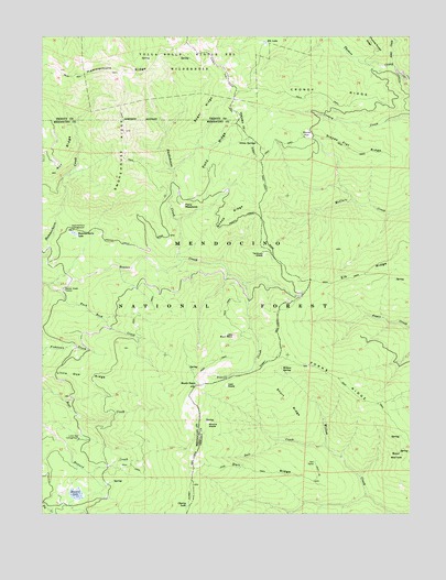
Buck Rock, CA USGS Topographic Map
Click on map above to begin viewing in our Map Viewer.

This topographic map contains these locations and features:
Feature Name Type Latitude Longitude GNIS ID View Map
Alder CreekStreamN39.9918°W122.8814°266372View Map
Ant RidgeRidgeN39.9707°W122.9922°256268View Map
Bear WallowBasinN39.8902°W122.8808°256728View Map
Beaver Glade StationLocaleN39.9335°W122.9939°256768View Map
Buck RockSummitN39.9088°W122.9489°257590View Map
Buck Rock CreekStreamN39.9346°W122.9992°257592View Map
Cherry LakeLakeN39.8774°W122.9519°258252View Map
Croney RidgeRidgeN39.9843°W122.8989°258929View Map
Doll CampLocaleN39.8882°W122.9083°259456View Map
Doll CreekStreamN39.8932°W122.9053°259457View Map
Doll RidgeRidgeN39.8865°W122.9247°259458View Map
Elk LakeLakeN39.9984°W122.9252°259851View Map
Elk RidgeRidgeN39.9415°W122.8789°259858View Map
Forks RidgeRidgeN39.9107°W122.9003°223690View Map
Green SpringsSpringN39.9724°W122.9339°260865View Map
Hammerhorn CampgroundLocaleN39.9490°W122.9917°261050View Map
Hammerhorn LakeLakeN39.9484°W122.9903°261052View Map
Hammerhorn RidgeRidgeN39.9918°W122.9742°261053View Map
Henderson Cabin (historical)BuildingN39.9457°W122.9775°1666473View Map
Howard LakeLakeN39.8802°W122.9896°261574View Map
Irish GladeFlatN39.9088°W122.9386°261805View Map
Little Buck RockSummitN39.9218°W122.9364°262554View Map
Little Doe CampgroundLocaleN39.8946°W122.9881°262588View Map
Little Doe RidgeRidgeN39.9115°W122.9861°262589View Map
Minnie GladeFlatN39.8990°W122.9445°263686View Map
Pony MeadowsFlatN39.9560°W122.9533°264936View Map
Pony RidgeRidgeN39.9710°W122.9414°264938View Map
Sheep RidgeRidgeN39.9542°W122.9361°2778565View Map
Short RidgeRidgeN39.9040°W122.9167°266139View Map
Slanes FlatFlatN39.9746°W122.9095°266260View Map
Slanes Flat RidgeRidgeN39.9707°W122.8964°266261View Map
Smoke Howe TrailTrailN39.9799°W122.9745°276276View Map
Smokehouse CreekStreamN39.9390°W122.9745°267273View Map
Smokehouse RidgeRidgeN39.9754°W122.9728°267276View Map
Sugar RidgeRidgeN39.9810°W122.9456°267855View Map
Summit TrailTrailN39.8829°W122.9508°267948View Map
Tantrum Glade Guard Station (historical)LocaleN39.9432°W122.9233°1666483View Map
Willow SpringSpringN39.9129°W122.9200°269186View Map

Note: Coordinates in the location and feature list above are referenced to NAD83 datum.


Copyright (C) 2008-2025 Ryan Niemi / Sunset Dynamics ... All Rights Reserved