TopoQuest Logo
Do you find TopoQuest useful?
Help keep TopoQuest running and adding new maps/features by donating!
Bitcoin:  19c7KJd3qBynnjoSw5npx9KScwjBe4ifkT
Litecoin:  LXs6TkuXGGXo1vDsWCkWVdjQX94eUKd6ui
Home View Maps Find Maps Find Places Resources & Links


Mendocino Pass, California Topographic Map

USGS Map Title: Mendocino Pass, CA
USGS Map MRC: 39122G8
DRG (GeoTIFF) Download: o39122g8.tif


Neighboring USGS Topographic Map Quads:


  Leech Lake Mountain, CA  
39123H1
 

  Buck Rock, CA  
39122H8
 

  Ball Mountain, CA  
39122H7
 

  Newhouse Ridge, CA  
39123G1
 

  Mendocino Pass, CA  
39122G8
 

  Log Spring, CA  
39122G7
 

  Thatcher Ridge, CA  
39123F1
 

  Plaskett Ridge, CA  
39122F8
 

  Plaskett Meadows, CA  
39122F7


Map MRC Location:

N40°
W123°
N40°
W122°
H8 H7 H6 H5 H4 H3 H2 H1
G8 G7 G6 G5 G4 G3 G2 G1
F8 F7 F6 F5 F4 F3 F2 F1
E8 E7 E6 E5 E4 E3 E2 E1
D8 D7 D6 D5 D4 D3 D2 D1
C8 C7 C6 C5 C4 C3 C2 C1
B8 B7 B6 B5 B4 B3 B2 B1
A8 A7 A6 A5 A4 A3 A2 A1
N39°
W123°
N39°
W122°

Mendocino Pass, CA USGS 1:24K Topographic Map Preview:
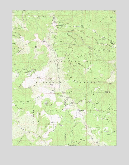
Mendocino Pass, CA USGS Topographic Map
Click on map above to begin viewing in our Map Viewer.

This topographic map contains these locations and features:
Feature Name Type Latitude Longitude GNIS ID View Map
Anthony PeakSummitN39.8463°W122.9645°218302View Map
Anthony Peak Lookout TowerLocaleN39.8463°W122.9645°1724059View Map
Atchison CampgroundLocaleN39.7504°W122.9258°256362View Map
Barras RanchLocaleN39.7693°W122.9433°256547View Map
Blue Slide CreekStreamN39.7552°W122.9614°257279View Map
Board RidgeRidgeN39.8104°W122.9294°257302View Map
Bollinger PlacePopulated PlaceN39.8435°W122.8797°1658101View Map
Bredehoft PlacePopulated PlaceN39.7827°W122.9394°1658129View Map
Brewer Oak Recreation SiteLocaleN39.8318°W122.9386°276270View Map
Burnt CreekStreamN39.8432°W122.9142°257726View Map
Buttermilk TrailTrailN39.8213°W122.8803°257782View Map
Cattle RidgeRidgeN39.8293°W122.9178°258088View Map
Clifton RidgeRidgeN39.7521°W122.9286°266580View Map
Cold SpringSpringN39.7532°W122.8972°258541View Map
Derby RidgeRidgeN39.8432°W122.9500°268289View Map
Espee RidgeRidgeN39.8693°W122.9731°259959View Map
Government FlatLocaleN39.8610°W122.9414°260725View Map
Grindstone Recreation SiteLocaleN39.8227°W122.8775°276271View Map
Hardy PlacePopulated PlaceN39.8010°W122.9508°1658714View Map
Lake RidgeRidgeN39.7960°W122.9053°262292View Map
Lightning SpringSpringN39.8483°W122.8923°262451View Map
Little BaldySummitN39.8496°W122.9892°262512View Map
Low Gap StationLocaleN39.7960°W122.9411°262996View Map
Mare BasinBasinN39.8407°W122.9742°263204View Map
Mendocino PassGapN39.7943°W122.9350°263454View Map
Mississippi CreekStreamN39.7627°W122.9847°263700View Map
Oak KnollSummitN39.7882°W122.9303°264290View Map
Recer RidgeRidgeN39.7927°W122.8844°265245View Map
Rock SpringSpringN39.8456°W122.8811°265512View Map
Seven Troughs SpringSpringN39.7827°W122.9211°266012View Map
Short RidgeRidgeN39.7985°W122.9328°266138View Map
Smith CampLocaleN39.7632°W122.8878°266317View Map
Sugar SpringSpringN39.8604°W122.9158°267857View Map
Sugar Spring CampgroundLocaleN39.8602°W122.9153°276269View Map
Surveyor CampgroundLocaleN39.8190°W122.9750°267988View Map
Templeton Cabin (historical)BuildingN39.8154°W122.9006°1666633View Map
Twin Rocks CreekStreamN39.8024°W122.9933°268543View Map
Twin Rocks RidgeRidgeN39.7932°W122.9750°268544View Map
Uhl PeakSummitN39.8624°W122.9525°268570View Map
Wells Cabin CampgroundLocaleN39.8377°W122.9494°268848View Map
White Hawk CreekStreamN39.7607°W122.9725°269002View Map
White Hawk RidgeRidgeN39.7792°W122.9750°2778645View Map

Note: Coordinates in the location and feature list above are referenced to NAD83 datum.


Copyright (C) 2008-2025 Ryan Niemi / Sunset Dynamics ... All Rights Reserved