TopoQuest Logo
Do you find TopoQuest useful?
Help keep TopoQuest running and adding new maps/features by donating!
Bitcoin:  19c7KJd3qBynnjoSw5npx9KScwjBe4ifkT
Litecoin:  LXs6TkuXGGXo1vDsWCkWVdjQX94eUKd6ui
Home View Maps Find Maps Find Places Resources & Links


Lena Creek, Montana Topographic Map

USGS Map Title: Lena Creek, MT
USGS Map MRC: 46110A5
DRG (GeoTIFF) Download: o46110a5.tif


Neighboring USGS Topographic Map Quads:


  Wolf Hill, MT  
46110B6
 

  Scab Rock Mountain, MT  
46110B5
 

  Virginia Peak, MT  
46110B4
 

  Cottonwood Reservoir, MT  
46110A6
 

  Lena Creek, MT  
46110A5
 

  Campfire Lake, MT  
46110A4
 

  Wilsall, MT  
45110H6
 

  Clyde Park, MT  
45110H5
 

  Ibex Mountain, MT  
45110H4


Map MRC Location:

N47°
W111°
N47°
W110°
H8 H7 H6 H5 H4 H3 H2 H1
G8 G7 G6 G5 G4 G3 G2 G1
F8 F7 F6 F5 F4 F3 F2 F1
E8 E7 E6 E5 E4 E3 E2 E1
D8 D7 D6 D5 D4 D3 D2 D1
C8 C7 C6 C5 C4 C3 C2 C1
B8 B7 B6 B5 B4 B3 B2 B1
A8 A7 A6 A5 A4 A3 A2 A1
N46°
W111°
N46°
W110°

Lena Creek, MT USGS 1:24K Topographic Map Preview:
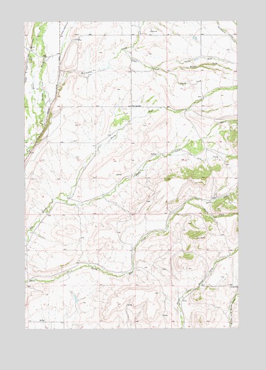
Lena Creek, MT USGS Topographic Map
Click on map above to begin viewing in our Map Viewer.

This topographic map contains these locations and features:
Feature Name Type Latitude Longitude GNIS ID View Map
03N09E15C___01 WellWellN46.0072°W110.5972°813745View Map
03N10E08A___01 SpringSpringN46.0285°W110.5030°813805View Map
04N09E01C___01 WellWellN46.1219°W110.5577°814084View Map
04N09E14AC__01 WellWellN46.0985°W110.5705°813992View Map
04N09E14CD__01 WellWellN46.0913°W110.5758°813960View Map
04N09E25B___01 WellWellN46.0713°W110.5577°813918View Map
04N09E28C___01 WellWellN46.0641°W110.6197°813891View Map
04N10E18C___01 WellWellN46.0927°W110.5369°813967View Map
Cole CreekStreamN46.0891°W110.6155°770023View Map
Dry CreekStreamN46.0705°W110.5405°782574View Map
Four CornersLocaleN46.0902°W110.5627°771547View Map
Kelley DamDamN46.0199°W110.5974°795578View Map
Lena CreekStreamN46.1133°W110.5663°773299View Map
McCauley North MineMineN46.0388°W110.6035°804909View Map
Middle Fork Lena CreekStreamN46.1041°W110.5410°774168View Map
Nollmeyer Number 1 DamDamN46.0649°W110.5991°798340View Map
North Fork Daisy Dean CreekStreamN46.0510°W110.5305°788128View Map
North Fork Elk CreekStreamN46.0535°W110.6066°788154View Map
North Fork Lena CreekStreamN46.1058°W110.5483°788196View Map
Pepper Number 1 DamDamN46.1183°W110.5258°796412View Map
Pepper Number 2 DamDamN46.1099°W110.5258°796413View Map
Porcupine CreekStreamN46.0827°W110.6135°789100View Map
Porcupine Post Office (historical)Post OfficeN46.1188°W110.5230°1743355View Map
Porcupine School (historical)SchoolN46.1188°W110.5230°1743356View Map
South Fork Daisy Dean CreekStreamN46.0510°W110.5305°790936View Map
South Fork Elk CreekStreamN46.0533°W110.6063°790959View Map
South Fork Lena CreekStreamN46.1058°W110.5483°776843View Map

Note: Coordinates in the location and feature list above are referenced to NAD83 datum.


Copyright (C) 2008-2025 Ryan Niemi / Sunset Dynamics ... All Rights Reserved