TopoQuest Logo
Do you find TopoQuest useful?
Help keep TopoQuest running and adding new maps/features by donating!
Bitcoin:  19c7KJd3qBynnjoSw5npx9KScwjBe4ifkT
Litecoin:  LXs6TkuXGGXo1vDsWCkWVdjQX94eUKd6ui
Home View Maps Find Maps Find Places Resources & Links


Wolf Hill, Montana Topographic Map

USGS Map Title: Wolf Hill, MT
USGS Map MRC: 46110B6
DRG (GeoTIFF) Download: o46110b6.tif


Neighboring USGS Topographic Map Quads:


  Ringling, MT  
46110C7
 

  Hamen, MT  
46110C6
 

  Rimrock Divide, MT  
46110C5
 

  Sixteen NE, MT  
46110B7
 

  Wolf Hill, MT  
46110B6
 

  Scab Rock Mountain, MT  
46110B5
 

  Wallrock, MT  
46110A7
 

  Cottonwood Reservoir, MT  
46110A6
 

  Lena Creek, MT  
46110A5


Map MRC Location:

N47°
W111°
N47°
W110°
H8 H7 H6 H5 H4 H3 H2 H1
G8 G7 G6 G5 G4 G3 G2 G1
F8 F7 F6 F5 F4 F3 F2 F1
E8 E7 E6 E5 E4 E3 E2 E1
D8 D7 D6 D5 D4 D3 D2 D1
C8 C7 C6 C5 C4 C3 C2 C1
B8 B7 B6 B5 B4 B3 B2 B1
A8 A7 A6 A5 A4 A3 A2 A1
N46°
W111°
N46°
W110°

Wolf Hill, MT USGS 1:24K Topographic Map Preview:
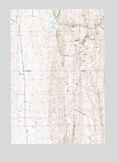
Wolf Hill, MT USGS Topographic Map
Click on map above to begin viewing in our Map Viewer.

This topographic map contains these locations and features:
Feature Name Type Latitude Longitude GNIS ID View Map
04N09E06B___01 WellWellN46.1291°W110.6608°814126View Map
05N09E21B___01 WellWellN46.1802°W110.7363°814442View Map
05N09E24D___01 WellWellN46.1730°W110.6635°814390View Map
05N09E26A___01 WellWellN46.1658°W110.6844°814342View Map
05N09E26D___01 WellWellN46.1585°W110.6844°814297View Map
06N08E28CA__01 WellWellN46.2499°W110.7344°814789View Map
06N08E34B___01 WellWellN46.2410°W110.7160°814745View Map
Arthun RanchLocaleN46.2399°W110.6291°768355View Map
Billy CreekStreamN46.2355°W110.6327°779919View Map
Canyon CreekStreamN46.2427°W110.6894°769572View Map
Cleora Post Office (historical)Post OfficeN46.1902°W110.7355°1743186View Map
Cottonwood CreekStreamN46.2313°W110.6935°770156View Map
Gjerde RanchLocaleN46.1902°W110.7358°771789View Map
Kiff Reservoir 1 DamDamN46.2349°W110.6808°795971View Map
Kiff Reservoir 2 DamDamN46.2316°W110.6958°795972View Map
Lucas Number 2 DamDamN46.2249°W110.6924°796267View Map
Lucas Number 3 DamDamN46.2249°W110.6874°796318View Map
Oil HillsOilfieldN46.1785°W110.6674°774916View Map
Rees HillsSummitN46.2177°W110.6599°775688View Map
Staley PlacePopulated PlaceN46.2435°W110.6566°777147View Map
Tyman PlacePopulated PlaceN46.2216°W110.6394°777895View Map
Wolf HillSummitN46.1994°W110.6466°778647View Map

Note: Coordinates in the location and feature list above are referenced to NAD83 datum.


Copyright (C) 2008-2025 Ryan Niemi / Sunset Dynamics ... All Rights Reserved