TopoQuest Logo
Do you find TopoQuest useful?
Help keep TopoQuest running and adding new maps/features by donating!
Bitcoin:  19c7KJd3qBynnjoSw5npx9KScwjBe4ifkT
Litecoin:  LXs6TkuXGGXo1vDsWCkWVdjQX94eUKd6ui
Home View Maps Find Maps Find Places Resources & Links


Leroy, Louisiana Topographic Map

USGS Map Title: Leroy, LA
USGS Map MRC: 30092A2
DRG (GeoTIFF) Download: o30092a2.tif


Neighboring USGS Topographic Map Quads:


  Crowley East, LA  
30092B3
 

  Duson, LA  
30092B2
 

  Lafayette, LA  
30092B1
 

  Kaplan North, LA  
30092A3
 

  Leroy, LA  
30092A2
 

  Milton, LA  
30092A1


  Abbeville West, LA  
29092H2
 

  Abbeville East, LA  
29092H1


Map MRC Location:

N31°
W93°
N31°
W92°
H8 H7 H6 H5 H4 H3 H2 H1
G8 G7 G6 G5 G4 G3 G2 G1
F8 F7 F6 F5 F4 F3 F2 F1
E8 E7 E6 E5 E4 E3 E2 E1
D8 D7 D6 D5 D4 D3 D2 D1
C8 C7 C6 C5 C4 C3 C2 C1
B8 B7 B6 B5 B4 B3 B2 B1
A8 A7 A6 A5 A4 A3 A2 A1
N30°
W93°
N30°
W92°

Leroy, LA USGS 1:24K Topographic Map Preview:
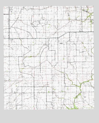
Leroy, LA USGS Topographic Map
Click on map above to begin viewing in our Map Viewer.

This topographic map contains these locations and features:
Feature Name Type Latitude Longitude GNIS ID View Map
Abshire CemeteryCemeteryN30.0435°W92.1548°532069View Map
AndrewPopulated PlaceN30.0849°W92.2429°542929View Map
Breaux CemeteryCemeteryN30.0210°W92.2335°533374View Map
Broussard CemeteryCemeteryN30.0046°W92.1826°533427View Map
Going West Mobile EstatesPopulated PlaceN30.1249°W92.1469°2600407View Map
Indian Bayou Volunteer Fire DepartmentBuildingN30.0830°W92.2419°2332548View Map
Ken Guidry Number 4 AirportAirportN30.0776°W92.2141°1632846View Map
Kenan AirstripAirportN30.0069°W92.2386°2676793View Map
KFXZ-FM (Maurice)TowerN30.0713°W92.1982°1632467View Map
Kidz Connection Day Care and Youth CampSchoolN30.0210°W92.1812°2600102View Map
LeroyPopulated PlaceN30.0788°W92.1923°555024View Map
Leroy Gas FieldOilfieldN30.0613°W92.1979°544234View Map
Main CanalCanalN30.0866°W92.1876°536853View Map
Maurice Gas FieldOilfieldN30.1158°W92.1496°544242View Map
Maurice Police DepartmentBuildingN30.1048°W92.1259°2333921View Map
Maurice Volunteer Fire DepartmentBuildingN30.1042°W92.1276°2332534View Map
MeauxPopulated PlaceN30.0208°W92.1826°555287View Map
Meaux - Nunez Volunteer Fire DepartmentBuildingN30.0184°W92.2085°2691679View Map
Meaux Elementary SchoolSchoolN30.0203°W92.1817°544244View Map
Meaux Post OfficePost OfficeN30.0208°W92.1826°1631609View Map
North Leroy Gas FieldOilfieldN30.1071°W92.1762°544253View Map
North Vermilion High SchoolSchoolN30.0799°W92.1684°544311View Map
Our Lady of Perpetual Help ChurchChurchN30.0783°W92.1916°2602546View Map
Parish Governing Authority District 2CivilN30.0721°W92.2110°1929922View Map
Petry CemeteryCemeteryN30.0249°W92.2312°538097View Map
Saint Alphonsus Catholic ChurchChurchN30.1074°W92.1257°544272View Map
Ward FourCivilN30.0805°W92.1293°545241View Map
West Maurice Gas FieldOilfieldN30.0941°W92.1585°544304View Map

Note: Coordinates in the location and feature list above are referenced to NAD83 datum.


Copyright (C) 2008-2025 Ryan Niemi / Sunset Dynamics ... All Rights Reserved