TopoQuest Logo
Do you find TopoQuest useful?
Help keep TopoQuest running and adding new maps/features by donating!
Bitcoin:  19c7KJd3qBynnjoSw5npx9KScwjBe4ifkT
Litecoin:  LXs6TkuXGGXo1vDsWCkWVdjQX94eUKd6ui
Home View Maps Find Maps Find Places Resources & Links


Leslie, Arkansas Topographic Map

USGS Map Title: Leslie, AR
USGS Map MRC: 35092G5
DRG (GeoTIFF) Download: o35092g5.tif


Neighboring USGS Topographic Map Quads:


  Marshall, AR  
35092H6
 

  Harriet, AR  
35092H5
 

  Landis, AR  
35092H4
 

  Canaan, AR  
35092G6
 

  Leslie, AR  
35092G5
 

  Oxley, AR  
35092G4
 

  Alread, AR  
35092F6
 

  Botkinburg, AR  
35092F5
 

  Old Lexington, AR  
35092F4


Map MRC Location:

N36°
W93°
N36°
W92°
H8 H7 H6 H5 H4 H3 H2 H1
G8 G7 G6 G5 G4 G3 G2 G1
F8 F7 F6 F5 F4 F3 F2 F1
E8 E7 E6 E5 E4 E3 E2 E1
D8 D7 D6 D5 D4 D3 D2 D1
C8 C7 C6 C5 C4 C3 C2 C1
B8 B7 B6 B5 B4 B3 B2 B1
A8 A7 A6 A5 A4 A3 A2 A1
N35°
W93°
N35°
W92°

Leslie, AR USGS 1:24K Topographic Map Preview:
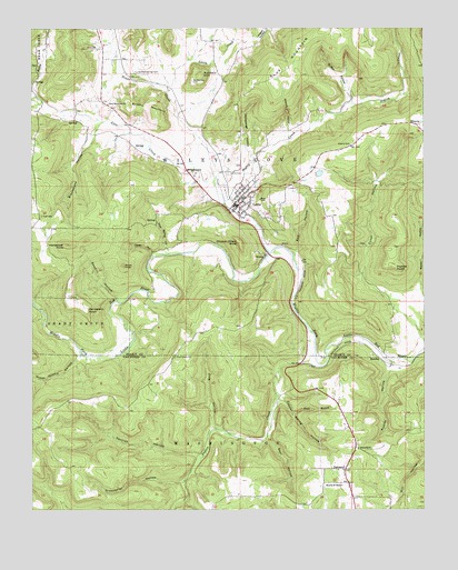
Leslie, AR USGS Topographic Map
Click on map above to begin viewing in our Map Viewer.

This topographic map contains these locations and features:
Feature Name Type Latitude Longitude GNIS ID View Map
Ashley Mill (historical)LocaleN35.8626°W92.5991°69951View Map
Baker LakeReservoirN35.8373°W92.5335°79618View Map
Baker Lake DamDamN35.8367°W92.5335°79617View Map
Baldwin HillSummitN35.8629°W92.5716°57318View Map
Baldwin Hill CemeteryCemeteryN35.8611°W92.5731°46051View Map
Bear HollowValleyN35.7698°W92.5502°46224View Map
Begley CreekStreamN35.8170°W92.5493°76288View Map
Blacksnake HollowValleyN35.8506°W92.6018°46694View Map
Blue MountainSummitN35.8604°W92.5482°70735View Map
Brushy MountainSummitN35.8534°W92.5854°57456View Map
Caid CemeteryCemeteryN35.8267°W92.6221°47274View Map
Cedar HollowValleyN35.8165°W92.5860°47617View Map
Chicken Wilson KnobSummitN35.8198°W92.5588°57545View Map
Church of ChristChurchN35.7562°W92.5265°68653View Map
City of LeslieCivilN35.8296°W92.5562°2404914View Map
Copper Spring HollowValleyN35.7795°W92.5468°48029View Map
Cove CreekStreamN35.8167°W92.5496°48101View Map
DennardPopulated PlaceN35.7567°W92.5246°76782View Map
Dennard CemeteryCemeteryN35.7667°W92.5215°68660View Map
Dennard ChurchChurchN35.7656°W92.5213°48467View Map
Dennard Post OfficePost OfficeN35.7531°W92.5225°84431View Map
Dennard School (historical)SchoolN35.7567°W92.5252°68661View Map
Dennard Volunteer Fire DepartmentBuildingN35.7565°W92.5238°2116356View Map
Eadl HollowValleyN35.8165°W92.5410°48728View Map
ElbertaPopulated PlaceN35.8501°W92.5021°57709View Map
Elberta CemeteryCemeteryN35.8448°W92.5232°48835View Map
Gibbins HollowValleyN35.8462°W92.5429°49387View Map
Green Griffin HollowValleyN35.7906°W92.6091°49634View Map
Greenbrier HollowValleyN35.7576°W92.5766°49652View Map
Griffin HollowValleyN35.8556°W92.5243°49677View Map
Happy HollowValleyN35.8701°W92.5618°49838View Map
Henderson KnobSummitN35.8184°W92.6143°57904View Map
Henderson PointCliffN35.8023°W92.6074°50013View Map
Hollabaugh HollowValleyN35.8401°W92.5549°50193View Map
Horn CemeteryCemeteryN35.8705°W92.6074°50322View Map
Kelley CreekStreamN35.8573°W92.6232°50791View Map
Kimbrell CreekStreamN35.8573°W92.6232°50842View Map
King HollowValleyN35.7698°W92.5621°50854View Map
LesliePopulated PlaceN35.8304°W92.5579°77477View Map
Leslie CemeteryCemeteryN35.8373°W92.5627°51071View Map
Leslie Elementary SchoolSchoolN35.8356°W92.5555°69966View Map
Leslie Fire DepartmentBuildingN35.8342°W92.5559°2116708View Map
Leslie High SchoolSchoolN35.8362°W92.5549°69967View Map
Little CreekStreamN35.8590°W92.5816°51246View Map
New Hopewell ChurchChurchN35.8554°W92.6007°52705View Map
NoahsPopulated PlaceN35.8159°W92.5504°58269View Map
Nolan KnobSummitN35.8134°W92.5957°52791View Map
Oak Flat (historical)Populated PlaceN35.7687°W92.5502°68681View Map
Peyton CreekStreamN35.7870°W92.5327°77982View Map
Pine Grove CemeteryCemeteryN35.7898°W92.5796°53422View Map
Pipkins PointSummitN35.8129°W92.5090°58393View Map
Poole BranchStreamN35.7751°W92.5424°53687View Map
RumleyPopulated PlaceN35.7890°W92.5138°58558View Map
Rumley HollowValleyN35.7884°W92.5107°54264View Map
Sawmill HollowValleyN35.8045°W92.5979°54603View Map
Section HollowValleyN35.7634°W92.5710°54664View Map
Sulphur Springs CemeteryCemeteryN35.8638°W92.5913°55325View Map
Township of Wileys CoveCivilN35.8413°W92.5467°69099View Map
Trace CreekStreamN35.8367°W92.5663°55631View Map
Watts HollowValleyN35.8054°W92.5002°56118View Map
West Spring HollowValleyN35.8165°W92.5816°56201View Map
Wileys CovePopulated PlaceN35.8376°W92.5738°58890View Map

Note: Coordinates in the location and feature list above are referenced to NAD83 datum.


Copyright (C) 2008-2025 Ryan Niemi / Sunset Dynamics ... All Rights Reserved