TopoQuest Logo
Do you find TopoQuest useful?
Help keep TopoQuest running and adding new maps/features by donating!
Bitcoin:  19c7KJd3qBynnjoSw5npx9KScwjBe4ifkT
Litecoin:  LXs6TkuXGGXo1vDsWCkWVdjQX94eUKd6ui
Home View Maps Find Maps Find Places Resources & Links


Letterbox Hill, California Topographic Map

USGS Map Title: Letterbox Hill, CA
USGS Map MRC: 41120A8
DRG (GeoTIFF) Download: o41120a8.tif


Neighboring USGS Topographic Map Quads:


  Big Swamp, CA  
41121B1
 

  Adin, CA  
41120B8
 

  Ambrose Valley, CA  
41120B7
 

  Hog Valley, CA  
41121A1
 

  Letterbox Hill, CA  
41120A8
 

  Lane Reservoir, CA  
41120A7
 

  Dixie Peak, CA  
40121H1
 

  Silva Flat Reservoir, CA  
40120H8
 

  Said Valley, CA  
40120H7


Map MRC Location:

N42°
W121°
N42°
W120°
H8 H7 H6 H5 H4 H3 H2 H1
G8 G7 G6 G5 G4 G3 G2 G1
F8 F7 F6 F5 F4 F3 F2 F1
E8 E7 E6 E5 E4 E3 E2 E1
D8 D7 D6 D5 D4 D3 D2 D1
C8 C7 C6 C5 C4 C3 C2 C1
B8 B7 B6 B5 B4 B3 B2 B1
A8 A7 A6 A5 A4 A3 A2 A1
N41°
W121°
N41°
W120°

Letterbox Hill, CA USGS 1:24K Topographic Map Preview:
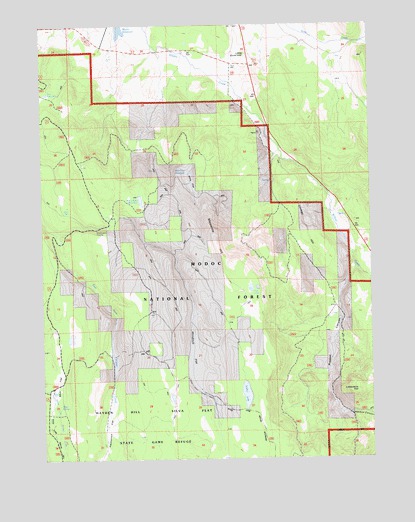
Letterbox Hill, CA USGS Topographic Map
Click on map above to begin viewing in our Map Viewer.

This topographic map contains these locations and features:
Feature Name Type Latitude Longitude GNIS ID View Map
Cary ReservoirReservoirN41.1054°W120.9988°258025View Map
Deer SpringSpringN41.0724°W120.9914°259248View Map
Hayden Hill-Silva Flat State Game RefugeParkN41.0082°W120.9641°1693316View Map
Knudsen RanchLocaleN41.1171°W120.9475°262231View Map
Letterbox CanyonValleyN41.0129°W120.8880°262417View Map
Letterbox HillSummitN41.0191°W120.8822°262418View Map
Little Gold HillSummitN41.1160°W120.9241°1658971View Map
Lonkey HillSummitN41.0599°W120.8977°262895View Map
Manzanita HillSummitN41.0563°W120.9305°263160View Map
McClelland ReservoirReservoirN41.0746°W120.9635°263312View Map
Myer FlatFlatN41.0207°W120.9969°263991View Map
Myer SpringSpringN41.0156°W120.9949°263992View Map
Packwood FlatFlatN41.0093°W120.9766°264443View Map
Packwood ReservoirReservoirN41.0190°W120.9751°276599View Map
Preston CanyonValleyN41.0541°W120.8822°1654933View Map
Snider LakeLakeN41.0184°W120.9240°267299View Map
Stonebreaker CrossingCrossingN41.0666°W120.9797°1659877View Map
Twin LakesLakeN41.0491°W120.9219°268531View Map
Whit FlatFlatN41.0807°W120.9455°268983View Map
Whit Flat ReservoirReservoirN41.0824°W120.9445°1665924View Map
Windmill FlatFlatN41.0302°W120.9439°255240View Map

Note: Coordinates in the location and feature list above are referenced to NAD83 datum.


Copyright (C) 2008-2024 Ryan Niemi / Sunset Dynamics ... All Rights Reserved