TopoQuest Logo
Do you find TopoQuest useful?
Help keep TopoQuest running and adding new maps/features by donating!
Bitcoin:  19c7KJd3qBynnjoSw5npx9KScwjBe4ifkT
Litecoin:  LXs6TkuXGGXo1vDsWCkWVdjQX94eUKd6ui
Home View Maps Find Maps Find Places Resources & Links


Lewiston Orchards North, Idaho Topographic Map

USGS Map Title: Lewiston Orchards North, ID
USGS Map MRC: 46116D8
DRG (GeoTIFF) Download: o46116d8.tif


Neighboring USGS Topographic Map Quads:


  Uniontown, WA  
46117E1
 

  Genesee, ID  
46116E8
 

  Green Knob, ID  
46116E7
 

  Clarkston, WA  
46117D1
 

  Lewiston Orchards North, ID  
46116D8
 

  Lapwai, ID  
46116D7
 

  Asotin, WA  
46117C1
 

  Lewiston Orchards South, ID  
46116C8
 

  Sweetwater, ID  
46116C7


Map MRC Location:

N47°
W117°
N47°
W116°
H8 H7 H6 H5 H4 H3 H2 H1
G8 G7 G6 G5 G4 G3 G2 G1
F8 F7 F6 F5 F4 F3 F2 F1
E8 E7 E6 E5 E4 E3 E2 E1
D8 D7 D6 D5 D4 D3 D2 D1
C8 C7 C6 C5 C4 C3 C2 C1
B8 B7 B6 B5 B4 B3 B2 B1
A8 A7 A6 A5 A4 A3 A2 A1
N46°
W117°
N46°
W116°

Lewiston Orchards North, ID USGS 1:24K Topographic Map Preview:
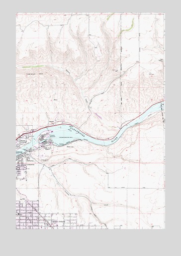
Lewiston Orchards North, ID USGS Topographic Map
Click on map above to begin viewing in our Map Viewer.

This topographic map contains these locations and features:
Feature Name Type Latitude Longitude GNIS ID View Map
City of LewistonCivilN46.3935°W116.9933°2410825View Map
ForebayPopulated PlaceN46.4235°W116.9602°396502View Map
Garfield SchoolSchoolN46.4152°W116.9907°372821View Map
GurneyPopulated PlaceN46.4263°W116.9518°399519View Map
HatwaiPopulated PlaceN46.4363°W116.9682°373007View Map
Hatwai CreekStreamN46.4327°W116.9124°382964View Map
Hidden LakeLakeN46.4227°W116.9574°373061View Map
Lewiston HillSummitN46.4635°W116.9768°373565View Map
Lewiston OrchardsPopulated PlaceN46.3804°W116.9754°396789View Map
Lewiston Police Training CenterBuildingN46.4048°W116.9963°2722435View Map
Lindsay CreekStreamN46.4202°W116.9918°373597View Map
Mark Means ParkParkN46.4154°W116.9763°373829View Map
McGhee Elementary SchoolSchoolN46.3838°W116.9975°400696View Map
McGuire CreekStreamN46.4532°W116.9449°376094View Map
Orchards Elementary SchoolSchoolN46.3779°W116.9699°401037View Map
Potlatch Corporation Fire and Rescue DepartmentBuildingN46.4252°W116.9402°2619233View Map
Southgate PlazaLocaleN46.3785°W116.9965°395974View Map
Valley View HeightsPopulated PlaceN46.4232°W116.9707°397292View Map
Wheatland Volunteer Fire DepartmentBuildingN46.4112°W116.9107°2619232View Map

Note: Coordinates in the location and feature list above are referenced to NAD83 datum.


Copyright (C) 2008-2025 Ryan Niemi / Sunset Dynamics ... All Rights Reserved