TopoQuest Logo
Do you find TopoQuest useful?
Help keep TopoQuest running and adding new maps/features by donating!
Bitcoin:  19c7KJd3qBynnjoSw5npx9KScwjBe4ifkT
Litecoin:  LXs6TkuXGGXo1vDsWCkWVdjQX94eUKd6ui
Home View Maps Find Maps Find Places Resources & Links


Uniontown, Washington Topographic Map

USGS Map Title: Uniontown, WA
USGS Map MRC: 46117E1
DRG (GeoTIFF) Download: o46117e1.tif


Neighboring USGS Topographic Map Quads:


  Pullman, WA  
46117F2
 

  Moscow West, ID  
46117F1
 

  Moscow East, ID  
46116F8
 

  Colton, WA  
46117E2
 

  Uniontown, WA  
46117E1
 

  Genesee, ID  
46116E8
 

  Silcott Island, WA  
46117D2
 

  Clarkston, WA  
46117D1
 

  Lewiston Orchards North, ID  
46116D8


Map MRC Location:

N47°
W118°
N47°
W117°
H8 H7 H6 H5 H4 H3 H2 H1
G8 G7 G6 G5 G4 G3 G2 G1
F8 F7 F6 F5 F4 F3 F2 F1
E8 E7 E6 E5 E4 E3 E2 E1
D8 D7 D6 D5 D4 D3 D2 D1
C8 C7 C6 C5 C4 C3 C2 C1
B8 B7 B6 B5 B4 B3 B2 B1
A8 A7 A6 A5 A4 A3 A2 A1
N46°
W118°
N46°
W117°

Uniontown, WA USGS 1:24K Topographic Map Preview:
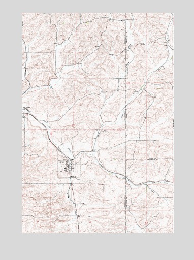
Uniontown, WA USGS Topographic Map
Click on map above to begin viewing in our Map Viewer.

This topographic map contains these locations and features:
Feature Name Type Latitude Longitude GNIS ID View Map
Busch PondReservoirN46.5498°W117.1201°1532831View Map
Busch Pond DamDamN46.5499°W117.1193°1532830View Map
Cow CreekStreamN46.5277°W117.0246°372193View Map
LeonPopulated PlaceN46.5318°W117.0393°1511096View Map
LeonPopulated PlaceN46.5318°W117.0402°376165View Map
Little Thorn CreekStreamN46.5600°W117.0591°373676View Map
Saint Bonaface School (historical)SchoolN46.5357°W117.0885°1531907View Map
Spring CreekStreamN46.5427°W117.0829°1508630View Map
Thorn CreekStreamN46.5432°W117.0691°375495View Map
Thorn Creek RanchLocaleN46.6082°W117.0066°375496View Map
Town of UniontownCivilN46.5391°W117.0861°2413413View Map
UniontownPopulated PlaceN46.5393°W117.0877°1509182View Map
Uniontown Police OfficeBuildingN46.5391°W117.0872°2722080View Map
Uniontown Post OfficePost OfficeN46.5380°W117.0869°2769144View Map
Whitman Fire District 14 Station 2BuildingN46.5387°W117.0871°2619402View Map

Note: Coordinates in the location and feature list above are referenced to NAD83 datum.


Copyright (C) 2008-2024 Ryan Niemi / Sunset Dynamics ... All Rights Reserved