TopoQuest Logo
Do you find TopoQuest useful?
Help keep TopoQuest running and adding new maps/features by donating!
Bitcoin:  19c7KJd3qBynnjoSw5npx9KScwjBe4ifkT
Litecoin:  LXs6TkuXGGXo1vDsWCkWVdjQX94eUKd6ui
Home View Maps Find Maps Find Places Resources & Links


Sweetwater, Idaho Topographic Map

USGS Map Title: Sweetwater, ID
USGS Map MRC: 46116C7
DRG (GeoTIFF) Download: o46116c7.tif


Neighboring USGS Topographic Map Quads:


  Lewiston Orchards North, ID  
46116D8
 

  Lapwai, ID  
46116D7
 

  Culdesac North, ID  
46116D6
 

  Lewiston Orchards South, ID  
46116C8
 

  Sweetwater, ID  
46116C7
 

  Culdesac South, ID  
46116C6
 

  Captain John Rapids, ID  
46116B8
 

  Waha, ID  
46116B7
 

  Winchester West, ID  
46116B6


Map MRC Location:

N47°
W117°
N47°
W116°
H8 H7 H6 H5 H4 H3 H2 H1
G8 G7 G6 G5 G4 G3 G2 G1
F8 F7 F6 F5 F4 F3 F2 F1
E8 E7 E6 E5 E4 E3 E2 E1
D8 D7 D6 D5 D4 D3 D2 D1
C8 C7 C6 C5 C4 C3 C2 C1
B8 B7 B6 B5 B4 B3 B2 B1
A8 A7 A6 A5 A4 A3 A2 A1
N46°
W117°
N46°
W116°

Sweetwater, ID USGS 1:24K Topographic Map Preview:
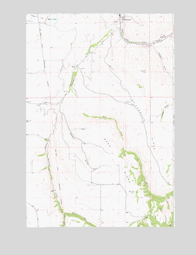
Sweetwater, ID USGS Topographic Map
Click on map above to begin viewing in our Map Viewer.

This topographic map contains these locations and features:
Feature Name Type Latitude Longitude GNIS ID View Map
BundyPopulated PlaceN46.3613°W116.7574°397499View Map
Bundy StationLocaleN46.3596°W116.7604°395569View Map
East Fork Sweetwater CreekStreamN46.2585°W116.8432°372564View Map
Mann LakeReservoirN46.3721°W116.8525°397891View Map
Mann Lake Public Fishing AreaLocaleN46.3702°W116.8588°401608View Map
McCormack RidgeRidgeN46.3082°W116.7754°373869View Map
Nez Perce CountyCivilN46.3268°W116.7503°399394View Map
Packers GulchValleyN46.3177°W116.8460°374298View Map
Polly CanyonValleyN46.2677°W116.7579°394933View Map
Red Elk CemeteryCemeteryN46.3233°W116.7873°374618View Map
Reservoir A DamDamN46.3716°W116.8577°398861View Map
Snow (historical)Populated PlaceN46.2999°W116.7918°399563View Map
SweetwaterPopulated PlaceN46.3724°W116.7929°398208View Map
Sweetwater CanalCanalN46.3329°W116.8432°375374View Map
Sweetwater CemeteryCemeteryN46.3693°W116.8005°375375View Map
Sweetwater Census Designated PlaceCensusN46.3676°W116.7975°2585594View Map
Sweetwater CreekStreamN46.3696°W116.7954°375377View Map
Thiessen GulchValleyN46.3552°W116.7665°375480View Map
WebbPopulated PlaceN46.3438°W116.8332°398327View Map
Webb CreekStreamN46.3310°W116.8376°400167View Map
Webb Creek CanalCanalN46.2516°W116.7571°375778View Map
Webb RidgeRidgeN46.2868°W116.7965°375779View Map
West Fork Sweetwater CreekStreamN46.2585°W116.8432°375821View Map
William Craig Historical MonumentParkN46.3574°W116.7696°375911View Map

Note: Coordinates in the location and feature list above are referenced to NAD83 datum.


Copyright (C) 2008-2024 Ryan Niemi / Sunset Dynamics ... All Rights Reserved