TopoQuest Logo
Do you find TopoQuest useful?
Help keep TopoQuest running and adding new maps/features by donating!
Bitcoin:  19c7KJd3qBynnjoSw5npx9KScwjBe4ifkT
Litecoin:  LXs6TkuXGGXo1vDsWCkWVdjQX94eUKd6ui
Home View Maps Find Maps Find Places Resources & Links


Lewiston Orchards South, Idaho Topographic Map

USGS Map Title: Lewiston Orchards South, ID
USGS Map MRC: 46116C8
DRG (GeoTIFF) Download: o46116c8.tif


Neighboring USGS Topographic Map Quads:


  Clarkston, WA  
46117D1
 

  Lewiston Orchards North, ID  
46116D8
 

  Lapwai, ID  
46116D7
 

  Asotin, WA  
46117C1
 

  Lewiston Orchards South, ID  
46116C8
 

  Sweetwater, ID  
46116C7
 

  Weissenfels Ridge, WA  
46117B1
 

  Captain John Rapids, ID  
46116B8
 

  Waha, ID  
46116B7


Map MRC Location:

N47°
W117°
N47°
W116°
H8 H7 H6 H5 H4 H3 H2 H1
G8 G7 G6 G5 G4 G3 G2 G1
F8 F7 F6 F5 F4 F3 F2 F1
E8 E7 E6 E5 E4 E3 E2 E1
D8 D7 D6 D5 D4 D3 D2 D1
C8 C7 C6 C5 C4 C3 C2 C1
B8 B7 B6 B5 B4 B3 B2 B1
A8 A7 A6 A5 A4 A3 A2 A1
N46°
W117°
N46°
W116°

Lewiston Orchards South, ID USGS 1:24K Topographic Map Preview:
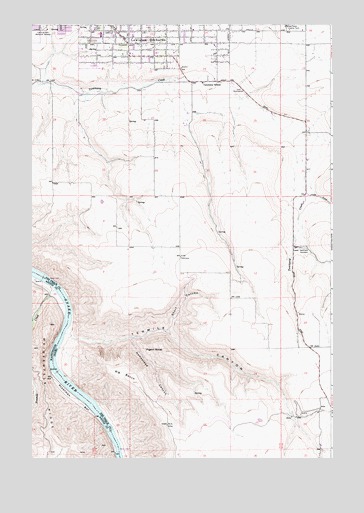
Lewiston Orchards South, ID USGS Topographic Map
Click on map above to begin viewing in our Map Viewer.

This topographic map contains these locations and features:
Feature Name Type Latitude Longitude GNIS ID View Map
Ackerman BarBarN46.2683°W116.9838°1502933View Map
Big BenchBeachN46.2718°W116.9563°371477View Map
Camelot Elementary SchoolSchoolN46.3739°W116.9328°401436View Map
Homestead CanyonValleyN46.2846°W116.9590°373122View Map
Lewis and Clark Memorial GardensCemeteryN46.3742°W116.9953°373562View Map
Lewiston Fire Department Station 2BuildingN46.3734°W116.9499°2619220View Map
Nez Perce County FarmLocaleN46.3746°W116.8943°374137View Map
Pigeon RoostSummitN46.2813°W116.9452°374394View Map
Sacajawea Junior High SchoolSchoolN46.3722°W116.9715°401163View Map
Short CanyonValleyN46.2871°W116.9440°375013View Map
Tammany Alternative Learning CenterSchoolN46.3582°W116.9292°400691View Map
Tammany CemeteryCemeteryN46.3107°W116.8868°375399View Map
Tenmile CanyonValleyN46.2857°W116.9840°375426View Map
Tenmile CreekStreamN46.2988°W116.9904°1508943View Map

Note: Coordinates in the location and feature list above are referenced to NAD83 datum.


Copyright (C) 2008-2024 Ryan Niemi / Sunset Dynamics ... All Rights Reserved