TopoQuest Logo
Do you find TopoQuest useful?
Help keep TopoQuest running and adding new maps/features by donating!
Bitcoin:  19c7KJd3qBynnjoSw5npx9KScwjBe4ifkT
Litecoin:  LXs6TkuXGGXo1vDsWCkWVdjQX94eUKd6ui
Home View Maps Find Maps Find Places Resources & Links


Lewistown, Missouri Topographic Map

USGS Map Title: Lewistown, MO
USGS Map MRC: 40091A7
DRG (GeoTIFF) Download: o40091a7.tif


Neighboring USGS Topographic Map Quads:


  Deer Ridge, MO  
40091B8
 

  Williamstown, MO  
40091B7
 

  Benjamin, MO  
40091B6
 

  La Belle, MO  
40091A8
 

  Lewistown, MO  
40091A7
 

  Monticello, MO  
40091A6
 

  Newark, MO  
39091H8
 

  Nelsonville, MO  
39091H7
 

  Durham, MO  
39091H6


Map MRC Location:

N41°
W92°
N41°
W91°
H8 H7 H6 H5 H4 H3 H2 H1
G8 G7 G6 G5 G4 G3 G2 G1
F8 F7 F6 F5 F4 F3 F2 F1
E8 E7 E6 E5 E4 E3 E2 E1
D8 D7 D6 D5 D4 D3 D2 D1
C8 C7 C6 C5 C4 C3 C2 C1
B8 B7 B6 B5 B4 B3 B2 B1
A8 A7 A6 A5 A4 A3 A2 A1
N40°
W92°
N40°
W91°

Lewistown, MO USGS 1:24K Topographic Map Preview:
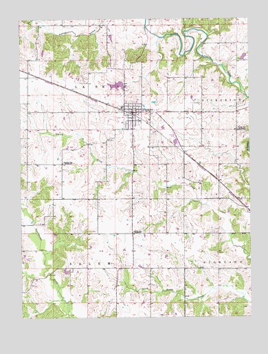
Lewistown, MO USGS Topographic Map
Click on map above to begin viewing in our Map Viewer.

This topographic map contains these locations and features:
Feature Name Type Latitude Longitude GNIS ID View Map
Baker DamDamN40.0734°W91.8002°760529View Map
Baker LakeReservoirN40.0734°W91.8002°760530View Map
Blair BranchStreamN40.1173°W91.7982°732817View Map
City of Lewistown DamDamN40.0984°W91.8185°760746View Map
City of Lewistown ReservoirReservoirN40.0972°W91.8220°760747View Map
Geisendorfer LakeReservoirN40.1242°W91.7604°761807View Map
Geisendorfer Lake DamDamN40.1234°W91.7602°761806View Map
Glaves SchoolSchoolN40.0356°W91.8143°735628View Map
JerusalemLocaleN40.0319°W91.8233°732031View Map
LewistownPopulated PlaceN40.0862°W91.8132°735689View Map
Lewistown Post OfficePost OfficeN40.0862°W91.8150°2783124View Map
Lewistown Volunteer Fire DepartmentBuildingN40.0857°W91.8169°2621238View Map
Luttrell Farms DamDamN40.1084°W91.7552°760787View Map
Luttrell Farms LakeLakeN40.1084°W91.7552°760788View Map
New Court VillagePopulated PlaceN40.1067°W91.8132°1669595View Map
Oakland SchoolSchoolN40.0648°W91.8521°723677View Map
Phillips Airport (historical)AirportN40.0750°W91.7899°758785View Map
Prim CemeteryCemeteryN40.0270°W91.7682°724933View Map
Sharpe LakeReservoirN40.0195°W91.8508°762203View Map
Sharpe Lake DamDamN40.0184°W91.8518°762202View Map
Town of LewistownCivilN40.0848°W91.8138°2396715View Map
Township of La BelleCivilN40.1010°W91.8678°766895View Map
Turner SchoolSchoolN40.0784°W91.7566°727908View Map

Note: Coordinates in the location and feature list above are referenced to NAD83 datum.


Copyright (C) 2008-2025 Ryan Niemi / Sunset Dynamics ... All Rights Reserved