TopoQuest Logo
Do you find TopoQuest useful?
Help keep TopoQuest running and adding new maps/features by donating!
Bitcoin:  19c7KJd3qBynnjoSw5npx9KScwjBe4ifkT
Litecoin:  LXs6TkuXGGXo1vDsWCkWVdjQX94eUKd6ui
Home View Maps Find Maps Find Places Resources & Links


Nelsonville, Missouri Topographic Map

USGS Map Title: Nelsonville, MO
USGS Map MRC: 39091H7
DRG (GeoTIFF) Download: o39091h7.tif


Neighboring USGS Topographic Map Quads:


  La Belle, MO  
40091A8
 

  Lewistown, MO  
40091A7
 

  Monticello, MO  
40091A6
 

  Newark, MO  
39091H8
 

  Nelsonville, MO  
39091H7
 

  Durham, MO  
39091H6
 

  Burksville, MO  
39091G8
 

  Emden, MO  
39091G7
 

  Philadelphia, MO  
39091G6


Map MRC Location:

N40°
W92°
N40°
W91°
H8 H7 H6 H5 H4 H3 H2 H1
G8 G7 G6 G5 G4 G3 G2 G1
F8 F7 F6 F5 F4 F3 F2 F1
E8 E7 E6 E5 E4 E3 E2 E1
D8 D7 D6 D5 D4 D3 D2 D1
C8 C7 C6 C5 C4 C3 C2 C1
B8 B7 B6 B5 B4 B3 B2 B1
A8 A7 A6 A5 A4 A3 A2 A1
N39°
W92°
N39°
W91°

Nelsonville, MO USGS 1:24K Topographic Map Preview:
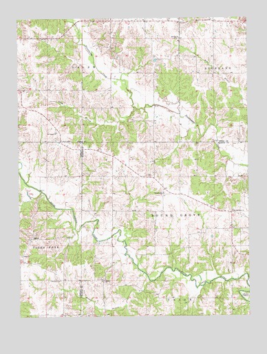
Nelsonville, MO USGS Topographic Map
Click on map above to begin viewing in our Map Viewer.

This topographic map contains these locations and features:
Feature Name Type Latitude Longitude GNIS ID View Map
Allen BranchStreamN39.9628°W91.8118°713211View Map
ArgolaPopulated PlaceN39.9975°W91.7871°755595View Map
Asbury ChapelChurchN39.9487°W91.8518°713414View Map
Bethany ChurchChurchN39.8900°W91.8291°714022View Map
Bragg School (historical)SchoolN39.8900°W91.8738°733523View Map
Bridgman DamDamN39.9267°W91.7918°762191View Map
Brower BranchStreamN39.8898°W91.8046°735533View Map
Center School (historical)SchoolN39.8823°W91.8246°732925View Map
Cherry Dell (historical)Populated PlaceN39.8900°W91.8360°755613View Map
Concord ChurchChurchN39.9003°W91.8738°716179View Map
Dickson Lake DamDamN39.9400°W91.8335°760611View Map
Doctor Wells LakeReservoirN39.9400°W91.8335°760612View Map
Doscher Brothers DamDamN39.9734°W91.8035°762194View Map
Doscher Brothers LakeReservoirN39.9734°W91.8035°762195View Map
Haycraft BridgeBridgeN39.9634°W91.8007°732834View Map
Haycraft School (historical)SchoolN39.9589°W91.8007°732835View Map
Iron Bridge School (historical)SchoolN39.9250°W91.8638°733522View Map
Loscher LakeReservoirN39.9967°W91.8235°762193View Map
Loscher Lake DamDamN39.9967°W91.8235°762192View Map
Methodist CemeteryCemeteryN39.8900°W91.8582°722255View Map
Mount Olivet ChurchChurchN39.9914°W91.7871°722837View Map
Mount Pleasant ChurchChurchN39.9523°W91.8543°722866View Map
NelsonvillePopulated PlaceN39.9262°W91.7966°741093View Map
New Providence ChurchChurchN39.9189°W91.7588°723295View Map
Oak Grove School (historical)SchoolN39.9256°W91.8235°732924View Map
SigsbeePopulated PlaceN39.9075°W91.8688°741265View Map
Sparrow Lake DamDamN39.9482°W91.8361°762190View Map
Tallent LakeReservoirN39.8971°W91.8256°761092View Map
Tallent Lake DamDamN39.8967°W91.8252°761091View Map
Township of SalemCivilN39.9993°W91.8693°766898View Map

Note: Coordinates in the location and feature list above are referenced to NAD83 datum.


Copyright (C) 2008-2025 Ryan Niemi / Sunset Dynamics ... All Rights Reserved