TopoQuest Logo
Do you find TopoQuest useful?
Help keep TopoQuest running and adding new maps/features by donating!
Bitcoin:  19c7KJd3qBynnjoSw5npx9KScwjBe4ifkT
Litecoin:  LXs6TkuXGGXo1vDsWCkWVdjQX94eUKd6ui
Home View Maps Find Maps Find Places Resources & Links


Lexington, Illinois Topographic Map

USGS Map Title: Lexington, IL
USGS Map MRC: 40088F7
DRG (GeoTIFF) Download: o40088f7.tif


Neighboring USGS Topographic Map Quads:


  Flanagan SW, IL  
40088G8
 

  Flanagan South, IL  
40088G7
 

  Southwest Pontiac, IL  
40088G6
 

  Gridley, IL  
40088F8
 

  Lexington, IL  
40088F7
 

  Chenoa, IL  
40088F6
 

  Normal East, IL  
40088E8
 

  Merna, IL  
40088E7
 

  Cooksville, IL  
40088E6


Map MRC Location:

N41°
W89°
N41°
W88°
H8 H7 H6 H5 H4 H3 H2 H1
G8 G7 G6 G5 G4 G3 G2 G1
F8 F7 F6 F5 F4 F3 F2 F1
E8 E7 E6 E5 E4 E3 E2 E1
D8 D7 D6 D5 D4 D3 D2 D1
C8 C7 C6 C5 C4 C3 C2 C1
B8 B7 B6 B5 B4 B3 B2 B1
A8 A7 A6 A5 A4 A3 A2 A1
N40°
W89°
N40°
W88°

Lexington, IL USGS 1:24K Topographic Map Preview:
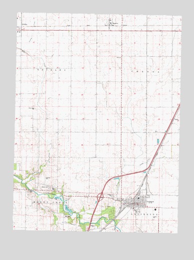
Lexington, IL USGS Topographic Map
Click on map above to begin viewing in our Map Viewer.

This topographic map contains these locations and features:
Feature Name Type Latitude Longitude GNIS ID View Map
BallardLocaleN40.6909°W88.7542°1747532View Map
Ballard School (historical)SchoolN40.6836°W88.7603°403863View Map
Bowman School (historical)SchoolN40.7406°W88.7590°404750View Map
Buck CreekStreamN40.6523°W88.8662°405096View Map
Buck Creek School (historical)SchoolN40.6859°W88.8612°405097View Map
Center School (historical)SchoolN40.7125°W88.7570°405821View Map
City of LexingtonCivilN40.6469°W88.7846°2395695View Map
ClarksvillePopulated PlaceN40.6506°W88.8484°422558View Map
Clarksville CemeteryCemeteryN40.6552°W88.8511°1747548View Map
Dawson CemeteryCemeteryN40.6283°W88.8131°1747553View Map
Enterprise School (historical)SchoolN40.7109°W88.7953°408042View Map
Franklin School (historical)SchoolN40.6481°W88.8317°408694View Map
Hibbs-Bigger CemeteryCemeteryN40.6950°W88.8601°1747582View Map
Interchange 178CrossingN40.6450°W88.8095°1822519View Map
Kuntz Field (historical)AirportN40.7231°W88.8667°427345View Map
LexingtonPopulated PlaceN40.6414°W88.7834°411977View Map
Lexington Ambulance AssociationBuildingN40.6409°W88.7871°2673816View Map
Lexington CemeteryCemeteryN40.6460°W88.8001°1747600View Map
Lexington City HallBuildingN40.6420°W88.7828°1822528View Map
Lexington Community Fire Protection DistrictBuildingN40.6409°W88.7871°2681897View Map
Lexington High SchoolSchoolN40.6450°W88.7801°1822529View Map
Lexington Police DepartmentBuildingN40.6418°W88.7843°2756997View Map
Lexington Post OfficePost OfficeN40.6417°W88.7835°1822530View Map
Lexington Public LibraryBuildingN40.6395°W88.7828°1822531View Map
MeadowsPopulated PlaceN40.7445°W88.8048°413354View Map
Meadows Post Office (historical)Post OfficeN40.7436°W88.8048°1822544View Map
Olive Branch School (historical)SchoolN40.6550°W88.8565°415090View Map
Payne School (historical)SchoolN40.6817°W88.8020°415474View Map
Prairie Valley School (historical)SchoolN40.7411°W88.8328°416173View Map
Scrogin CemeteryCemeteryN40.6447°W88.7880°1952810View Map
Thacker AirportAirportN40.7237°W88.7692°427138View Map
Timber RidgePopulated PlaceN40.6356°W88.8001°1822599View Map
Township of ChenoaCivilN40.7120°W88.7563°428797View Map
Turkey CreekStreamN40.6350°W88.8253°419924View Map

Note: Coordinates in the location and feature list above are referenced to NAD83 datum.


Copyright (C) 2008-2025 Ryan Niemi / Sunset Dynamics ... All Rights Reserved