TopoQuest Logo
Do you find TopoQuest useful?
Help keep TopoQuest running and adding new maps/features by donating!
Bitcoin:  19c7KJd3qBynnjoSw5npx9KScwjBe4ifkT
Litecoin:  LXs6TkuXGGXo1vDsWCkWVdjQX94eUKd6ui
Home View Maps Find Maps Find Places Resources & Links


Lexington North, Mississippi Topographic Map

USGS Map Title: Lexington North, MS
USGS Map MRC: 33090B1
DRG (GeoTIFF) Download: o33090b1.tif


Neighboring USGS Topographic Map Quads:


  Cruger, MS  
33090C2
 

  Black Hawk, MS  
33090C1
 

  Murdock Lake, MS  
33089C8
 

  Tchula, MS  
33090B2
 

  Lexington North, MS  
33090B1
 

  Bowling Green, MS  
33089B8
 

  Howard, MS  
33090A2
 

  Lexington South, MS  
33090A1
 

  Owens Wells, MS  
33089A8


Map MRC Location:

N34°
W91°
N34°
W90°
H8 H7 H6 H5 H4 H3 H2 H1
G8 G7 G6 G5 G4 G3 G2 G1
F8 F7 F6 F5 F4 F3 F2 F1
E8 E7 E6 E5 E4 E3 E2 E1
D8 D7 D6 D5 D4 D3 D2 D1
C8 C7 C6 C5 C4 C3 C2 C1
B8 B7 B6 B5 B4 B3 B2 B1
A8 A7 A6 A5 A4 A3 A2 A1
N33°
W91°
N33°
W90°

Lexington North, MS USGS 1:24K Topographic Map Preview:
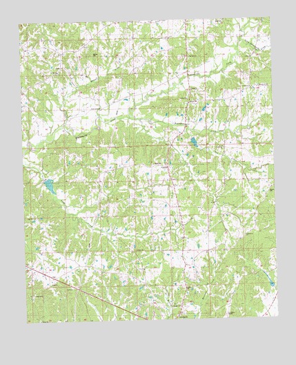
Lexington North, MS USGS Topographic Map
Click on map above to begin viewing in our Map Viewer.

This topographic map contains these locations and features:
Feature Name Type Latitude Longitude GNIS ID View Map
Ashville (historical)LocaleN33.2001°W90.0501°684277View Map
Beall-Stigler CemeteryCemeteryN33.2382°W90.0515°706584View Map
Bell Grove ChurchChurchN33.1296°W90.0943°666781View Map
Beulah Grove ChurchChurchN33.1601°W90.0159°667053View Map
Beulah Grove SchoolSchoolN33.1610°W90.0148°667055View Map
Black Watershed Y-36-21 DamDamN33.2018°W90.0451°681915View Map
Black Watershed Y-36-23 DamDamN33.1851°W90.1134°681906View Map
Black Watershed Y-36-28 DamDamN33.1351°W90.0034°681869View Map
Bophumpa CreekStreamN33.2093°W90.0693°667446View Map
C A Moore AirportAirportN33.1256°W90.0264°680367View Map
Camp CalvinLocaleN33.1362°W90.1209°684283View Map
Dixon CemeteryCemeteryN33.2490°W90.0240°684292View Map
Dry CreekStreamN33.2062°W90.0426°669442View Map
Edmund Hooker Lake DamDamN33.2135°W90.0368°681921View Map
Hodges CemeteryCemeteryN33.1307°W90.0479°684302View Map
Horring CemeteryCemeteryN33.1743°W90.0534°706640View Map
ItumaPopulated PlaceN33.2307°W90.1051°684305View Map
Johnson CemeteryCemeteryN33.2154°W90.0415°684307View Map
Jordan Bailey CemeteryCemeteryN33.2346°W90.0326°706643View Map
LebanonPopulated PlaceN33.1890°W90.0529°684308View Map
Lebanon ChurchChurchN33.1860°W90.0512°672356View Map
Lebanon SchoolSchoolN33.1879°W90.0520°672362View Map
Little Fannegusha CreekStreamN33.2410°W90.0156°672608View Map
Mount Olive CemeteryCemeteryN33.2290°W90.1056°674110View Map
Mount Olive ChurchChurchN33.2290°W90.1056°674144View Map
Mount Olive SchoolSchoolN33.2326°W90.1023°674173View Map
Olive CemeteryCemeteryN33.1882°W90.0601°706667View Map
OregonPopulated PlaceN33.1440°W90.1134°706669View Map
Oregon CemeteryCemeteryN33.1398°W90.1115°706670View Map
Oregon ChurchChurchN33.1401°W90.1123°684315View Map
Pine Grove ChurchChurchN33.2348°W90.0412°684319View Map
Pinkston CemeteryCemeteryN33.1379°W90.0465°675920View Map
Rhynes CemeteryCemeteryN33.1779°W90.0029°684322View Map
Rockport SchoolSchoolN33.1543°W90.0693°676771View Map
Shady Grove CemeteryCemeteryN33.1685°W90.1187°677543View Map
Shady Grove ChurchChurchN33.1685°W90.1187°677575View Map
Sunnymount ChurchChurchN33.2212°W90.0112°678425View Map
Sunnymount SchoolSchoolN33.2212°W90.0112°678426View Map
Supervisor District 1CivilN33.1767°W90.0280°711880View Map
Sweet Canaan ChurchChurchN33.2132°W90.0851°678465View Map
Sweetwater CemeteryCemeteryN33.1957°W90.0245°678490View Map
Sweetwater ChurchChurchN33.1965°W90.0254°678495View Map
Wade CemeteryCemeteryN33.1690°W90.0151°706704View Map
Wade CemeteryCemeteryN33.1273°W90.0523°706705View Map
Wadell CemeteryCemeteryN33.1901°W90.0592°679238View Map
Wanlaw CemeteryCemeteryN33.2360°W90.0890°684327View Map
Whites CreekStreamN33.2076°W90.1026°679638View Map

Note: Coordinates in the location and feature list above are referenced to NAD83 datum.


Copyright (C) 2008-2024 Ryan Niemi / Sunset Dynamics ... All Rights Reserved