TopoQuest Logo
Do you find TopoQuest useful?
Help keep TopoQuest running and adding new maps/features by donating!
Bitcoin:  19c7KJd3qBynnjoSw5npx9KScwjBe4ifkT
Litecoin:  LXs6TkuXGGXo1vDsWCkWVdjQX94eUKd6ui
Home View Maps Find Maps Find Places Resources & Links


Owens Wells, Mississippi Topographic Map

USGS Map Title: Owens Wells, MS
USGS Map MRC: 33089A8
DRG (GeoTIFF) Download: o33089a8.tif


Neighboring USGS Topographic Map Quads:


  Lexington North, MS  
33090B1
 

  Bowling Green, MS  
33089B8
 

  West, MS  
33089B7
 

  Lexington South, MS  
33090A1
 

  Owens Wells, MS  
33089A8
 

  Durant, MS  
33089A7
 

  Ebenezer, MS  
32090H1
 

  Goodman, MS  
32089H8
 

  Newport, MS  
32089H7


Map MRC Location:

N34°
W90°
N34°
W89°
H8 H7 H6 H5 H4 H3 H2 H1
G8 G7 G6 G5 G4 G3 G2 G1
F8 F7 F6 F5 F4 F3 F2 F1
E8 E7 E6 E5 E4 E3 E2 E1
D8 D7 D6 D5 D4 D3 D2 D1
C8 C7 C6 C5 C4 C3 C2 C1
B8 B7 B6 B5 B4 B3 B2 B1
A8 A7 A6 A5 A4 A3 A2 A1
N33°
W90°
N33°
W89°

Owens Wells, MS USGS 1:24K Topographic Map Preview:
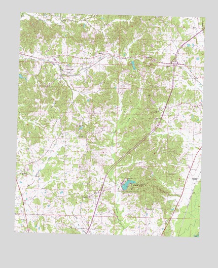
Owens Wells, MS USGS Topographic Map
Click on map above to begin viewing in our Map Viewer.

This topographic map contains these locations and features:
Feature Name Type Latitude Longitude GNIS ID View Map
Aberdeen JunctionPopulated PlaceN33.0326°W89.8776°691660View Map
Barksdale CemeteryCemeteryN33.1196°W89.8981°706583View Map
Bush CemeteryCemeteryN33.1037°W89.8809°706594View Map
Camp Castalian SpringsLocaleN33.0710°W89.9051°667968View Map
Castalian SpringsPopulated PlaceN33.0729°W89.9043°684285View Map
Damascus CemeteryCemeteryN33.0357°W89.8970°669083View Map
Damascus ChurchChurchN33.0482°W89.8929°669087View Map
Durham CemeteryCemeteryN33.0501°W89.9776°706615View Map
Franklin CemeteryCemeteryN33.0329°W89.9942°706624View Map
Franklin ChurchChurchN33.0332°W89.9951°670161View Map
Gages Springs CemeteryCemeteryN33.0546°W89.9592°670280View Map
Gages Springs ChurchChurchN33.0612°W89.9584°670281View Map
Georgeville (historical)LocaleN33.0212°W89.9543°684298View Map
Georgeville ChurchChurchN33.0210°W89.9540°670360View Map
Gulledge CemeteryCemeteryN33.0257°W89.8981°706631View Map
Holmes County Lake DamDamN33.0301°W89.9234°681795View Map
Holmes County Lake DamDamN33.0301°W89.9301°681796View Map
Holmes County State ParkParkN33.0290°W89.9162°671352View Map
Interchange 150CrossingN33.0246°W89.9420°691443View Map
Interchange 156CrossingN33.0982°W89.8951°691444View Map
International Paper Company Pond DamDamN33.1001°W89.9218°681848View Map
Lockhart (historical)LocaleN33.0890°W89.9154°684310View Map
Macedonia CemeteryCemeteryN33.0326°W89.9259°672984View Map
McMillanPopulated PlaceN33.1026°W89.9426°692058View Map
Mount Calvary ChurchChurchN33.0854°W89.9095°673940View Map
Mount Sinai ChurchChurchN33.0071°W89.9934°674273View Map
New Tribe Mission Lake DamDamN33.0751°W89.9101°681832View Map
Owen CemeteryCemeteryN33.0948°W89.9659°706673View Map
Owens WellsPopulated PlaceN33.0951°W89.9679°675353View Map
Salem CemeteryCemeteryN33.0796°W89.9129°706691View Map
Salem ChurchChurchN33.0799°W89.9120°677283View Map
Shady Grove CemeteryCemeteryN33.0168°W89.9117°706692View Map
Shady Grove ChurchChurchN33.0151°W89.9109°677573View Map
Shipp CreekStreamN33.1246°W89.9984°677725View Map
Sproles CemeteryCemeteryN33.0737°W89.8990°678191View Map
Union Paradise ChurchChurchN33.0835°W89.9806°679106View Map
Wesley Chapel (historical)ChurchN33.0668°W89.9081°684328View Map
Wesley Chapel CemeteryCemeteryN33.0668°W89.9073°679457View Map
West HillPopulated PlaceN33.1024°W89.9148°679499View Map
West Hill ChurchChurchN33.0962°W89.9112°679500View Map

Note: Coordinates in the location and feature list above are referenced to NAD83 datum.


Copyright (C) 2008-2025 Ryan Niemi / Sunset Dynamics ... All Rights Reserved