TopoQuest Logo
Do you find TopoQuest useful?
Help keep TopoQuest running and adding new maps/features by donating!
Bitcoin:  19c7KJd3qBynnjoSw5npx9KScwjBe4ifkT
Litecoin:  LXs6TkuXGGXo1vDsWCkWVdjQX94eUKd6ui
Home View Maps Find Maps Find Places Resources & Links


Bassett, Virginia Topographic Map

USGS Map Title: Bassett, VA
USGS Map MRC: 36079G8
DRG (GeoTIFF) Download: o36079g8.tif


Neighboring USGS Topographic Map Quads:


  Ferrum, VA  
36080H1
 

  Rocky Mount, VA  
36079H8
 

  Gladehill, VA  
36079H7
 

  Philpott Lake, VA  
36080G1
 

  Bassett, VA  
36079G8
 

  Snow Creek, VA  
36079G7
 

  Sanville, VA  
36080F1
 

  Martinsville West, VA  
36079F8
 

  Martinsville East, VA  
36079F7


Map MRC Location:

N37°
W80°
N37°
W79°
H8 H7 H6 H5 H4 H3 H2 H1
G8 G7 G6 G5 G4 G3 G2 G1
F8 F7 F6 F5 F4 F3 F2 F1
E8 E7 E6 E5 E4 E3 E2 E1
D8 D7 D6 D5 D4 D3 D2 D1
C8 C7 C6 C5 C4 C3 C2 C1
B8 B7 B6 B5 B4 B3 B2 B1
A8 A7 A6 A5 A4 A3 A2 A1
N36°
W80°
N36°
W79°

Bassett, VA USGS 1:24K Topographic Map Preview:
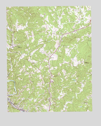
Bassett, VA USGS Topographic Map
Click on map above to begin viewing in our Map Viewer.

This topographic map contains these locations and features:
Feature Name Type Latitude Longitude GNIS ID View Map
Barr CreekStreamN36.8679°W79.8820°1462809View Map
BassettPopulated PlaceN36.7593°W79.9903°1488909View Map
Bassett Baptist TabernacleChurchN36.7524°W79.9750°1690847View Map
Bassett Census Designated PlaceCensusN36.7614°W79.9866°2389176View Map
Bassett Church of the BrethrenChurchN36.7651°W79.9978°1690848View Map
Bassett High SchoolSchoolN36.7618°W79.9964°1690154View Map
Bassett Middle School (historical)SchoolN36.7620°W79.9965°1497318View Map
Bassett Post OfficePost OfficeN36.7584°W79.9905°1690849View Map
Bassett School (historical)SchoolN36.7737°W79.9803°1497277View Map
Bassett Volunteer Fire DepartmentBuildingN36.7612°W79.9938°2075344View Map
Blackberry CreekStreamN36.7507°W79.9781°1488914View Map
Bowles Mill (historical)LocaleN36.7929°W79.9270°1497282View Map
Bowles-Shelton CemeteryCemeteryN36.8290°W79.9856°1791498View Map
Brown CemeteryCemeteryN36.8490°W79.8920°1791504View Map
Burnt Oaks School (historical)SchoolN36.8201°W79.9845°1497285View Map
Campbell Court Elementary SchoolSchoolN36.7570°W79.9825°1497287View Map
Canton CreekStreamN36.8529°W79.9161°1464420View Map
Cooling Springs School (historical)SchoolN36.8215°W79.9887°1497292View Map
Davis CemeteryCemeteryN36.8274°W79.9456°1791519View Map
Draper School (historical)SchoolN36.7896°W79.8953°1497296View Map
First Baptist ChurchChurchN36.7549°W79.9867°1466576View Map
Fork MountainPopulated PlaceN36.8457°W79.8989°1494431View Map
Fork Mountain ChurchChurchN36.8335°W79.8750°1466780View Map
Fork Mountain School (historical)SchoolN36.8390°W79.8939°1494432View Map
Fork Mountain Volunteer Fire Department and Rescue Squad Company 8BuildingN36.8457°W79.9012°2086296View Map
Free Worship ChurchChurchN36.7551°W79.9564°1466874View Map
Friendship ChurchChurchN36.7862°W79.9639°1466894View Map
Gardner CemeteryCemeteryN36.8524°W79.8986°1791536View Map
Gardner-Ramsey CemeteryCemeteryN36.8554°W79.8956°1791537View Map
Gospel ChurchChurchN36.7921°W79.8973°1467282View Map
Grassy ForkStreamN36.8057°W79.9923°1467372View Map
HenryPopulated PlaceN36.8293°W79.9917°1493072View Map
Henry Elementary SchoolSchoolN36.8490°W79.9284°1494445View Map
Henry Memorial ParkCemeteryN36.7843°W79.9381°1467933View Map
Henry Post OfficePost OfficeN36.8302°W79.9900°2766222View Map
Holcomb CemeteryCemeteryN36.8401°W79.8784°1791555View Map
Holiness Church (historical)ChurchN36.7543°W79.9770°1690850View Map
Hunter SchoolSchoolN36.7571°W79.9989°1468389View Map
Hurt-Thompson CemeteryCemeteryN36.8679°W79.9725°1791565View Map
Jamison CemeteryCemeteryN36.8629°W79.9206°1791568View Map
Juggs GapGapN36.8274°W79.9167°1468895View Map
Kittson Memorial ChurchChurchN36.8210°W79.9853°1469064View Map
Lipscomb CemeteryCemeteryN36.8732°W79.9767°1791583View Map
Lipscomb-Thornton CemeteryCemeteryN36.8665°W79.9584°1791584View Map
McGhee CemeteryCemeteryN36.8501°W79.9936°1791592View Map
Memorial ChurchChurchN36.7562°W79.9909°1470356View Map
Metz-Nunn CemeteryCemeteryN36.8171°W79.9300°1791595View Map
Muddy Fork School (historical)SchoolN36.8518°W79.8775°1494469View Map
Mullins-East CemeteryCemeteryN36.8296°W79.9853°1791600View Map
North BassettPopulated PlaceN36.7693°W79.9992°1493352View Map
Oak Hill ChurchChurchN36.7640°W79.9795°1471752View Map
Oak LevelPopulated PlaceN36.8154°W79.9356°1471759View Map
Oak Level Census Designated PlaceCensusN36.7944°W79.9392°2389601View Map
Oak Level ChurchChurchN36.7982°W79.9725°1471760View Map
Oak Ridge School (historical)SchoolN36.8701°W79.8936°1494474View Map
Pearson CemeteryCemeteryN36.8401°W79.9500°1472158View Map
Pocahontas Baptist ChurchChurchN36.7560°W79.9853°1690851View Map
Providence ChurchChurchN36.7601°W79.8834°1472817View Map
Ramsey CemeteryCemeteryN36.8454°W79.9120°1791615View Map
Ramsey CemeteryCemeteryN36.8696°W79.8986°1791616View Map
Ramsey School (historical)SchoolN36.8568°W79.9770°1494494View Map
Ramsey-Stanley-King CemeteryCemeteryN36.8529°W79.9717°1791617View Map
Randolph CemeteryCemeteryN36.8710°W79.9989°1791618View Map
Reed Creek ChurchChurchN36.7651°W79.9314°1473089View Map
Reed Creek DistrictCivilN36.7726°W79.8800°1927458View Map
Reed Creek VillagePopulated PlaceN36.7668°W79.9184°1497345View Map
Riverview Primitive Baptist Church (historical)ChurchN36.7562°W79.9845°1690852View Map
Root Mill CreekStreamN36.8585°W79.9206°1473524View Map
Sink CemeteryCemeteryN36.8593°W79.9073°1791625View Map
Skelt MountainSummitN36.8329°W79.9070°1474646View Map
Stanley CemeteryCemeteryN36.8740°W79.9359°1791629View Map
Stanleytown Census Designated PlaceCensusN36.7512°W79.9522°2390352View Map
Starkey-Barbour CemeteryCemeteryN36.8276°W79.9217°1791630View Map
Taylor CemeteryCemeteryN36.8468°W79.9000°1791635View Map
Thornton CemeteryCemeteryN36.8454°W79.9481°1475666View Map
Town Creek CemeteryCemeteryN36.8371°W79.9700°1494523View Map
Town Creek ChurchChurchN36.8371°W79.9703°1475814View Map
Waid School (historical)SchoolN36.8454°W79.9409°1494527View Map
Williams CemeteryCemeteryN36.8215°W79.9239°1791648View Map
Williams CemeteryCemeteryN36.8615°W79.9464°1791649View Map
Wray CemeteryCemeteryN36.8243°W79.9509°1791655View Map
Young CemeteryCemeteryN36.8285°W79.9103°1791659View Map
Young CemeteryCemeteryN36.8174°W79.9075°1791660View Map

Note: Coordinates in the location and feature list above are referenced to NAD83 datum.


Copyright (C) 2008-2024 Ryan Niemi / Sunset Dynamics ... All Rights Reserved