TopoQuest Logo
Do you find TopoQuest useful?
Help keep TopoQuest running and adding new maps/features by donating!
Bitcoin:  19c7KJd3qBynnjoSw5npx9KScwjBe4ifkT
Litecoin:  LXs6TkuXGGXo1vDsWCkWVdjQX94eUKd6ui
Home View Maps Find Maps Find Places Resources & Links


Snow Creek, Virginia Topographic Map

USGS Map Title: Snow Creek, VA
USGS Map MRC: 36079G7
DRG (GeoTIFF) Download: o36079g7.tif


Neighboring USGS Topographic Map Quads:


  Rocky Mount, VA  
36079H8
 

  Gladehill, VA  
36079H7
 

  Penhook, VA  
36079H6
 

  Bassett, VA  
36079G8
 

  Snow Creek, VA  
36079G7
 

  Mountain Valley, VA  
36079G6
 

  Martinsville West, VA  
36079F8
 

  Martinsville East, VA  
36079F7
 

  Axton, VA  
36079F6


Map MRC Location:

N37°
W80°
N37°
W79°
H8 H7 H6 H5 H4 H3 H2 H1
G8 G7 G6 G5 G4 G3 G2 G1
F8 F7 F6 F5 F4 F3 F2 F1
E8 E7 E6 E5 E4 E3 E2 E1
D8 D7 D6 D5 D4 D3 D2 D1
C8 C7 C6 C5 C4 C3 C2 C1
B8 B7 B6 B5 B4 B3 B2 B1
A8 A7 A6 A5 A4 A3 A2 A1
N36°
W80°
N36°
W79°

Snow Creek, VA USGS 1:24K Topographic Map Preview:
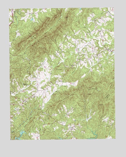
Snow Creek, VA USGS Topographic Map
Click on map above to begin viewing in our Map Viewer.

This topographic map contains these locations and features:
Feature Name Type Latitude Longitude GNIS ID View Map
Barrows Mill School (historical)SchoolN36.7562°W79.8359°1497276View Map
Belcher CemeteryCemeteryN36.8249°W79.7545°1791492View Map
Belchers Mill (historical)LocaleN36.8212°W79.7575°1494382View Map
Bernard CemeteryCemeteryN36.8540°W79.7578°1791494View Map
Blue Hill Church (historical)ChurchN36.8299°W79.7703°1494390View Map
Blue KnobSummitN36.7829°W79.7634°1463580View Map
Blue MountainSummitN36.8160°W79.8161°1499149View Map
Brodie BranchStreamN36.8307°W79.8011°1463869View Map
Brodie CemeteryCemeteryN36.8626°W79.7742°1791500View Map
Camp BranchStreamN36.7599°W79.8595°1464308View Map
Camp Branch ChurchChurchN36.7910°W79.8461°1464314View Map
Carver Memorial GardensCemeteryN36.7940°W79.8351°2701846View Map
Casters TrailTrailN36.8535°W79.8523°1464518View Map
Center for Community LearningSchoolN36.7638°W79.8729°1497304View Map
Cook CemeteryCemeteryN36.8526°W79.7648°1791514View Map
Crawford CreekStreamN36.8318°W79.7934°1465416View Map
Dyers StoreLocaleN36.7618°W79.7995°1466074View Map
Dyers Store School (historical)SchoolN36.7546°W79.8020°1497298View Map
Eggleston CemeteryCemeteryN36.7599°W79.8000°1466199View Map
Fairview ChurchChurchN36.7593°W79.8334°1466410View Map
FigsboroPopulated PlaceN36.7865°W79.8586°1477323View Map
Flatrock ChurchChurchN36.7790°W79.8378°1466671View Map
Flatrock School (historical)SchoolN36.7793°W79.8381°1497305View Map
Fork MountainSummitN36.8521°W79.8411°1466778View Map
Grindstaff CemeteryCemeteryN36.8640°W79.7711°1791544View Map
Hunley School (historical)SchoolN36.8285°W79.8561°1494448View Map
Jamison CemeteryCemeteryN36.7985°W79.8309°1791569View Map
Johnson CemeteryCemeteryN36.7621°W79.7620°1468779View Map
Jones DamDamN36.8651°W79.8464°1489808View Map
Jones PondReservoirN36.8646°W79.8475°1489809View Map
Law CemeteryCemeteryN36.8715°W79.8314°1791582View Map
Lee BranchStreamN36.7543°W79.7745°1469258View Map
Memorial Gardens CemeteryCemeteryN36.8337°W79.7617°1791594View Map
Mountain School (historical)SchoolN36.8099°W79.7511°1494467View Map
Muddy ForkStreamN36.8601°W79.8650°1471230View Map
Niblett Hill School (historical)SchoolN36.8182°W79.8028°1494472View Map
Orchard KnobSummitN36.7929°W79.7778°1499827View Map
Pleasant Grove CemeteryCemeteryN36.8049°W79.8164°1791610View Map
Pleasant Grove ChurchChurchN36.8051°W79.8161°1472475View Map
Shady Grove School (historical)SchoolN36.8037°W79.8367°1494508View Map
Snow CreekLocaleN36.8351°W79.7575°1474810View Map
Snow Creek ChurchChurchN36.8632°W79.7731°1474812View Map
Snow Creek Elementary SchoolSchoolN36.8339°W79.7547°1494514View Map
Snow Creek School (historical)SchoolN36.8310°W79.7748°1494515View Map
Sunnyview School (historical)SchoolN36.8599°W79.7728°1494519View Map
Tench CemeteryCemeteryN36.8707°W79.7759°1791636View Map
Toms CreekStreamN36.8465°W79.7750°1475776View Map
Toms KnobSummitN36.8663°W79.8042°1475779View Map
Trinity ChurchChurchN36.8201°W79.8000°1475863View Map
Twin Oaks Dairy FarmLocaleN36.8131°W79.8358°2676017View Map
Wyatt CemeteryCemeteryN36.7668°W79.7600°1474308View Map

Note: Coordinates in the location and feature list above are referenced to NAD83 datum.


Copyright (C) 2008-2024 Ryan Niemi / Sunset Dynamics ... All Rights Reserved