TopoQuest Logo
Do you find TopoQuest useful?
Help keep TopoQuest running and adding new maps/features by donating!
Bitcoin:  19c7KJd3qBynnjoSw5npx9KScwjBe4ifkT
Litecoin:  LXs6TkuXGGXo1vDsWCkWVdjQX94eUKd6ui
Home View Maps Find Maps Find Places Resources & Links


Sanville, Virginia Topographic Map

USGS Map Title: Sanville, VA
USGS Map MRC: 36080F1
DRG (GeoTIFF) Download: o36080f1.tif


Neighboring USGS Topographic Map Quads:


  Charity, VA  
36080G2
 

  Philpott Lake, VA  
36080G1
 

  Bassett, VA  
36079G8
 

  Patrick Springs, VA  
36080F2
 

  Sanville, VA  
36080F1
 

  Martinsville West, VA  
36079F8
 

  Nettleridge, VA  
36080E2
 

  Spencer, VA  
36080E1
 

  Price, NC  
36079E8


Map MRC Location:

N37°
W81°
N37°
W80°
H8 H7 H6 H5 H4 H3 H2 H1
G8 G7 G6 G5 G4 G3 G2 G1
F8 F7 F6 F5 F4 F3 F2 F1
E8 E7 E6 E5 E4 E3 E2 E1
D8 D7 D6 D5 D4 D3 D2 D1
C8 C7 C6 C5 C4 C3 C2 C1
B8 B7 B6 B5 B4 B3 B2 B1
A8 A7 A6 A5 A4 A3 A2 A1
N36°
W81°
N36°
W80°

Sanville, VA USGS 1:24K Topographic Map Preview:
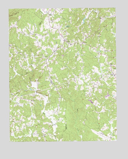
Sanville, VA USGS Topographic Map
Click on map above to begin viewing in our Map Viewer.

This topographic map contains these locations and features:
Feature Name Type Latitude Longitude GNIS ID View Map
Anthony School (historical)SchoolN36.7054°W80.0853°1497923View Map
Antioch ChurchChurchN36.6276°W80.0075°1462492View Map
BlackberryPopulated PlaceN36.7168°W80.0387°1499140View Map
Blackberry Baptist ChurchChurchN36.7151°W80.0412°1497281View Map
Blackberry DistrictCivilN36.7352°W80.0320°1927098View Map
Blue Ridge AirportAirportN36.6323°W80.0180°1498736View Map
Brown School (historical)SchoolN36.7407°W80.0887°1497939View Map
Bull RunStreamN36.6607°W80.0150°1464070View Map
Center School (historical)SchoolN36.7210°W80.0598°1497289View Map
Clark School (historical)SchoolN36.6660°W80.0650°1497941View Map
Coleman School (historical)SchoolN36.6512°W80.0214°1497290View Map
County Line ChurchChurchN36.7037°W80.0809°1465305View Map
Dillons ForkPopulated PlaceN36.6957°W80.0062°1465804View Map
Fryes Store (historical)Populated PlaceN36.6857°W80.0331°1497307View Map
Gethsemane ChurchChurchN36.7404°W80.0164°1467055View Map
Goodwill CemeteryCemeteryN36.7093°W80.1142°1497962View Map
Goodwill ChurchChurchN36.7087°W80.1139°1467232View Map
Grassy BranchStreamN36.6976°W80.0987°1467359View Map
Grays ForkStreamN36.6326°W80.0992°1467412View Map
Hales PondsReservoirN36.7326°W80.0531°1467653View Map
Happy BranchStreamN36.6724°W80.0934°1467724View Map
Hogpen MountainSummitN36.7429°W80.1212°1468120View Map
Horse Pasture Creek Number Two DamDamN36.6618°W80.0264°1490096View Map
Horse Pasture Dam Number 1cDamN36.6635°W80.0131°1490101View Map
Koger (historical)Populated PlaceN36.6326°W80.0984°1497977View Map
Kogers MillLocaleN36.6821°W80.0998°1497978View Map
Laurel BranchStreamN36.6893°W80.1150°1469166View Map
Mayo ChurchChurchN36.6637°W80.0973°1470217View Map
Mayo River DistrictCivilN36.6437°W80.1227°1927396View Map
Mount Calvary ChurchChurchN36.7232°W80.0200°1470818View Map
Mount Nemo ChurchChurchN36.6437°W80.1192°1470956View Map
Mount Olive ChurchChurchN36.6646°W80.0000°1470960View Map
Mount Pleasant School (historical)SchoolN36.6854°W80.0448°1497334View Map
Old Center CemeteryCemeteryN36.7204°W80.0587°1498380View Map
Old Center ChurchChurchN36.7201°W80.0587°1471830View Map
Pannill ForkPopulated PlaceN36.7090°W80.0131°1499837View Map
Patrick - Henry Volunteer Fire DepartmentBuildingN36.7053°W80.0853°2086074View Map
Philpott School (historical)SchoolN36.7435°W80.0034°1497341View Map
Pleasant GrovePopulated PlaceN36.6868°W80.0020°1472465View Map
Pleasant Grove Christian ChurchChurchN36.6865°W80.0020°1497342View Map
Pleasant View ChurchChurchN36.7154°W80.1245°1472515View Map
Polebridge CreekStreamN36.6893°W80.1150°1472579View Map
Rock Hill ChurchChurchN36.7318°W80.0120°1473373View Map
Salem ChurchChurchN36.6693°W80.1209°1473934View Map
SanvillePopulated PlaceN36.7199°W80.0592°1474053View Map
Sanville Elementary SchoolSchoolN36.7160°W80.0523°2498481View Map
Spencer CreekStreamN36.6907°W80.0970°1474939View Map
StellaPopulated PlaceN36.6307°W80.0848°1477782View Map
Stones StorePopulated PlaceN36.7443°W80.0770°1500166View Map
Trent Farm AirstripAirportN36.6489°W80.1144°1498644View Map
Via School (historical)SchoolN36.7162°W80.1237°1498012View Map
Whitts BranchStreamN36.7460°W80.0287°1488965View Map
Wood School (historical)SchoolN36.6671°W80.1114°1498019View Map

Note: Coordinates in the location and feature list above are referenced to NAD83 datum.


Copyright (C) 2008-2025 Ryan Niemi / Sunset Dynamics ... All Rights Reserved