TopoQuest Logo
Do you find TopoQuest useful?
Help keep TopoQuest running and adding new maps/features by donating!
Bitcoin:  19c7KJd3qBynnjoSw5npx9KScwjBe4ifkT
Litecoin:  LXs6TkuXGGXo1vDsWCkWVdjQX94eUKd6ui
Home View Maps Find Maps Find Places Resources & Links


Linesville, Pennsylvania Topographic Map

USGS Map Title: Linesville, PA
USGS Map MRC: 41080F4
DRG (GeoTIFF) Download: o41080f4.tif


Neighboring USGS Topographic Map Quads:


  Pierpont, OH  
41080G5
 

  Beaver Center, PA  
41080G4
 

  Conneautville, PA  
41080G3
 

  Leon, OH  
41080F5
 

  Linesville, PA  
41080F4
 

  Harmonsburg, PA  
41080F3
 

  Andover, OH  
41080E5
 

  Hartstown, PA  
41080E4
 

  Conneaut Lake, PA  
41080E3


Map MRC Location:

N42°
W81°
N42°
W80°
H8 H7 H6 H5 H4 H3 H2 H1
G8 G7 G6 G5 G4 G3 G2 G1
F8 F7 F6 F5 F4 F3 F2 F1
E8 E7 E6 E5 E4 E3 E2 E1
D8 D7 D6 D5 D4 D3 D2 D1
C8 C7 C6 C5 C4 C3 C2 C1
B8 B7 B6 B5 B4 B3 B2 B1
A8 A7 A6 A5 A4 A3 A2 A1
N41°
W81°
N41°
W80°

Linesville, PA USGS 1:24K Topographic Map Preview:
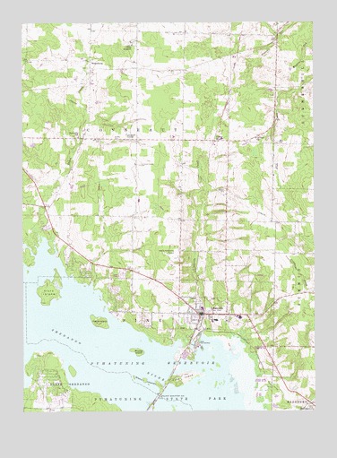
Linesville, PA USGS Topographic Map
Click on map above to begin viewing in our Map Viewer.

This topographic map contains these locations and features:
Feature Name Type Latitude Longitude GNIS ID View Map
Baldwin CemeteryCemeteryN41.7124°W80.4598°1168652View Map
Borough of LinesvilleCivilN41.6564°W80.4224°1215137View Map
Calvary ChurchChurchN41.7128°W80.3990°1170945View Map
Camp IroquoisLocaleN41.7428°W80.4517°1171033View Map
Center RoadPopulated PlaceN41.7120°W80.4170°1171444View Map
Center Road Station Post Office (historical)Post OfficeN41.7120°W80.4167°1214273View Map
Clark IslandIslandN41.6634°W80.4887°1171913View Map
Conneaut CenterPopulated PlaceN41.7123°W80.4501°1172334View Map
Conneaut Center CemeteryCemeteryN41.7041°W80.4494°1172335View Map
DantownPopulated PlaceN41.7067°W80.3915°1201608View Map
Finley BridgeBridgeN41.6909°W80.4903°1198729View Map
Ford IslandIslandN41.6356°W80.4315°1174956View Map
Frey Church (historical)ChurchN41.6709°W80.4570°1206028View Map
Glenn IslandsIslandN41.6351°W80.4476°1175724View Map
Harris IslandIslandN41.6537°W80.4670°1176574View Map
LinesvillePopulated PlaceN41.6562°W80.4240°1179422View Map
Linesville Area Ambulance ServiceBuildingN41.6565°W80.4254°2719571View Map
Linesville Conneaut Summit High SchoolSchoolN41.6545°W80.4170°1211648View Map
Linesville CreekStreamN41.6481°W80.4190°1179424View Map
Linesville Police DepartmentBuildingN41.6564°W80.4203°2777013View Map
Linesville Post OfficePost OfficeN41.6564°W80.4231°2772797View Map
Linesville Volunteer Fire DepartmentBuildingN41.6566°W80.4254°2645492View Map
Manning CemeteryCemeteryN41.7124°W80.4666°1180281View Map
Merrys Pymatuning AirportAirportN41.6757°W80.4345°1194271View Map
Paden CreekStreamN41.6789°W80.4923°1183185View Map
Pymatuning North Census Designated PlaceCensusN41.6659°W80.4647°2389716View Map
Raceground School (historical)SchoolN41.7467°W80.4373°1206027View Map
Shaw CemeteryCemeteryN41.7115°W80.3897°1187392View Map
SteamburgPopulated PlaceN41.7378°W80.4703°1204725View Map
Summers HeliportAirportN41.6667°W80.4165°1213807View Map
Summit (historical)LocaleN41.7123°W80.4187°1217451View Map
Township of ConneautCivilN41.7119°W80.4561°1216300View Map
Township of PineCivilN41.6473°W80.4370°1216310View Map
Tuttle LakePopulated PlaceN41.6334°W80.4898°1212151View Map
WaringPopulated PlaceN41.6859°W80.4873°1201609View Map
Whaley IslandIslandN41.6442°W80.4506°1191200View Map
WVCC-FM (Linesville)TowerN41.6801°W80.4531°1200319View Map

Note: Coordinates in the location and feature list above are referenced to NAD83 datum.


Copyright (C) 2008-2024 Ryan Niemi / Sunset Dynamics ... All Rights Reserved