TopoQuest Logo
Do you find TopoQuest useful?
Help keep TopoQuest running and adding new maps/features by donating!
Bitcoin:  19c7KJd3qBynnjoSw5npx9KScwjBe4ifkT
Litecoin:  LXs6TkuXGGXo1vDsWCkWVdjQX94eUKd6ui
Home View Maps Find Maps Find Places Resources & Links


Lisbon, New Hampshire Topographic Map

USGS Map Title: Lisbon, NH
USGS Map MRC: 44071B8
DRG (GeoTIFF) Download: o44071b8.tif


Neighboring USGS Topographic Map Quads:


  Lower Waterford, VT  
44071C8
 

  Littleton, NH  
44071C7
 

  Woodsville, NH  
44072B1
 

  Lisbon, NH  
44071B8
 

  Sugar Hill, NH  
44071B7
 

  Newbury, VT  
44072A1
 

  East Haverhill, NH  
44071A8
 

  Mount Moosilauke, NH  
44071A7


Map MRC Location:

N45°
W72°
N45°
W71°
H8 H7 H6 H5 H4 H3 H2 H1
G8 G7 G6 G5 G4 G3 G2 G1
F8 F7 F6 F5 F4 F3 F2 F1
E8 E7 E6 E5 E4 E3 E2 E1
D8 D7 D6 D5 D4 D3 D2 D1
C8 C7 C6 C5 C4 C3 C2 C1
B8 B7 B6 B5 B4 B3 B2 B1
A8 A7 A6 A5 A4 A3 A2 A1
N44°
W72°
N44°
W71°

Lisbon, NH USGS 1:24K Topographic Map Preview:
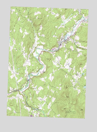
Lisbon, NH USGS Topographic Map
Click on map above to begin viewing in our Map Viewer.

This topographic map contains these locations and features:
Feature Name Type Latitude Longitude GNIS ID View Map
Ammonoosuc Country ClubLocaleN44.2320°W71.8940°1916397View Map
Ammonoosuc River DamDamN44.1667°W71.9762°1774865View Map
Ammonoosuc River ReservoirReservoirN44.1667°W71.9762°1774866View Map
Ammonoosuc River ReservoirReservoirN44.2151°W71.9129°1775014View Map
Babbit HillSummitN44.1915°W71.9351°871420View Map
BathPopulated PlaceN44.1670°W71.9662°871457View Map
Bath BridgeBridgeN44.1667°W71.9668°1916412View Map
Bath CemeteryCemeteryN44.1698°W71.9621°1916413View Map
Bath Congregational ChurchChurchN44.1676°W71.9662°1916414View Map
Bath Police DepartmentBuildingN44.1675°W71.9659°2753024View Map
Bath Post OfficePost OfficeN44.1674°W71.9658°1916415View Map
Bath Public LibraryBuildingN44.1676°W71.9662°1916416View Map
Bath Town HallBuildingN44.1678°W71.9662°1916417View Map
Bath Village SchoolSchoolN44.1691°W71.9635°1916418View Map
Bath Volunteer Fire DepartmentBuildingN44.1641°W71.9643°2605263View Map
Black ValleyValleyN44.1934°W71.9595°871531View Map
Center Hill CemeteryCemeteryN44.1738°W71.8845°871653View Map
Center Hill ChurchChurchN44.1751°W71.8879°871654View Map
Chandler PondLakeN44.1606°W71.8751°873012View Map
Childs BrookStreamN44.1565°W71.9773°871672View Map
Church of the Epiphany Episcopal ChurchChurchN44.2131°W71.9134°1916489View Map
Clough Hill School (historical)SchoolN44.2420°W71.9254°1916492View Map
Cole BrookStreamN44.2467°W71.8881°871714View Map
Cole PlainFlatN44.2317°W71.9120°871716View Map
Dark HollowValleyN44.1790°W71.9859°871760View Map
Foster HillSummitN44.1598°W71.9068°871900View Map
Gordon PondLakeN44.1763°W71.8795°871950View Map
Green MountainSummitN44.1484°W71.9051°871968View Map
Grove Hill CemeteryCemeteryN44.2111°W71.9094°871979View Map
Hanno PondLakeN44.2213°W71.8969°872007View Map
IrelandPopulated PlaceN44.1595°W71.8934°872082View Map
Ireland School (historical)SchoolN44.1609°W71.8934°1916619View Map
Jockey HillPopulated PlaceN44.1865°W71.9056°872112View Map
Landaff CenterPopulated PlaceN44.1751°W71.8870°872152View Map
Landaff Volunteer Fire DepartmentBuildingN44.1759°W71.8873°2605285View Map
LisbonPopulated PlaceN44.2134°W71.9109°872180View Map
Lisbon Bible ChurchChurchN44.2165°W71.9123°1916649View Map
Lisbon Census Designated PlaceCensusN44.2126°W71.9090°2378077View Map
Lisbon Fire DepartmentBuildingN44.2149°W71.9112°2605148View Map
Lisbon Life SquadBuildingN44.2150°W71.9114°2658855View Map
Lisbon Police DeptBuildingN44.2149°W71.9118°2752928View Map
Lisbon Post OfficePost OfficeN44.2144°W71.9075°1916650View Map
Lisbon Public LibraryBuildingN44.2148°W71.9115°1916651View Map
Lisbon Regional Elementary SchoolSchoolN44.2141°W71.9165°1916652View Map
Lisbon Regional High SchoolSchoolN44.2141°W71.9165°1916653View Map
Lisbon Regional Middle SchoolSchoolN44.2141°W71.9165°1916654View Map
Lisbon-Landaff Shared MinistryChurchN44.2142°W71.9129°1916655View Map
Lower Lisbon DamDamN44.2151°W71.9129°1775013View Map
Lower Mountain Lake DamDamN44.1270°W71.9600°1775107View Map
Mill BrookStreamN44.2003°W71.9312°872298View Map
Moody LedgeSummitN44.1340°W71.8812°872315View Map
Moulton HillSummitN44.2167°W71.9801°1916696View Map
Moulton Hill BrookStreamN44.2365°W71.9687°872331View Map
Moulton Hill CemeteryCemeteryN44.2459°W71.9868°872332View Map
Mount HopeSummitN44.1867°W71.8856°872050View Map
NutterPopulated PlaceN44.1448°W71.9448°872420View Map
Nutter School (historical)SchoolN44.1456°W71.9429°1916732View Map
Ogontz BrookStreamN44.2412°W71.8843°873202View Map
Pearl Lake BrookStreamN44.2195°W71.9018°872477View Map
PettyboroPopulated PlaceN44.2042°W71.9615°872491View Map
Pettyboro BrookStreamN44.1940°W71.9570°872492View Map
Pettyboro District CemeteryCemeteryN44.2039°W71.9620°1916754View Map
Pettyboro School (historical)SchoolN44.2012°W71.9634°1916755View Map
Saint Catherine of Siena Roman Catholic ChurchChurchN44.2134°W71.9098°1916798View Map
Salmon HoleBendN44.2390°W71.8834°872614View Map
Salmon Hole BridgeBridgeN44.2378°W71.8801°1916805View Map
Salmon Hole BrookStreamN44.2378°W71.8759°872615View Map
Salmon Hole School (historical)SchoolN44.2390°W71.8790°1916806View Map
SavagevillePopulated PlaceN44.2117°W71.8937°872627View Map
Simonds BrookStreamN44.1598°W71.9679°872666View Map
Sugar Hill StationLocaleN44.2367°W71.8845°872758View Map
Sunny ValleyValleyN44.2412°W71.8837°872763View Map
SwiftwaterPopulated PlaceN44.1328°W71.9515°872770View Map
Swiftwater BridgeBridgeN44.1340°W71.9506°1916840View Map
Swiftwater District CemeteryCemeteryN44.1304°W71.9574°1916841View Map
Teter Meadow BrookStreamN44.2365°W71.9684°872779View Map
The Blue SchoolSchoolN44.1819°W71.9169°871542View Map
The PlainFlatN44.1477°W71.9630°872793View Map
Town of BathCivilN44.1799°W71.9866°873540View Map
Town of LandaffCivilN44.1549°W71.8792°873641View Map
Trevena HillSummitN44.2490°W71.9129°872829View Map
Upper VillagePopulated PlaceN44.1773°W71.9443°872853View Map
Waterman BrookStreamN44.1359°W71.9601°872865View Map
West BathPopulated PlaceN44.1742°W71.9873°872890View Map
Wild Ammonoosuc RiverStreamN44.1542°W71.9793°872934View Map
Young MountainSummitN44.1353°W71.9090°872969View Map

Note: Coordinates in the location and feature list above are referenced to NAD83 datum.


Copyright (C) 2008-2024 Ryan Niemi / Sunset Dynamics ... All Rights Reserved