TopoQuest Logo
Do you find TopoQuest useful?
Help keep TopoQuest running and adding new maps/features by donating!
Bitcoin:  19c7KJd3qBynnjoSw5npx9KScwjBe4ifkT
Litecoin:  LXs6TkuXGGXo1vDsWCkWVdjQX94eUKd6ui
Home View Maps Find Maps Find Places Resources & Links


Batchelor, Louisiana Topographic Map

USGS Map Title: Batchelor, LA
USGS Map MRC: 30091G6
DRG (GeoTIFF) Download: o30091g6.tif


Neighboring USGS Topographic Map Quads:


  Simmesport, LA  
30091H7
 

  Innis, LA  
30091H6
 

  Angola, LA  
30091H5
 

  Bayou Current, LA  
30091G7
 

  Batchelor, LA  
30091G6
 

  Lacour, LA  
30091G5
 

  Swayze Lake, LA  
30091F7
 

  Melville, LA  
30091F6
 

  Morganza, LA  
30091F5


Map MRC Location:

N31°
W92°
N31°
W91°
H8 H7 H6 H5 H4 H3 H2 H1
G8 G7 G6 G5 G4 G3 G2 G1
F8 F7 F6 F5 F4 F3 F2 F1
E8 E7 E6 E5 E4 E3 E2 E1
D8 D7 D6 D5 D4 D3 D2 D1
C8 C7 C6 C5 C4 C3 C2 C1
B8 B7 B6 B5 B4 B3 B2 B1
A8 A7 A6 A5 A4 A3 A2 A1
N30°
W92°
N30°
W91°

Batchelor, LA USGS 1:24K Topographic Map Preview:
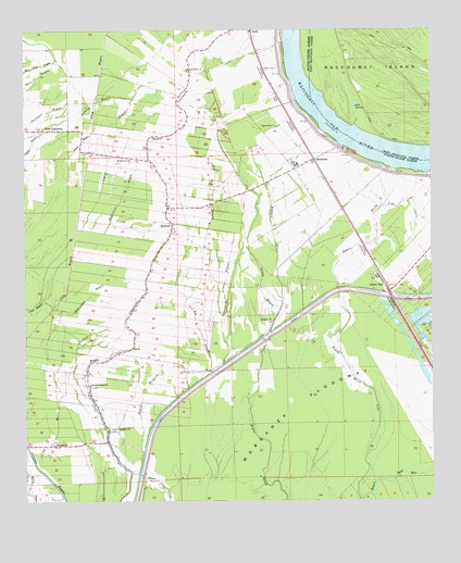
Batchelor, LA USGS Topographic Map
Click on map above to begin viewing in our Map Viewer.

This topographic map contains these locations and features:
Feature Name Type Latitude Longitude GNIS ID View Map
BatchelorPopulated PlaceN30.8405°W91.6615°553356View Map
Batchelor Post OfficePost OfficeN30.8388°W91.6593°1630504View Map
Bayou BundickStreamN30.7632°W91.7137°532474View Map
Bayou Garwood Oil FieldOilfieldN30.8335°W91.7432°546224View Map
Benton PlantationLocaleN30.7660°W91.7229°549431View Map
Big BayouStreamN30.7841°W91.6932°533025View Map
Clay BayouCanalN30.8355°W91.7318°533971View Map
Clay BayouGutN30.7694°W91.7404°533972View Map
Coyles BayouStreamN30.8321°W91.7323°534225View Map
Duck BayouStreamN30.8471°W91.7298°534631View Map
Graveyard BayouStreamN30.7866°W91.6896°535364View Map
Greater Saint Marks ChurchChurchN30.7807°W91.7304°535376View Map
Gumlog BayouGutN30.8557°W91.7293°535464View Map
Lacour SpurLocaleN30.8074°W91.6390°536254View Map
Lake BreezeLakeN30.8589°W91.6496°553771View Map
Little Zion CemeteryCemeteryN30.8646°W91.6996°549449View Map
Little Zion ChurchChurchN30.8646°W91.7001°536629View Map
Little Zion School (historical)SchoolN30.8649°W91.6996°549450View Map
Lower Latenache ChurchCemeteryN30.7693°W91.7246°536768View Map
Lower Latenache School (historical)SchoolN30.7827°W91.7315°549451View Map
Mains PlantationLocaleN30.8299°W91.7093°549452View Map
Mount Marias CemeteryCemeteryN30.8402°W91.7176°549454View Map
Mount Moriah ChurchChurchN30.8407°W91.7176°555394View Map
New CaliforniaPopulated PlaceN30.8485°W91.7451°537557View Map
New Zion ChurchChurchN30.7655°W91.7418°537642View Map
Parish Governing Authority District 2CivilN30.7695°W91.6587°1929907View Map
Pilgrim Rest CemeteryCemeteryN30.8493°W91.6721°538142View Map
Pilgrim Rest ChurchChurchN30.8399°W91.6637°549463View Map
QuintonPopulated PlaceN30.8224°W91.7051°541171View Map
Randall (historical)Populated PlaceN30.7844°W91.7012°546257View Map
Robertson BayouStreamN30.8005°W91.7426°538640View Map
Robertson BayouStreamN30.8224°W91.7343°538641View Map
Saint Marks CemeteryCemeteryN30.7980°W91.6743°549471View Map
Saint Marks ChurchChurchN30.7980°W91.6743°538969View Map
Sandy BayouStreamN30.7982°W91.6737°539152View Map
Upper Pointe Coupee Elementary SchoolSchoolN30.8391°W91.6665°546278View Map
Upper Pointe Coupee High SchoolSchoolN30.8393°W91.6662°546279View Map
Ward ThreeCivilN30.8318°W91.6498°545160View Map
Wilson DitchCanalN30.7888°W91.7348°540486View Map

Note: Coordinates in the location and feature list above are referenced to NAD83 datum.


Copyright (C) 2008-2024 Ryan Niemi / Sunset Dynamics ... All Rights Reserved