TopoQuest Logo
Do you find TopoQuest useful?
Help keep TopoQuest running and adding new maps/features by donating!
Bitcoin:  19c7KJd3qBynnjoSw5npx9KScwjBe4ifkT
Litecoin:  LXs6TkuXGGXo1vDsWCkWVdjQX94eUKd6ui
Home View Maps Find Maps Find Places Resources & Links


Little Texas, Alabama Topographic Map

USGS Map Title: Little Texas, AL
USGS Map MRC: 32085D5
DRG (GeoTIFF) Download: o32085d5.tif


Neighboring USGS Topographic Map Quads:


  Notasulga, AL  
32085E6
 

  Loachapoka, AL  
32085E5
 

  Auburn, AL  
32085E4
 

  Tuskegee, AL  
32085D6
 

  Little Texas, AL  
32085D5
 

  Society Hill, AL  
32085D4
 

  Davisville, AL  
32085C6
 

  Warriorstand, AL  
32085C5
 

  Creek Stand, AL  
32085C4


Map MRC Location:

N33°
W86°
N33°
W85°
H8 H7 H6 H5 H4 H3 H2 H1
G8 G7 G6 G5 G4 G3 G2 G1
F8 F7 F6 F5 F4 F3 F2 F1
E8 E7 E6 E5 E4 E3 E2 E1
D8 D7 D6 D5 D4 D3 D2 D1
C8 C7 C6 C5 C4 C3 C2 C1
B8 B7 B6 B5 B4 B3 B2 B1
A8 A7 A6 A5 A4 A3 A2 A1
N32°
W86°
N32°
W85°

Little Texas, AL USGS 1:24K Topographic Map Preview:
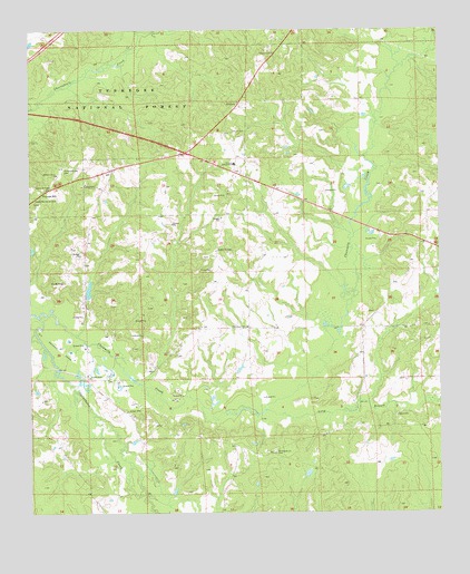
Little Texas, AL USGS Topographic Map
Click on map above to begin viewing in our Map Viewer.

This topographic map contains these locations and features:
Feature Name Type Latitude Longitude GNIS ID View Map
AlliancePopulated PlaceN32.4810°W85.5622°113023View Map
Antioch ChurchChurchN32.4210°W85.5911°113144View Map
Big BranchStreamN32.4635°W85.5199°133996View Map
Camp Ground BranchStreamN32.4085°W85.5911°134003View Map
Chewacla CreekStreamN32.4263°W85.6222°149940View Map
Cossey BranchStreamN32.4943°W85.5027°116667View Map
Darlington CemeteryCemeteryN32.4274°W85.5202°137111View Map
Darlington ChurchChurchN32.4265°W85.5194°134009View Map
Gilmore BranchStreamN32.4757°W85.5188°134019View Map
Hickory Grove CemeteryCemeteryN32.4649°W85.6141°120025View Map
Hickory Grove ChurchChurchN32.4629°W85.6166°120030View Map
Hodnett CreekStreamN32.4990°W85.5908°120180View Map
Little TexasPopulated PlaceN32.4429°W85.5683°156618View Map
Little Texas AirportAirportN32.4530°W85.5598°2676339View Map
Little Texas CemeteryCemeteryN32.4412°W85.5708°137120View Map
Little Texas Volunteer Fire DepartmentBuildingN32.4775°W85.5636°2691575View Map
Little Texas-Society Hill DivisionCivilN32.4272°W85.5203°165859View Map
Long BranchStreamN32.4018°W85.5533°152144View Map
Macedonia Volunteer Fire DepartmentBuildingN32.3779°W85.6044°2691288View Map
Miles CreekStreamN32.4799°W85.6238°152319View Map
Mount Ester Church (historical)ChurchN32.4793°W85.5630°134037View Map
Mount Myriant Church (historical)ChurchN32.3868°W85.5372°134038View Map
Mount Pleasant CemeteryCemeteryN32.3907°W85.5502°154821View Map
Mount Pleasant ChurchChurchN32.3907°W85.5508°123363View Map
Mount Sheba Church (historical)ChurchN32.4840°W85.6022°134040View Map
Mount Zion CemeteryCemeteryN32.4812°W85.5613°154823View Map
Mount Zion ChurchChurchN32.4812°W85.5611°134041View Map
New Hope SchoolSchoolN32.3913°W85.5505°134044View Map
New Potasi (historical)LocaleN32.4729°W85.5652°134045View Map
Nichols Junior High SchoolSchoolN32.4657°W85.5630°152691View Map
Oak Grove CemeteryCemeteryN32.4937°W85.5505°154824View Map
Oak Grove ChurchChurchN32.4940°W85.5511°124089View Map
Opintlocco CreekStreamN32.4260°W85.6225°152815View Map
Pine Grove CemeteryCemeteryN32.4232°W85.5591°154822View Map
Pine Grove ChurchChurchN32.4232°W85.5599°124791View Map
Pleasant HillPopulated PlaceN32.4585°W85.6158°156910View Map
Pleasant Hill ChurchChurchN32.4554°W85.6219°134050View Map
Pleasant Hill School (historical)SchoolN32.4454°W85.6077°134051View Map
Taska Recreation SiteLocaleN32.4574°W85.6230°164507View Map
Tuskegee Lookout TowerTowerN32.4599°W85.6230°163801View Map
Tuskegee National ForestForestN32.4690°W85.6091°128214View Map
Tuskegee Ranger StationBuildingN32.4774°W85.6102°164514View Map
Union CemeteryCemeteryN32.4743°W85.5638°128266View Map
Union ChurchChurchN32.4382°W85.5705°128293View Map
Williams Chapel (historical)ChurchN32.4429°W85.5680°134071View Map

Note: Coordinates in the location and feature list above are referenced to NAD83 datum.


Copyright (C) 2008-2024 Ryan Niemi / Sunset Dynamics ... All Rights Reserved