TopoQuest Logo
Do you find TopoQuest useful?
Help keep TopoQuest running and adding new maps/features by donating!
Bitcoin:  19c7KJd3qBynnjoSw5npx9KScwjBe4ifkT
Litecoin:  LXs6TkuXGGXo1vDsWCkWVdjQX94eUKd6ui
Home View Maps Find Maps Find Places Resources & Links


Lockridge East, Iowa Topographic Map

USGS Map Title: Lockridge East, IA
USGS Map MRC: 40091H6
DRG (GeoTIFF) Download: o40091h6.tif


Neighboring USGS Topographic Map Quads:


  Salina, IA  
41091A7
 

  Trenton, IA  
41091A6
 

  Swedesburg, IA  
41091A5
 

  Lockridge West, IA  
40091H7
 

  Lockridge East, IA  
40091H6
 

  Mount Pleasant, IA  
40091H5
 

  Stockport, IA  
40091G7
 

  Hillsboro, IA  
40091G6
 

  Salem, IA  
40091G5


Map MRC Location:

N41°
W92°
N41°
W91°
H8 H7 H6 H5 H4 H3 H2 H1
G8 G7 G6 G5 G4 G3 G2 G1
F8 F7 F6 F5 F4 F3 F2 F1
E8 E7 E6 E5 E4 E3 E2 E1
D8 D7 D6 D5 D4 D3 D2 D1
C8 C7 C6 C5 C4 C3 C2 C1
B8 B7 B6 B5 B4 B3 B2 B1
A8 A7 A6 A5 A4 A3 A2 A1
N40°
W92°
N40°
W91°

Lockridge East, IA USGS 1:24K Topographic Map Preview:
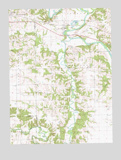
Lockridge East, IA USGS Topographic Map
Click on map above to begin viewing in our Map Viewer.

This topographic map contains these locations and features:
Feature Name Type Latitude Longitude GNIS ID View Map
Belfast (historical)Populated PlaceN40.9897°W91.6854°465344View Map
Berry BranchStreamN40.9195°W91.6729°454530View Map
Cedar Creek CemeteryCemeteryN40.8984°W91.6310°455237View Map
Cedar Creek ChurchStreamN40.9011°W91.6313°455238View Map
Cedar Creek Friends CemeteryCemeteryN40.8981°W91.6310°1981565View Map
Cholera Hill CemeteryCemeteryN40.9806°W91.6529°1981553View Map
City of LockridgeCivilN40.9937°W91.7492°2395741View Map
City of RomeCivilN40.9822°W91.6819°2396422View Map
City of WestwoodCivilN40.9648°W91.6266°2397288View Map
Crane CemeteryCemeteryN40.9250°W91.7279°1976501View Map
DenovaPopulated PlaceN40.9084°W91.6371°464317View Map
Denova (historical)LocaleN40.9084°W91.6371°1981412View Map
Denova Post Office (historical)Post OfficeN40.9084°W91.6371°1981411View Map
Finis Post Office (historical)Post OfficeN40.9453°W91.6613°1981397View Map
First Augustana Lutheran ChurchChurchN40.9947°W91.7482°1976474View Map
Gibson Recreation AreaParkN40.9250°W91.6724°1981391View Map
Grant CemeteryCemeteryN40.9881°W91.6993°457054View Map
Hickory CemeteryCemeteryN40.8870°W91.7471°457422View Map
Hickory ChurchChurchN40.8870°W91.7471°457423View Map
Honey CreekStreamN40.9953°W91.6507°457605View Map
Lambirth CemeteryCemeteryN40.9232°W91.7149°458210View Map
LockridgePopulated PlaceN40.9947°W91.7482°458552View Map
LockridgeLocaleN40.9959°W91.7468°1976473View Map
Lockridge Baptist ChurchChurchN40.9950°W91.7482°1976469View Map
Lockridge Community HallBuildingN40.9945°W91.7479°1976470View Map
Lockridge Elementary SchoolSchoolN40.9928°W91.7474°1976471View Map
Lockridge Post OfficePost OfficeN40.9936°W91.7488°1976472View Map
Morman GravesCemeteryN40.9834°W91.6891°1981567View Map
O'Laughlin Recreation Wildlife AreaParkN40.9875°W91.6557°1981392View Map
Pleasant Point CemeteryCemeteryN40.9447°W91.6546°1981566View Map
Pleasant Point ChurchChurchN40.9453°W91.6552°460277View Map
R S Auto AirportAirportN40.9901°W91.7445°2677128View Map
RomeLocaleN40.9847°W91.6835°1981414View Map
RomePopulated PlaceN40.9814°W91.6824°460771View Map
Rome Baptist ChurchChurchN40.9820°W91.6835°1981460View Map
Rome Post Office (historical)Post OfficeN40.9814°W91.6824°1981413View Map
Round Prairie ChurchChurchN40.9295°W91.7421°460832View Map
Township of TippecanoeCivilN40.9450°W91.6605°468792View Map
Upland CemeteryCemeteryN40.9700°W91.7461°462489View Map
Vega (historical)LocaleN40.9875°W91.7168°1981399View Map
Vega Post Office (historical)Post OfficeN40.9875°W91.7168°1981398View Map
Vega Post Office (historical)Post OfficeN40.9153°W91.7424°466544View Map
Wolf CreekStreamN40.9600°W91.6827°463160View Map

Note: Coordinates in the location and feature list above are referenced to NAD83 datum.


Copyright (C) 2008-2024 Ryan Niemi / Sunset Dynamics ... All Rights Reserved