TopoQuest Logo
Do you find TopoQuest useful?
Help keep TopoQuest running and adding new maps/features by donating!
Bitcoin:  19c7KJd3qBynnjoSw5npx9KScwjBe4ifkT
Litecoin:  LXs6TkuXGGXo1vDsWCkWVdjQX94eUKd6ui
Home View Maps Find Maps Find Places Resources & Links


Swedesburg, Iowa Topographic Map

USGS Map Title: Swedesburg, IA
USGS Map MRC: 41091A5
DRG (GeoTIFF) Download: o41091a5.tif


Neighboring USGS Topographic Map Quads:


  Wayland, IA  
41091B6
 

  Crawfordsville, IA  
41091B5
 

  Winfield North, IA  
41091B4
 

  Trenton, IA  
41091A6
 

  Swedesburg, IA  
41091A5
 

  Winfield South, IA  
41091A4
 

  Lockridge East, IA  
40091H6
 

  Mount Pleasant, IA  
40091H5
 

  New London, IA  
40091H4


Map MRC Location:

N42°
W92°
N42°
W91°
H8 H7 H6 H5 H4 H3 H2 H1
G8 G7 G6 G5 G4 G3 G2 G1
F8 F7 F6 F5 F4 F3 F2 F1
E8 E7 E6 E5 E4 E3 E2 E1
D8 D7 D6 D5 D4 D3 D2 D1
C8 C7 C6 C5 C4 C3 C2 C1
B8 B7 B6 B5 B4 B3 B2 B1
A8 A7 A6 A5 A4 A3 A2 A1
N41°
W92°
N41°
W91°

Swedesburg, IA USGS 1:24K Topographic Map Preview:
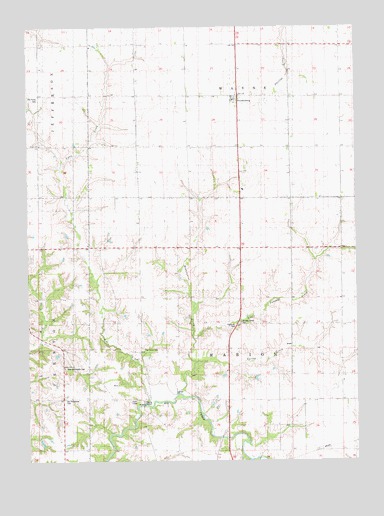
Swedesburg, IA USGS Topographic Map
Click on map above to begin viewing in our Map Viewer.

This topographic map contains these locations and features:
Feature Name Type Latitude Longitude GNIS ID View Map
Brandywine CreekStreamN41.0167°W91.5716°454807View Map
Finley CemeteryCemeteryN41.0914°W91.6202°1981555View Map
Finley ChurchChurchN41.0914°W91.6202°1825012View Map
Hickory Grove CemeteryCemeteryN41.0397°W91.5443°1825010View Map
Hickory Grove Rest AreaLocaleN41.0389°W91.5465°1981389View Map
Little Potomac CreekStreamN41.0361°W91.5618°458495View Map
Lynn CreekStreamN41.0164°W91.5810°1825011View Map
New Richwoods CemeteryCemeteryN41.0269°W91.6111°1825007View Map
Oak Grove CemeteryCemeteryN41.0322°W91.5815°1825009View Map
Old Finley CemeteryCemeteryN41.1044°W91.6209°1825013View Map
Old Richwoods CemeteryCemeteryN41.0177°W91.6116°1825006View Map
Richwoods ChurchChurchN41.0270°W91.6113°1825008View Map
Spring CreekStreamN41.0272°W91.5632°461878View Map
SwedesburgPopulated PlaceN41.1053°W91.5471°462147View Map
Swedesburg CemeteryCemeteryN41.1059°W91.5454°1981556View Map
Swedesburg Evangelical Lutheran ChurchChurchN41.1050°W91.5471°1981522View Map
Swedesburg Post OfficePost OfficeN41.1045°W91.5440°466537View Map
Swedish Heritage MuseumBuildingN41.1050°W91.5471°1981521View Map
Township of MarionCivilN41.0320°W91.5444°468353View Map
Township of WayneCivilN41.1193°W91.5437°468956View Map
Traxler (historical)Populated PlaceN41.0278°W91.5807°1982151View Map
Traxler CemeteryCemeteryN41.0414°W91.5922°1981557View Map
Traxler Post Office (historical)Post OfficeN41.0278°W91.5807°1981400View Map
Winona Post Office (historical)Post OfficeN41.1209°W91.5046°466538View Map

Note: Coordinates in the location and feature list above are referenced to NAD83 datum.


Copyright (C) 2008-2024 Ryan Niemi / Sunset Dynamics ... All Rights Reserved