TopoQuest Logo
Do you find TopoQuest useful?
Help keep TopoQuest running and adding new maps/features by donating!
Bitcoin:  19c7KJd3qBynnjoSw5npx9KScwjBe4ifkT
Litecoin:  LXs6TkuXGGXo1vDsWCkWVdjQX94eUKd6ui
Home View Maps Find Maps Find Places Resources & Links


Logdell, Oregon Topographic Map

USGS Map Title: Logdell, OR
USGS Map MRC: 44119B2
DRG (GeoTIFF) Download: o44119b2.tif


Neighboring USGS Topographic Map Quads:


  Big Weasel Springs, OR  
44119C3
 

  McClellan Mountain, OR  
44119C2
 

  Fall Mountain, OR  
44119C1
 

  Flagtail Mountain, OR  
44119B3
 

  Logdell, OR  
44119B2
 

  Scotty Creek, OR  
44119B1
 

  Lewis Creek, OR  
44119A3
 

  Five Hundred Flat, OR  
44119A2
 

  Rail Creek Butte, OR  
44119A1


Map MRC Location:

N45°
W120°
N45°
W119°
H8 H7 H6 H5 H4 H3 H2 H1
G8 G7 G6 G5 G4 G3 G2 G1
F8 F7 F6 F5 F4 F3 F2 F1
E8 E7 E6 E5 E4 E3 E2 E1
D8 D7 D6 D5 D4 D3 D2 D1
C8 C7 C6 C5 C4 C3 C2 C1
B8 B7 B6 B5 B4 B3 B2 B1
A8 A7 A6 A5 A4 A3 A2 A1
N44°
W120°
N44°
W119°

Logdell, OR USGS 1:24K Topographic Map Preview:
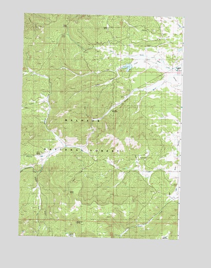
Logdell, OR USGS Topographic Map
Click on map above to begin viewing in our Map Viewer.

This topographic map contains these locations and features:
Feature Name Type Latitude Longitude GNIS ID View Map
Bear Valley Work CenterLocaleN44.1960°W119.1825°1137763View Map
Cold CreekStreamN44.1913°W119.1950°1139914View Map
Dipping Vat CreekStreamN44.1627°W119.1491°1141044View Map
Duncanville Post Office (historical)Post OfficeN44.2210°W119.1441°1164323View Map
Flagtail Cow CampLocaleN44.1718°W119.2325°1142221View Map
Flagtail CreekStreamN44.2004°W119.2311°1142222View Map
Hay CreekStreamN44.2227°W119.1416°1143390View Map
Hog CreekStreamN44.1488°W119.2355°1143632View Map
Keller SpringSpringN44.2432°W119.2162°1144517View Map
Little Snowshoe CreekStreamN44.1607°W119.2361°1145259View Map
LogdellLocaleN44.2227°W119.1291°1145340View Map
Logdell Post Office (historical)Post OfficeN44.2227°W119.1291°1165555View Map
Lost CreekStreamN44.1485°W119.1316°1154533View Map
Lost Creek ReservoirReservoirN44.1490°W119.1413°1156926View Map
Luce CreekStreamN44.2438°W119.1291°1158342View Map
Ninety Six SpringSpringN44.1703°W119.1522°1159228View Map
Oxbow ButteSummitN44.2471°W119.2011°1154531View Map
Oxbow SpringSpringN44.2427°W119.1846°1147323View Map
Poison SpringSpringN44.1513°W119.2120°1147827View Map
Rail GulchValleyN44.1818°W119.1288°1154530View Map
Roads End SpringSpringN44.1331°W119.2052°1148505View Map
Snow CreekStreamN44.1749°W119.2044°1149807View Map
Snowshoe CreekStreamN44.1710°W119.2283°1149829View Map
Sproul DamDamN44.2223°W119.1655°1161695View Map
Sproul RanchLocaleN44.2199°W119.1311°1156929View Map
Sproul ReservoirReservoirN44.2210°W119.1681°1161653View Map
Sproul SpringSpringN44.1715°W119.2343°1150203View Map
Station SpringSpringN44.1915°W119.1830°1156927View Map
Swamp CreekStreamN44.2199°W119.1783°1150735View Map
Wickiup CreekStreamN44.1757°W119.2161°1152314View Map

Note: Coordinates in the location and feature list above are referenced to NAD83 datum.


Copyright (C) 2008-2024 Ryan Niemi / Sunset Dynamics ... All Rights Reserved