TopoQuest Logo
Do you find TopoQuest useful?
Help keep TopoQuest running and adding new maps/features by donating!
Bitcoin:  19c7KJd3qBynnjoSw5npx9KScwjBe4ifkT
Litecoin:  LXs6TkuXGGXo1vDsWCkWVdjQX94eUKd6ui
Home View Maps Find Maps Find Places Resources & Links


Scotty Creek, Oregon Topographic Map

USGS Map Title: Scotty Creek, OR
USGS Map MRC: 44119B1
DRG (GeoTIFF) Download: o44119b1.tif


Neighboring USGS Topographic Map Quads:


  McClellan Mountain, OR  
44119C2
 

  Fall Mountain, OR  
44119C1
 

  Canyon Mountain, OR  
44118C8
 

  Logdell, OR  
44119B2
 

  Scotty Creek, OR  
44119B1
 

  Seneca, OR  
44118B8
 

  Five Hundred Flat, OR  
44119A2
 

  Rail Creek Butte, OR  
44119A1
 

  Silvies, OR  
44118A8


Map MRC Location:

N45°
W120°
N45°
W119°
H8 H7 H6 H5 H4 H3 H2 H1
G8 G7 G6 G5 G4 G3 G2 G1
F8 F7 F6 F5 F4 F3 F2 F1
E8 E7 E6 E5 E4 E3 E2 E1
D8 D7 D6 D5 D4 D3 D2 D1
C8 C7 C6 C5 C4 C3 C2 C1
B8 B7 B6 B5 B4 B3 B2 B1
A8 A7 A6 A5 A4 A3 A2 A1
N44°
W120°
N44°
W119°

Scotty Creek, OR USGS 1:24K Topographic Map Preview:
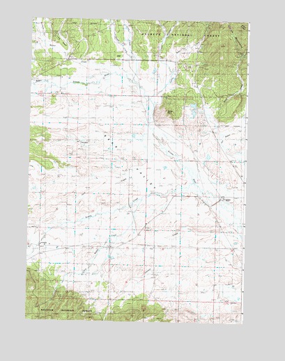
Scotty Creek, OR USGS Topographic Map
Click on map above to begin viewing in our Map Viewer.

This topographic map contains these locations and features:
Feature Name Type Latitude Longitude GNIS ID View Map
Allen CreekStreamN44.2318°W119.0661°1137142View Map
Bear ValleyBasinN44.1960°W119.0738°1137760View Map
Blanton Post Office (historical)Post OfficeN44.1904°W119.0072°1164222View Map
Camp CreekStreamN44.2174°W119.0569°1139225View Map
Cerny AirportAirportN44.2440°W119.1239°2650866View Map
Damon CreekStreamN44.1607°W119.0011°1140610View Map
Eddington CreekStreamN44.1846°W119.0705°1154532View Map
Ferris SpringSpringN44.2220°W119.0431°1156924View Map
Geary CreekStreamN44.2243°W119.0663°1142599View Map
Holliday RanchLocaleN44.1763°W119.0133°1133903View Map
Homer Post Office (historical)Post OfficeN44.2252°W119.1236°1164420View Map
Jack CreekStreamN44.1840°W119.0316°1144165View Map
Jenkins CreekStreamN44.2407°W119.1216°1144247View Map
Keller CreekStreamN44.2221°W119.1138°1144516View Map
Klink ReservoirReservoirN44.1602°W119.0502°1638107View Map
Little Scotty CreekStreamN44.1749°W119.0616°1145252View Map
Long GladeValleyN44.2354°W119.1086°1145401View Map
Lowe RanchLocaleN44.1993°W119.0975°1133904View Map
Mason SpringSpringN44.2398°W119.0191°1145865View Map
Mothers CreekStreamN44.2404°W119.1216°1146519View Map
Ninety-Six RanchLocaleN44.1563°W119.1186°1133902View Map
Randall SpringSpringN44.1458°W119.0506°1156923View Map
S-2 SpringSpringN44.2330°W119.0267°1148886View Map
Scotty CreekStreamN44.1824°W119.0308°1149182View Map
Seneca Cow CampLocaleN44.2346°W119.0475°1167323View Map
South Fork Eddington CreekStreamN44.1832°W119.0927°1156841View Map
Starr CreekStreamN44.2374°W119.0397°1158935View Map
Swick CreekStreamN44.2018°W119.0144°1150781View Map
Van Aspen CreekStreamN44.1946°W119.0011°1151722View Map
Willow SpringsSpringN44.1386°W119.0445°1156925View Map
Windfall CreekStreamN44.2435°W119.0486°1152495View Map
Windy PointSummitN44.2110°W119.0469°1152518View Map
Wymer CreekStreamN44.2268°W119.0755°1152673View Map

Note: Coordinates in the location and feature list above are referenced to NAD83 datum.


Copyright (C) 2008-2025 Ryan Niemi / Sunset Dynamics ... All Rights Reserved