TopoQuest Logo
Do you find TopoQuest useful?
Help keep TopoQuest running and adding new maps/features by donating!
Bitcoin:  19c7KJd3qBynnjoSw5npx9KScwjBe4ifkT
Litecoin:  LXs6TkuXGGXo1vDsWCkWVdjQX94eUKd6ui
Home View Maps Find Maps Find Places Resources & Links


Lewis Creek, Oregon Topographic Map

USGS Map Title: Lewis Creek, OR
USGS Map MRC: 44119A3
DRG (GeoTIFF) Download: o44119a3.tif


Neighboring USGS Topographic Map Quads:


  Graylock Butte, OR  
44119B4
 

  Flagtail Mountain, OR  
44119B3
 

  Logdell, OR  
44119B2
 

  Izee, OR  
44119A4
 

  Lewis Creek, OR  
44119A3
 

  Five Hundred Flat, OR  
44119A2
 

  Whiskey Mountain, OR  
43119H4
 

  Alsup Mountain, OR  
43119H3
 

  West Myrtle Butte, OR  
43119H2


Map MRC Location:

N45°
W120°
N45°
W119°
H8 H7 H6 H5 H4 H3 H2 H1
G8 G7 G6 G5 G4 G3 G2 G1
F8 F7 F6 F5 F4 F3 F2 F1
E8 E7 E6 E5 E4 E3 E2 E1
D8 D7 D6 D5 D4 D3 D2 D1
C8 C7 C6 C5 C4 C3 C2 C1
B8 B7 B6 B5 B4 B3 B2 B1
A8 A7 A6 A5 A4 A3 A2 A1
N44°
W120°
N44°
W119°

Lewis Creek, OR USGS 1:24K Topographic Map Preview:
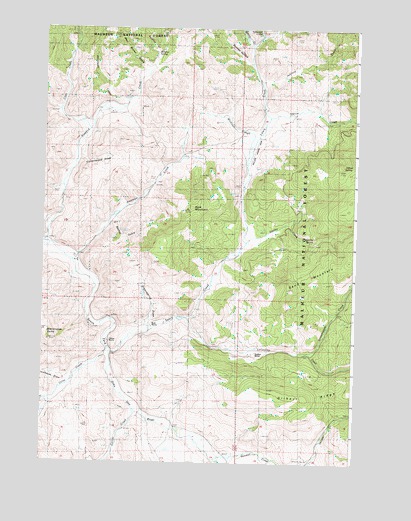
Lewis Creek, OR USGS Topographic Map
Click on map above to begin viewing in our Map Viewer.

This topographic map contains these locations and features:
Feature Name Type Latitude Longitude GNIS ID View Map
Antelope CreekStreamN44.0582°W119.3641°1137234View Map
Badley GulchValleyN44.0693°W119.3466°1137403View Map
Blackhorse ButteSummitN44.0346°W119.3733°1138228View Map
Blackhorse DrawValleyN44.0246°W119.3661°1138230View Map
Bradley RanchLocaleN44.0318°W119.2911°1156580View Map
Buck MountainSummitN44.0729°W119.3175°1138801View Map
Bunton CreekStreamN44.1201°W119.2927°1138962View Map
Bush RanchLocaleN44.0385°W119.3300°1156578View Map
C H Jackson RanchLocaleN44.0585°W119.3613°1638108View Map
Caps CreekStreamN44.0954°W119.3580°1139362View Map
Chappel GulchValleyN44.0026°W119.2955°1152961View Map
Chappel Gulch ReservoirReservoirN44.0138°W119.2844°1154194View Map
Corral CreekStreamN44.0149°W119.3383°1140142View Map
Cottonwood DrawValleyN44.0915°W119.3622°1152960View Map
Duncan HollowValleyN44.1154°W119.2947°1141404View Map
Flat CreekStreamN44.0324°W119.3488°1142233View Map
Grasshopper CreekStreamN44.0315°W119.2675°1142960View Map
Greenspring DrawValleyN44.0393°W119.3327°1143069View Map
H H Trowbridge RanchLocaleN44.0635°W119.3750°1156583View Map
H Officer RanchLocaleN44.0146°W119.3741°1167328View Map
Hyde RanchLocaleN44.0829°W119.3269°1156582View Map
Inshallah International AirportAirportN44.0874°W119.2919°1153872View Map
Johnnie CreekStreamN44.1093°W119.2880°1144312View Map
Lewis CreekStreamN44.0315°W119.3475°1144969View Map
Lonesome CreekStreamN44.0418°W119.3180°1145377View Map
Officer CreekStreamN44.0990°W119.2855°1147164View Map
Officer RanchLocaleN44.0349°W119.3494°1156579View Map
Officer SpringSpringN44.0857°W119.2554°1147165View Map
P W Hyde RanchLocaleN44.0915°W119.2963°1156581View Map
Road GulchValleyN44.1138°W119.3302°1156937View Map
Sand MountainSummitN44.0501°W119.2769°1149038View Map
Seneca DivisionCivilN44.1181°W119.2532°1938116View Map
Smoky CreekStreamN44.0638°W119.2938°1149777View Map
Smoky SpringSpringN44.0642°W119.2705°1149779View Map
Stonewall CreekStreamN44.1026°W119.3433°1150449View Map
Sulphur GulchValleyN44.1174°W119.3316°1150585View Map
Sulphur SpringSpringN44.1181°W119.3311°1150586View Map
Tamarack CreekStreamN44.1229°W119.2891°1150867View Map
Utley CreekStreamN44.0185°W119.3697°1151714View Map
Venator CreekStreamN44.0010°W119.3058°1151748View Map
Walt Brown GulchValleyN44.1138°W119.3358°1151870View Map
Wickiser SloughStreamN44.0940°W119.2894°1152291View Map
Wickiser SpringSpringN44.1021°W119.3039°1154195View Map

Note: Coordinates in the location and feature list above are referenced to NAD83 datum.


Copyright (C) 2008-2024 Ryan Niemi / Sunset Dynamics ... All Rights Reserved