TopoQuest Logo
Do you find TopoQuest useful?
Help keep TopoQuest running and adding new maps/features by donating!
Bitcoin:  19c7KJd3qBynnjoSw5npx9KScwjBe4ifkT
Litecoin:  LXs6TkuXGGXo1vDsWCkWVdjQX94eUKd6ui
Home View Maps Find Maps Find Places Resources & Links


Flagtail Mountain, Oregon Topographic Map

USGS Map Title: Flagtail Mountain, OR
USGS Map MRC: 44119B3
DRG (GeoTIFF) Download: o44119b3.tif


Neighboring USGS Topographic Map Quads:


  Aldrich Mountain South, OR  
44119C4
 

  Big Weasel Springs, OR  
44119C3
 

  McClellan Mountain, OR  
44119C2
 

  Graylock Butte, OR  
44119B4
 

  Flagtail Mountain, OR  
44119B3
 

  Logdell, OR  
44119B2
 

  Izee, OR  
44119A4
 

  Lewis Creek, OR  
44119A3
 

  Five Hundred Flat, OR  
44119A2


Map MRC Location:

N45°
W120°
N45°
W119°
H8 H7 H6 H5 H4 H3 H2 H1
G8 G7 G6 G5 G4 G3 G2 G1
F8 F7 F6 F5 F4 F3 F2 F1
E8 E7 E6 E5 E4 E3 E2 E1
D8 D7 D6 D5 D4 D3 D2 D1
C8 C7 C6 C5 C4 C3 C2 C1
B8 B7 B6 B5 B4 B3 B2 B1
A8 A7 A6 A5 A4 A3 A2 A1
N44°
W120°
N44°
W119°

Flagtail Mountain, OR USGS 1:24K Topographic Map Preview:
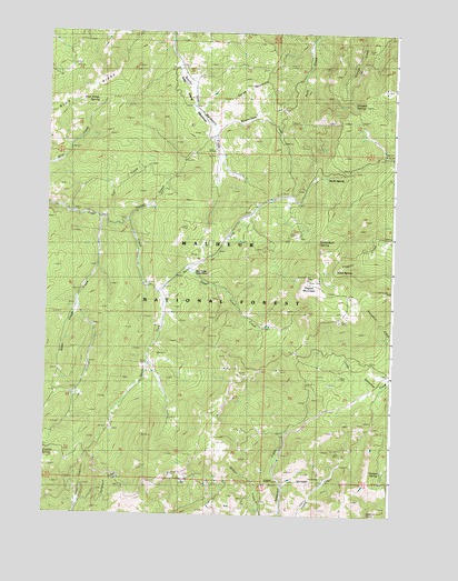
Flagtail Mountain, OR USGS Topographic Map
Click on map above to begin viewing in our Map Viewer.

This topographic map contains these locations and features:
Feature Name Type Latitude Longitude GNIS ID View Map
Alder CreekStreamN44.1788°W119.3664°1137067View Map
Beaverdam CreekStreamN44.2257°W119.3172°1137854View Map
Blue RidgeRidgeN44.2349°W119.3633°1138328View Map
Blue Ridge SpringSpringN44.2321°W119.3578°1138330View Map
Carson SpringSpringN44.1364°W119.2542°1139402View Map
Cliffs CampLocaleN44.1351°W119.2744°1158166View Map
Corral CreekStreamN44.2018°W119.3591°1140143View Map
Dead Injun CreekStreamN44.1890°W119.3250°1140704View Map
Deer Creek Guard StationBuildingN44.1873°W119.3223°1140846View Map
Donaldson SpringSpringN44.1959°W119.2773°1141174View Map
Elliot SpringSpringN44.1886°W119.2712°1141831View Map
Flagtail MountainSummitN44.1863°W119.2813°1142223View Map
Flagtail Mountain Fire LookoutLocaleN44.1860°W119.2808°1167237View Map
Horse MountainSummitN44.2365°W119.3044°1143774View Map
John Young MeadowsFlatN44.2293°W119.3215°1144310View Map
Mutiny SpringSpringN44.2164°W119.2502°1156928View Map
North Fork Deer CreekStreamN44.1829°W119.3364°1146943View Map
Roba Brothers MineMineN44.1990°W119.2855°1148529View Map
Roba Westfall MineMineN44.2101°W119.2836°1148533View Map
Softwater SpringSpringN44.1412°W119.3736°1149860View Map
South Fork Deer CreekStreamN44.1829°W119.3364°1149964View Map
Stewart SpringSpringN44.2318°W119.2654°1150422View Map
Thirty-Thirty SpringSpringN44.2127°W119.2748°1151071View Map
Thorpe CreekStreamN44.2010°W119.3483°1151142View Map
Trail CreekStreamN44.2013°W119.3566°1151367View Map
York and Rannels MineMineN44.1968°W119.2891°1152746View Map

Note: Coordinates in the location and feature list above are referenced to NAD83 datum.


Copyright (C) 2008-2024 Ryan Niemi / Sunset Dynamics ... All Rights Reserved