TopoQuest Logo
Do you find TopoQuest useful?
Help keep TopoQuest running and adding new maps/features by donating!
Bitcoin:  19c7KJd3qBynnjoSw5npx9KScwjBe4ifkT
Litecoin:  LXs6TkuXGGXo1vDsWCkWVdjQX94eUKd6ui
Home View Maps Find Maps Find Places Resources & Links


Lomira, Wisconsin Topographic Map

USGS Map Title: Lomira, WI
USGS Map MRC: 43088E4
DRG (GeoTIFF) Download: o43088e4.tif


Neighboring USGS Topographic Map Quads:


  Oakfield, WI  
43088F5
 

  Byron, WI  
43088F4
 

  Eden, WI  
43088F3
 

  Mayville North, WI  
43088E5
 

  Lomira, WI  
43088E4
 

  Campbellsport, WI  
43088E3
 

  Mayville South, WI  
43088D5
 

  Nenno, WI  
43088D4
 

  Allenton, WI  
43088D3


Map MRC Location:

N44°
W89°
N44°
W88°
H8 H7 H6 H5 H4 H3 H2 H1
G8 G7 G6 G5 G4 G3 G2 G1
F8 F7 F6 F5 F4 F3 F2 F1
E8 E7 E6 E5 E4 E3 E2 E1
D8 D7 D6 D5 D4 D3 D2 D1
C8 C7 C6 C5 C4 C3 C2 C1
B8 B7 B6 B5 B4 B3 B2 B1
A8 A7 A6 A5 A4 A3 A2 A1
N43°
W89°
N43°
W88°

Lomira, WI USGS 1:24K Topographic Map Preview:
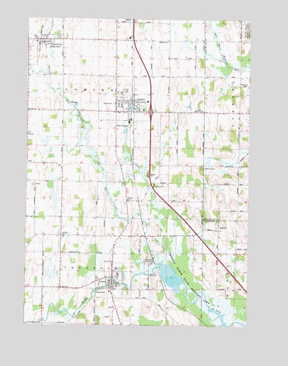
Lomira, WI USGS Topographic Map
Click on map above to begin viewing in our Map Viewer.

This topographic map contains these locations and features:
Feature Name Type Latitude Longitude GNIS ID View Map
144 ReservoirReservoirN43.5196°W88.4175°1792734View Map
Adelmeyer FarmsLocaleN43.5022°W88.4175°2724845View Map
Beldo FarmsLocaleN43.5722°W88.4781°2724816View Map
BrownsvillePopulated PlaceN43.6164°W88.4907°1562277View Map
Brownsville Fire CompanyBuildingN43.6158°W88.4909°2698057View Map
Brownsville Police DepartmentBuildingN43.6157°W88.4921°2759744View Map
Brownsville Post OfficePost OfficeN43.6164°W88.4986°2723996View Map
Brownsville Public LibraryBuildingN43.6161°W88.4858°2723998View Map
Budjon FarmsLocaleN43.5503°W88.4336°2724819View Map
Camelot Country ClubLocaleN43.5875°W88.4057°1581186View Map
Centery FarmsLocaleN43.5039°W88.4219°2724846View Map
Consolidated Catholic SchoolSchoolN43.5908°W88.4507°1850835View Map
Crystal SpringSpringN43.5905°W88.4398°1563601View Map
Ebenezer CemeteryCemeteryN43.6155°W88.4212°1564417View Map
Ebenezer Church (historical)ChurchN43.6158°W88.4218°1850677View Map
Ebenezer Church (historical)SchoolN43.6158°W88.4218°1850691View Map
Golden CornersLocaleN43.5653°W88.4004°1565605View Map
Gusty Winds FarmLocaleN43.5233°W88.4783°2724848View Map
Hickory Grove School (historical)SchoolN43.5583°W88.4998°1850732View Map
Hilltop AcresLocaleN43.6031°W88.3983°2726918View Map
Immanuel Lutheran SchoolSchoolN43.5004°W88.4856°1566888View Map
Interchange 81CrossingN43.5375°W88.4039°2356992View Map
Interchange 85CrossingN43.5869°W88.4308°2356991View Map
Interchange 87CrossingN43.6161°W88.4408°2356990View Map
Kummel CreekStreamN43.5236°W88.4257°1567659View Map
Leemar FarmsLocaleN43.5431°W88.4614°2724817View Map
LomiraPopulated PlaceN43.5914°W88.4437°1568503View Map
Lomira CreekStreamN43.5242°W88.4193°1568504View Map
Lomira Elementary SchoolSchoolN43.5902°W88.4469°2716442View Map
Lomira Fire DepartmentBuildingN43.5868°W88.4398°2697909View Map
Lomira High SchoolSchoolN43.5891°W88.4469°1850766View Map
Lomira Middle SchoolSchoolN43.5897°W88.4469°2716304View Map
Lomira Police DepartmentBuildingN43.5858°W88.4407°2759390View Map
Lomira PondLakeN43.5880°W88.4421°2761860View Map
Lomira Post OfficePost OfficeN43.5922°W88.4417°2723997View Map
Mullen School (historical)SchoolN43.5300°W88.3815°1840947View Map
Ries Pure Breed Hog FarmLocaleN43.5925°W88.4192°2724821View Map
Rural Leader School (historical)SchoolN43.5872°W88.4998°1850814View Map
Saint Gobki CemeteryCemeteryN43.5144°W88.4804°1572955View Map
Saint John's Lutheran SchoolSchoolN43.5882°W88.4394°1850825View Map
Saint Johns Lutheran ChurchChurchN43.5880°W88.4401°1850823View Map
Saint Mary's CemeteryCemeteryN43.5905°W88.4516°1573284View Map
Saint Marys Catholic ChurchChurchN43.5903°W88.4507°1850831View Map
Saint Pauls Lutheran SchoolSchoolN43.6147°W88.4912°1850843View Map
Saint Pauls SchoolSchoolN43.5514°W88.4432°1573499View Map
Saint Peters CemeteryCemeteryN43.5367°W88.4795°1573518View Map
Silver Leaf School (historical)SchoolN43.5583°W88.4795°1850858View Map
Spring Valley FarmLocaleN43.5736°W88.4142°2724820View Map
Sterr ParkParkN43.5897°W88.4426°1574868View Map
TheresaPopulated PlaceN43.5172°W88.4512°1575345View Map
Theresa Ambulance ServiceBuildingN43.5224°W88.4465°2698298View Map
Theresa Elementary SchoolSchoolN43.5182°W88.4532°1850853View Map
Theresa Elementary SchoolSchoolN43.5139°W88.4523°1850874View Map
Theresa Marsh 2WP2537 DamDamN43.5250°W88.4218°1792733View Map
Theresa Marsh State Wildlife AreaParkN43.5167°W88.4140°1575346View Map
Theresa MillpondReservoirN43.5191°W88.4528°2761861View Map
Theresa Police DepartmentBuildingN43.5170°W88.4515°2759583View Map
Theresa Post OfficePost OfficeN43.5178°W88.4522°2723995View Map
Theresa Public LibraryBuildingN43.5203°W88.4536°2723999View Map
Theresa StationPopulated PlaceN43.5267°W88.4279°1575347View Map
Theresa Volunteer Fire DepartmentBuildingN43.5224°W88.4465°2698135View Map
Town of LomiraCivilN43.5867°W88.4617°1583594View Map
Trinity Methodist ChurchChurchN43.5878°W88.4348°1850882View Map
Union CemeteryCemeteryN43.5261°W88.4515°1575877View Map
Village of BrownsvilleCivilN43.6145°W88.4952°1582876View Map
Village of LomiraCivilN43.5944°W88.4420°1583593View Map
Village of TheresaCivilN43.5165°W88.4540°1584271View Map
Wayne CemeteryCemeteryN43.5403°W88.3912°1576351View Map
WMVM-FM (Mayville)TowerN43.5047°W88.4182°1582608View Map
WWRS-AM (Mayville)TowerN43.5389°W88.4765°1582560View Map
Zedland FarmLocaleN43.5503°W88.4442°2724818View Map

Note: Coordinates in the location and feature list above are referenced to NAD83 datum.


Copyright (C) 2008-2024 Ryan Niemi / Sunset Dynamics ... All Rights Reserved