TopoQuest Logo
Do you find TopoQuest useful?
Help keep TopoQuest running and adding new maps/features by donating!
Bitcoin:  19c7KJd3qBynnjoSw5npx9KScwjBe4ifkT
Litecoin:  LXs6TkuXGGXo1vDsWCkWVdjQX94eUKd6ui
Home View Maps Find Maps Find Places Resources & Links


Oakfield, Wisconsin Topographic Map

USGS Map Title: Oakfield, WI
USGS Map MRC: 43088F5
DRG (GeoTIFF) Download: o43088f5.tif


Neighboring USGS Topographic Map Quads:


  Rosendale, WI  
43088G6
 

  Eldorado, WI  
43088G5
 

  Fond du Lac, WI  
43088G4
 

  Waupun North, WI  
43088F6
 

  Oakfield, WI  
43088F5
 

  Byron, WI  
43088F4
 

  Waupun South, WI  
43088E6
 

  Mayville North, WI  
43088E5
 

  Lomira, WI  
43088E4


Map MRC Location:

N44°
W89°
N44°
W88°
H8 H7 H6 H5 H4 H3 H2 H1
G8 G7 G6 G5 G4 G3 G2 G1
F8 F7 F6 F5 F4 F3 F2 F1
E8 E7 E6 E5 E4 E3 E2 E1
D8 D7 D6 D5 D4 D3 D2 D1
C8 C7 C6 C5 C4 C3 C2 C1
B8 B7 B6 B5 B4 B3 B2 B1
A8 A7 A6 A5 A4 A3 A2 A1
N43°
W89°
N43°
W88°

Oakfield, WI USGS 1:24K Topographic Map Preview:
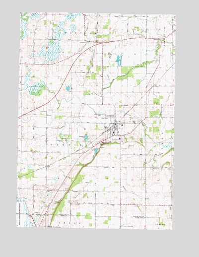
Oakfield, WI USGS Topographic Map
Click on map above to begin viewing in our Map Viewer.

This topographic map contains these locations and features:
Feature Name Type Latitude Longitude GNIS ID View Map
1 ReservoirReservoirN43.6717°W88.5668°1793384View Map
Avoca CemeteryCemeteryN43.6872°W88.5320°1845726View Map
Campground CreekStreamN43.7005°W88.5721°1562689View Map
Crestledge FarmsLocaleN43.6314°W88.5228°2724853View Map
Genesee CemeteryCemeteryN43.6614°W88.5068°1845806View Map
Genessee School (historical)SchoolN43.6605°W88.5215°1565458View Map
Guenther FarmLocaleN43.7186°W88.6069°2726969View Map
Hawes CemeteryCemeteryN43.7360°W88.5146°1845814View Map
Highland School (historical)SchoolN43.6464°W88.5618°1566399View Map
Kinwood CemeteryCemeteryN43.6391°W88.5462°1567527View Map
Kollman FarmsLocaleN43.6381°W88.5719°2726970View Map
LamartinePopulated PlaceN43.7333°W88.5687°1567812View Map
Lamartine CemeteryCemeteryN43.7278°W88.5776°1845843View Map
Lamartine United Methodist ChurchChurchN43.7339°W88.5712°1845844View Map
Lamartine Volunteer Fire DepartmentBuildingN43.7331°W88.5652°2698043View Map
Lamonske FarmLocaleN43.6672°W88.5903°2726972View Map
Ledgewind FarmLocaleN43.6458°W88.5947°2726966View Map
M and M FarmsLocaleN43.7050°W88.6244°2726965View Map
Mittelstadt Landing Strip (historical)AirportN43.6272°W88.5362°1850785View Map
Oak CenterPopulated PlaceN43.6608°W88.6001°1570599View Map
Oak Center CemeteryCemeteryN43.6466°W88.6009°1845870View Map
Oak Center School (historical)SchoolN43.6683°W88.5998°1570600View Map
Oak Ridge FarmLocaleN43.6708°W88.5439°2726971View Map
OakfieldPopulated PlaceN43.6861°W88.5465°1570697View Map
Oakfield Fire Department and EMSBuildingN43.6839°W88.5479°2697786View Map
Oakfield High SchoolSchoolN43.6854°W88.5419°1845871View Map
Oakfield Ledge State Natural AreaParkN43.6736°W88.5537°2059228View Map
Oakfield Police DepartmentBuildingN43.6839°W88.5479°2759524View Map
Oakfield QuarryMineN43.6447°W88.5756°2633156View Map
Oakfield Railroad Prairie State Natural AreaParkN43.7175°W88.5059°2059229View Map
Oakfield United Methodist ChurchChurchN43.6814°W88.5479°1845872View Map
Raspberry LakeReservoirN43.6778°W88.5703°1845880View Map
Reynolds Elementary SchoolSchoolN43.6774°W88.5434°1845884View Map
Saint James Catholic ChurchChurchN43.6839°W88.5471°1845907View Map
Saint Luke's Lutheran SchoolSchoolN43.6814°W88.5444°1845924View Map
Saint Lukes Lutheran ChurchChurchN43.6814°W88.5448°1845923View Map
Schley E5190 DamDamN43.6717°W88.5668°1793383View Map
Sevenmile CreekStreamN43.7028°W88.5698°1560988View Map
Stone School (historical)SchoolN43.6464°W88.5918°1574933View Map
Town of OakfieldCivilN43.6757°W88.5843°1583839View Map
Unity School (historical)SchoolN43.6967°W88.5473°1575929View Map
Village of OakfieldCivilN43.6843°W88.5476°1583838View Map
WFDL-FM (Lomira)TowerN43.6400°W88.5537°1582399View Map

Note: Coordinates in the location and feature list above are referenced to NAD83 datum.


Copyright (C) 2008-2025 Ryan Niemi / Sunset Dynamics ... All Rights Reserved