TopoQuest Logo
Do you find TopoQuest useful?
Help keep TopoQuest running and adding new maps/features by donating!
Bitcoin:  19c7KJd3qBynnjoSw5npx9KScwjBe4ifkT
Litecoin:  LXs6TkuXGGXo1vDsWCkWVdjQX94eUKd6ui
Home View Maps Find Maps Find Places Resources & Links


Eden, Wisconsin Topographic Map

USGS Map Title: Eden, WI
USGS Map MRC: 43088F3
DRG (GeoTIFF) Download: o43088f3.tif


Neighboring USGS Topographic Map Quads:


  Fond du Lac, WI  
43088G4
 

  Saint Peter, WI  
43088G3
 

  Saint Cloud, WI  
43088G2
 

  Byron, WI  
43088F4
 

  Eden, WI  
43088F3
 

  Dundee, WI  
43088F2
 

  Lomira, WI  
43088E4
 

  Campbellsport, WI  
43088E3
 

  Kewaskum, WI  
43088E2


Map MRC Location:

N44°
W89°
N44°
W88°
H8 H7 H6 H5 H4 H3 H2 H1
G8 G7 G6 G5 G4 G3 G2 G1
F8 F7 F6 F5 F4 F3 F2 F1
E8 E7 E6 E5 E4 E3 E2 E1
D8 D7 D6 D5 D4 D3 D2 D1
C8 C7 C6 C5 C4 C3 C2 C1
B8 B7 B6 B5 B4 B3 B2 B1
A8 A7 A6 A5 A4 A3 A2 A1
N43°
W89°
N43°
W88°

Eden, WI USGS 1:24K Topographic Map Preview:
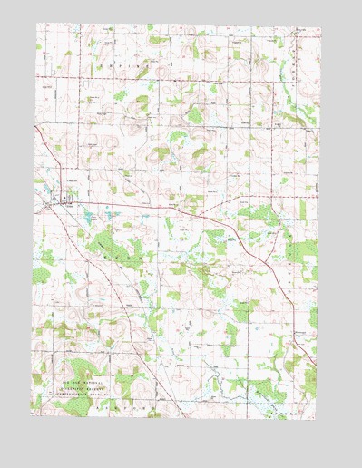
Eden, WI USGS Topographic Map
Click on map above to begin viewing in our Map Viewer.

This topographic map contains these locations and features:
Feature Name Type Latitude Longitude GNIS ID View Map
Braatz FarmsLocaleN43.7317°W88.3494°2726892View Map
Broken Bow DairyLocaleN43.6794°W88.2725°2726884View Map
Buena Vista Airport (historical)AirportN43.7411°W88.3248°1581976View Map
Dinner Bell FarmsLocaleN43.7072°W88.2889°2726885View Map
Dinnerbell AirportAirportN43.7083°W88.2883°1581960View Map
Dunisch FarmLocaleN43.7044°W88.3444°2726886View Map
EdenPopulated PlaceN43.6936°W88.3609°1564440View Map
Eden Elementary SchoolSchoolN43.6946°W88.3611°1845765View Map
Eden Post OfficePost OfficeN43.6933°W88.3617°2726975View Map
Eden Volunteer Fire DepartmentBuildingN43.6921°W88.3571°2697944View Map
Edgewood School (historical)SchoolN43.6886°W88.2662°1845766View Map
Empire CemeteryCemeteryN43.7250°W88.3544°1564641View Map
Foursome AcresLocaleN43.6617°W88.3386°2726887View Map
Gobels PitMineN43.7136°W88.2547°2711512View Map
Gudex CemeteryCemeteryN43.6264°W88.3081°1565932View Map
Guells Dairy FarmLocaleN43.6511°W88.3042°2726916View Map
Harcum School (historical)SchoolN43.6933°W88.3245°1845811View Map
Hayes School (historical)SchoolN43.7042°W88.3612°1845815View Map
Hill Vu Dairy FarmLocaleN43.6586°W88.3353°2726888View Map
Ice Age National Scientific ReserveUnknownN43.6308°W88.3508°1581237View Map
Jackson School (historical)SchoolN43.6903°W88.3004°1845829View Map
Leonard FarmsLocaleN43.7375°W88.2597°2726889View Map
McCoullough MarshSwampN43.6303°W88.2701°1569187View Map
Odekirk CemeteryCemeteryN43.6603°W88.3309°1570750View Map
Saint James CemeteryCemeteryN43.6603°W88.3490°1572974View Map
Saint James Church (historical)ChurchN43.6603°W88.3498°1845908View Map
Saint John CemeteryCemeteryN43.7181°W88.2694°1573042View Map
Saint Mary SchoolSchoolN43.6925°W88.3587°1845926View Map
Saint Mary's CemeteryCemeteryN43.6999°W88.3625°1573285View Map
Saint Michael CemeteryCemeteryN43.7474°W88.2614°1845936View Map
Tabor ChurchChurchN43.6933°W88.3251°1575218View Map
Town of EdenCivilN43.6741°W88.3405°1583130View Map
Twin LakesLakeN43.6885°W88.3508°1575791View Map
Village of EdenCivilN43.6928°W88.3642°1583129View Map
WaucoustaPopulated PlaceN43.6525°W88.2604°1576308View Map
Waucousta Lutheran SchoolSchoolN43.6525°W88.2558°2716470View Map
Woodside School (historical)SchoolN43.6600°W88.3054°1845978View Map

Note: Coordinates in the location and feature list above are referenced to NAD83 datum.


Copyright (C) 2008-2025 Ryan Niemi / Sunset Dynamics ... All Rights Reserved