TopoQuest Logo
Do you find TopoQuest useful?
Help keep TopoQuest running and adding new maps/features by donating!
Bitcoin:  19c7KJd3qBynnjoSw5npx9KScwjBe4ifkT
Litecoin:  LXs6TkuXGGXo1vDsWCkWVdjQX94eUKd6ui
Home View Maps Find Maps Find Places Resources & Links


Sunrise, Virginia Topographic Map

USGS Map Title: Sunrise, VA
USGS Map MRC: 38079B7
DRG (GeoTIFF) Download: o38079b7.tif


Neighboring USGS Topographic Map Quads:


  Clover Lick, WV  
38079C8
 

  Paddy Knob, WV  
38079C7
 

  Mustoe, VA  
38079C6
 

  Minnehaha Springs, WV  
38079B8
 

  Sunrise, VA  
38079B7
 

  Burnsville, VA  
38079B6
 

  Mountain Grove, VA  
38079A8
 

  Warm Springs, VA  
38079A7
 

  Bath Alum, VA  
38079A6


Map MRC Location:

N39°
W80°
N39°
W79°
H8 H7 H6 H5 H4 H3 H2 H1
G8 G7 G6 G5 G4 G3 G2 G1
F8 F7 F6 F5 F4 F3 F2 F1
E8 E7 E6 E5 E4 E3 E2 E1
D8 D7 D6 D5 D4 D3 D2 D1
C8 C7 C6 C5 C4 C3 C2 C1
B8 B7 B6 B5 B4 B3 B2 B1
A8 A7 A6 A5 A4 A3 A2 A1
N38°
W80°
N38°
W79°

Sunrise, VA USGS 1:24K Topographic Map Preview:
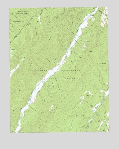
Sunrise, VA USGS Topographic Map
Click on map above to begin viewing in our Map Viewer.

This topographic map contains these locations and features:
Feature Name Type Latitude Longitude GNIS ID View Map
Bath County Pumped Storage LakeReservoirN38.1937°W79.8098°1488506View Map
Beaver RunStreamN38.1898°W79.8114°1481566View Map
Berry KnobSummitN38.1632°W79.7773°1499123View Map
Birch RunStreamN38.1479°W79.7667°1481808View Map
Bogan RunStreamN38.1540°W79.8501°1481901View Map
Bugan RunStreamN38.1543°W79.8501°1673641View Map
Castle RunStreamN38.1301°W79.7745°1482371View Map
Chestnut LevelsFlatN38.2085°W79.8728°1482483View Map
Dam HollowValleyN38.1805°W79.8244°1482903View Map
Doyle CemeteryCemeteryN38.2434°W79.7556°1483081View Map
Dry RunStreamN38.2282°W79.7859°1483136View Map
Fodder HouseSummitN38.2057°W79.7695°1499428View Map
Ford RunStreamN38.1754°W79.8320°1483477View Map
Gap RunStreamN38.2373°W79.7776°1483584View Map
Hacken RunStreamN38.2007°W79.8020°1483879View Map
House HoleValleyN38.2359°W79.7806°1484245View Map
Jewel HoleValleyN38.2289°W79.7870°1484447View Map
Joe HollowValleyN38.1941°W79.8136°1484454View Map
Kelly RunStreamN38.1348°W79.7739°1484542View Map
Lightner CemeteryCemeteryN38.2415°W79.7709°1484839View Map
Lightner RunStreamN38.2326°W79.8189°1484840View Map
Little MountainRangeN38.1756°W79.8576°1487052View Map
Long RunStreamN38.2418°W79.7734°1485065View Map
Long Spring RunStreamN38.2151°W79.8348°1485067View Map
Mad SheepSummitN38.2362°W79.8356°1485152View Map
Mad TomSummitN38.2337°W79.8501°1499700View Map
Mud Lick RunStreamN38.2365°W79.7798°1485723View Map
Ned HollowValleyN38.1557°W79.7587°1485814View Map
Paddy LickStreamN38.2487°W79.7614°1486029View Map
Pole RunStreamN38.1773°W79.8278°1486315View Map
Port Lock RunStreamN38.1601°W79.8476°1486360View Map
Saw Pit HollowValleyN38.2216°W79.7913°1486951View Map
Sawmill RunStreamN38.2079°W79.8009°1486958View Map
Schoolhouse RunStreamN38.1765°W79.8306°1486966View Map
Sively CemeteryCemeteryN38.1559°W79.8451°1487270View Map
Spring RunStreamN38.1260°W79.8656°1487459View Map
Spring RunStreamN38.2215°W79.7892°1487460View Map
Springhouse RunStreamN38.1885°W79.8137°1487473View Map
SunrisePopulated PlaceN38.1926°W79.8137°1488606View Map
Wildcat HollowValleyN38.1863°W79.8733°1488371View Map
Zion Hill ChurchChurchN38.2162°W79.7903°1487143View Map

Note: Coordinates in the location and feature list above are referenced to NAD83 datum.


Copyright (C) 2008-2024 Ryan Niemi / Sunset Dynamics ... All Rights Reserved