TopoQuest Logo
Do you find TopoQuest useful?
Help keep TopoQuest running and adding new maps/features by donating!
Bitcoin:  19c7KJd3qBynnjoSw5npx9KScwjBe4ifkT
Litecoin:  LXs6TkuXGGXo1vDsWCkWVdjQX94eUKd6ui
Home View Maps Find Maps Find Places Resources & Links


Burnsville, Virginia Topographic Map

USGS Map Title: Burnsville, VA
USGS Map MRC: 38079B6
DRG (GeoTIFF) Download: o38079b6.tif


Neighboring USGS Topographic Map Quads:


  Paddy Knob, WV  
38079C7
 

  Mustoe, VA  
38079C6
 

  Monterey SE, VA  
38079C5
 

  Sunrise, VA  
38079B7
 

  Burnsville, VA  
38079B6
 

  Williamsville, VA  
38079B5
 

  Warm Springs, VA  
38079A7
 

  Bath Alum, VA  
38079A6
 

  Green Valley, VA  
38079A5


Map MRC Location:

N39°
W80°
N39°
W79°
H8 H7 H6 H5 H4 H3 H2 H1
G8 G7 G6 G5 G4 G3 G2 G1
F8 F7 F6 F5 F4 F3 F2 F1
E8 E7 E6 E5 E4 E3 E2 E1
D8 D7 D6 D5 D4 D3 D2 D1
C8 C7 C6 C5 C4 C3 C2 C1
B8 B7 B6 B5 B4 B3 B2 B1
A8 A7 A6 A5 A4 A3 A2 A1
N38°
W80°
N38°
W79°

Burnsville, VA USGS 1:24K Topographic Map Preview:
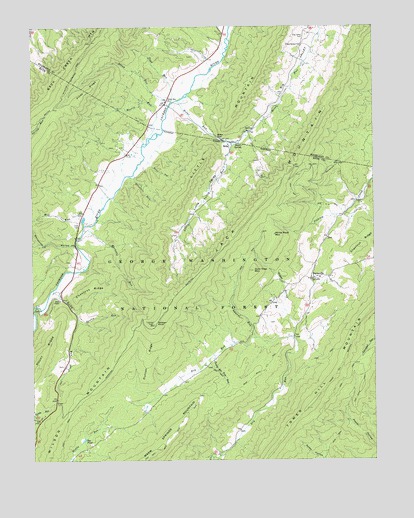
Burnsville, VA USGS Topographic Map
Click on map above to begin viewing in our Map Viewer.

This topographic map contains these locations and features:
Feature Name Type Latitude Longitude GNIS ID View Map
Barnetts RunStreamN38.1912°W79.7309°1481468View Map
Bath - Highland Burnsville Volunteer Fire DepartmentBuildingN38.1753°W79.6572°2766734View Map
BethelPopulated PlaceN38.2479°W79.6498°1673764View Map
Big PondLakeN38.1311°W79.7313°1481762View Map
Big Valley CemeteryCemeteryN38.2484°W79.6498°1481796View Map
BolarPopulated PlaceN38.2173°W79.6764°1492604View Map
Bolar GapGapN38.2190°W79.6814°1481912View Map
Bolar Methodist Church (historical)ChurchN38.2160°W79.6775°1673640View Map
Bolar RunStreamN38.2296°W79.6953°1481914View Map
Bolar SpringSpringN38.2164°W79.6736°1481915View Map
Bolar Volunteer Fire DepartmentBuildingN38.2289°W79.7015°2075317View Map
BurnsvillePopulated PlaceN38.1779°W79.6475°1492679View Map
Burnsville United Methodist ChurchChurchN38.1773°W79.6464°1673642View Map
Cave RunStreamN38.1679°W79.7487°1482385View Map
Chestnut RidgeRidgeN38.1754°W79.7281°1482502View Map
Cleek CemeteryCemeteryN38.1932°W79.7320°1482569View Map
Cleeks Mill (historical)LocaleN38.1965°W79.7312°1690041View Map
Daggy HollowValleyN38.1642°W79.6537°1482895View Map
Duncan KnobSummitN38.1648°W79.7050°1483166View Map
Duncan Knob LookoutLocaleN38.1643°W79.7050°1488559View Map
Duncan RidgeRidgeN38.1546°W79.7078°1483168View Map
Fort Lewis TrailTrailN38.1457°W79.6298°1483498View Map
Givens RunStreamN38.2082°W79.7120°1483651View Map
Gulley RunStreamN38.1662°W79.7328°1483861View Map
Gum Tree MountainSummitN38.1804°W79.6684°1483868View Map
Laurel RunStreamN38.1607°W79.6678°1484721View Map
Little ValleyValleyN38.2164°W79.6769°1484995View Map
Little Valley RunStreamN38.2176°W79.6778°1484999View Map
McGuffin TrailTrailN38.2365°W79.7342°1485302View Map
Mill RunStreamN38.1937°W79.7303°1485453View Map
Morris RunStreamN38.2185°W79.7070°1485558View Map
Paddy Bee Tree RunStreamN38.1557°W79.6828°1486026View Map
Peak RunStreamN38.2287°W79.6978°1486109View Map
Piney RidgeRidgeN38.2321°W79.7298°1486266View Map
Pritt HollowValleyN38.2105°W79.7062°1486431View Map
Rocky RidgeRidgeN38.1523°W79.7489°1486745View Map
Rocky RunStreamN38.1746°W79.7423°1486749View Map
Set Free Christian Fellowship ChurchChurchN38.2160°W79.6775°1673655View Map
Singleton AirportAirportN38.2108°W79.7141°2675588View Map
Starr Chapel United Methodist ChurchChurchN38.1718°W79.7398°1487536View Map
Stillhouse HollowValleyN38.1867°W79.7342°1487582View Map
Stony RunStreamN38.2279°W79.6989°1487633View Map
Stony Run CemeteryCemeteryN38.2293°W79.7000°1487640View Map
Stony Run ChurchChurchN38.2285°W79.6992°1488560View Map
Tower Hill MountainSummitN38.1401°W79.6495°1487961View Map
Tower Hill Mountain TrailTrailN38.1329°W79.6575°1487962View Map
Valley Bethel ChurchChurchN38.2460°W79.6506°1488080View Map
White Rock MountainSummitN38.1907°W79.6609°1493798View Map
Wilson MountainSummitN38.1404°W79.7359°1493817View Map

Note: Coordinates in the location and feature list above are referenced to NAD83 datum.


Copyright (C) 2008-2024 Ryan Niemi / Sunset Dynamics ... All Rights Reserved