TopoQuest Logo
Do you find TopoQuest useful?
Help keep TopoQuest running and adding new maps/features by donating!
Bitcoin:  19c7KJd3qBynnjoSw5npx9KScwjBe4ifkT
Litecoin:  LXs6TkuXGGXo1vDsWCkWVdjQX94eUKd6ui
Home View Maps Find Maps Find Places Resources & Links


Lone Man Coulee West, Montana Topographic Map

USGS Map Title: Lone Man Coulee West, MT
USGS Map MRC: 48112B3
DRG (GeoTIFF) Download: o48112b3.tif


Neighboring USGS Topographic Map Quads:


  Kuka Crossing, MT  
48112C4
 

  Valier West, MT  
48112C3
 

  Valier East, MT  
48112C2
 

  Dupuyer East, MT  
48112B4
 

  Lone Man Coulee West, MT  
48112B3
 

  Lone Man Coulee East, MT  
48112B2
 

  Soap Creek, MT  
48112A4
 

  Pendroy, MT  
48112A3
 

  Agawam North, MT  
48112A2


Map MRC Location:

N49°
W113°
N49°
W112°
H8 H7 H6 H5 H4 H3 H2 H1
G8 G7 G6 G5 G4 G3 G2 G1
F8 F7 F6 F5 F4 F3 F2 F1
E8 E7 E6 E5 E4 E3 E2 E1
D8 D7 D6 D5 D4 D3 D2 D1
C8 C7 C6 C5 C4 C3 C2 C1
B8 B7 B6 B5 B4 B3 B2 B1
A8 A7 A6 A5 A4 A3 A2 A1
N48°
W113°
N48°
W112°

Lone Man Coulee West, MT USGS 1:24K Topographic Map Preview:
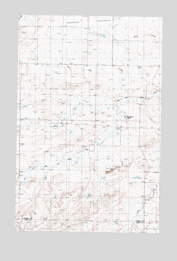
Lone Man Coulee West, MT USGS Topographic Map
Click on map above to begin viewing in our Map Viewer.

This topographic map contains these locations and features:
Feature Name Type Latitude Longitude GNIS ID View Map
28N06W03CBBC01 WellWellN48.2077°W112.3720°1634121View Map
Armstrong RanchLocaleN48.1744°W112.3120°768341View Map
Black ButtesSummitN48.1627°W112.2870°768932View Map
Broten (historical)LocaleN48.1889°W112.3731°1748805View Map
Frances HeightsBenchN48.2475°W112.3048°771597View Map
Gundlach Post Office (historical)Post OfficeN48.1991°W112.2684°1748795View Map
Hall RanchLocaleN48.1927°W112.2825°772090View Map
Hubbard MineMineN48.1764°W112.2700°772596View Map
Kellogg MineMineN48.1636°W112.2589°772964View Map
Miami Colony SchoolSchoolN48.1914°W112.2814°1748828View Map
Middle Fork Dry Fork Marias RiverStreamN48.1605°W112.3598°787269View Map
New Miami ColonyPopulated PlaceN48.1919°W112.2823°805913View Map
North Fork Dry Fork Marias RiverStreamN48.1964°W112.2917°774742View Map
Oak Ridge DamDamN48.1283°W112.2892°798453View Map
Oertel MineMineN48.1591°W112.2623°774912View Map
Redbridge School (historical)SchoolN48.2072°W112.2867°775667View Map
South Fork Dry Fork Marias RiverStreamN48.1616°W112.3606°776822View Map
Widower DamDamN48.2350°W112.3025°798471View Map

Note: Coordinates in the location and feature list above are referenced to NAD83 datum.


Copyright (C) 2008-2024 Ryan Niemi / Sunset Dynamics ... All Rights Reserved