TopoQuest Logo
Do you find TopoQuest useful?
Help keep TopoQuest running and adding new maps/features by donating!
Bitcoin:  19c7KJd3qBynnjoSw5npx9KScwjBe4ifkT
Litecoin:  LXs6TkuXGGXo1vDsWCkWVdjQX94eUKd6ui
Home View Maps Find Maps Find Places Resources & Links


Kuka Crossing, Montana Topographic Map

USGS Map Title: Kuka Crossing, MT
USGS Map MRC: 48112C4
DRG (GeoTIFF) Download: o48112c4.tif


Neighboring USGS Topographic Map Quads:


  Rocky Ridge, MT  
48112D5
 

  Flag Butte, MT  
48112D4
 

  Rock City, MT  
48112D3
 

  Robere, MT  
48112C5
 

  Kuka Crossing, MT  
48112C4
 

  Valier West, MT  
48112C3
 

  Dupuyer West, MT  
48112B5
 

  Dupuyer East, MT  
48112B4
 

  Lone Man Coulee West, MT  
48112B3


Map MRC Location:

N49°
W113°
N49°
W112°
H8 H7 H6 H5 H4 H3 H2 H1
G8 G7 G6 G5 G4 G3 G2 G1
F8 F7 F6 F5 F4 F3 F2 F1
E8 E7 E6 E5 E4 E3 E2 E1
D8 D7 D6 D5 D4 D3 D2 D1
C8 C7 C6 C5 C4 C3 C2 C1
B8 B7 B6 B5 B4 B3 B2 B1
A8 A7 A6 A5 A4 A3 A2 A1
N48°
W113°
N48°
W112°

Kuka Crossing, MT USGS 1:24K Topographic Map Preview:
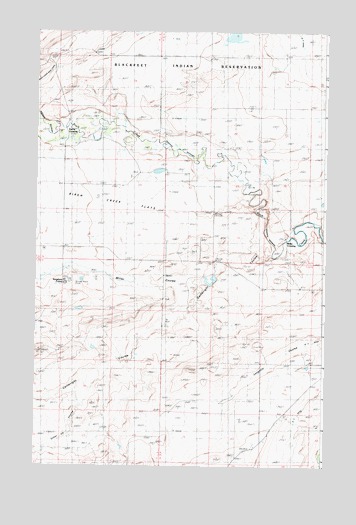
Kuka Crossing, MT USGS Topographic Map
Click on map above to begin viewing in our Map Viewer.

This topographic map contains these locations and features:
Feature Name Type Latitude Longitude GNIS ID View Map
Aubrey CrossingPopulated PlaceN48.3378°W112.4112°768393View Map
B Four DitchCanalN48.2636°W112.3875°805917View Map
Bartley RanchLocaleN48.3644°W112.4292°768536View Map
Birch Creek FlatsFlatN48.3283°W112.4889°768868View Map
Birch Creek School (historical)SchoolN48.3130°W112.4881°768873View Map
Cartwright CouleeValleyN48.3103°W112.3978°769635View Map
Collins RanchLocaleN48.3147°W112.4445°770035View Map
Grand View School (historical)SchoolN48.3455°W112.4034°771906View Map
Hubbard RanchLocaleN48.2803°W112.4092°772597View Map
Kingsbury ColonyPopulated PlaceN48.3028°W112.4875°805918View Map
Kingsbury Colony SchoolSchoolN48.3022°W112.4870°1748829View Map
Kuka CrossingPopulated PlaceN48.3139°W112.3931°773147View Map
Kuka RanchLocaleN48.3161°W112.3928°773148View Map
Lauffer RanchLocaleN48.3083°W112.4850°773252View Map
Miller CouleeValleyN48.3080°W112.4870°774240View Map
Moser RanchLocaleN48.2816°W112.3845°774408View Map
Pierce CrossingPopulated PlaceN48.3475°W112.4898°775215View Map
Pierce RanchLocaleN48.3511°W112.4867°775216View Map
Pondera ColonyPopulated PlaceN48.2605°W112.3925°1748785View Map
Pondera Colony SchoolSchoolN48.2597°W112.3925°1748826View Map
Ryan RanchLocaleN48.3089°W112.4234°776038View Map
Sober Up CouleeValleyN48.2722°W112.4806°768085View Map
Twentytwo K CanalCanalN48.3647°W112.3848°805920View Map
Wheeler RanchLocaleN48.3208°W112.4881°778342View Map
Wolstad RanchLocaleN48.3639°W112.4000°778661View Map

Note: Coordinates in the location and feature list above are referenced to NAD83 datum.


Copyright (C) 2008-2025 Ryan Niemi / Sunset Dynamics ... All Rights Reserved