TopoQuest Logo
Do you find TopoQuest useful?
Help keep TopoQuest running and adding new maps/features by donating!
Bitcoin:  19c7KJd3qBynnjoSw5npx9KScwjBe4ifkT
Litecoin:  LXs6TkuXGGXo1vDsWCkWVdjQX94eUKd6ui
Home View Maps Find Maps Find Places Resources & Links


Longstreet, Louisiana Topographic Map

USGS Map Title: Longstreet, LA
USGS Map MRC: 32093A8
DRG (GeoTIFF) Download: o32093a8.tif


Neighboring USGS Topographic Map Quads:


  Old Panola, TX  
32094B1
 

  Keatchie, LA  
32093B8
 

  Gloster, LA  
32093B7
 

  Galloway, TX  
32094A1
 

  Longstreet, LA  
32093A8
 

  Grand Cane, LA  
32093A7
 

  Logansport West, LA  
31094H1
 

  Logansport East, LA  
31093H8
 

  Hunter, LA  
31093H7


Map MRC Location:

N33°
W94°
N33°
W93°
H8 H7 H6 H5 H4 H3 H2 H1
G8 G7 G6 G5 G4 G3 G2 G1
F8 F7 F6 F5 F4 F3 F2 F1
E8 E7 E6 E5 E4 E3 E2 E1
D8 D7 D6 D5 D4 D3 D2 D1
C8 C7 C6 C5 C4 C3 C2 C1
B8 B7 B6 B5 B4 B3 B2 B1
A8 A7 A6 A5 A4 A3 A2 A1
N32°
W94°
N32°
W93°

Longstreet, LA USGS 1:24K Topographic Map Preview:
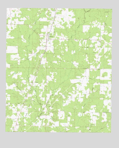
Longstreet, LA USGS Topographic Map
Click on map above to begin viewing in our Map Viewer.

This topographic map contains these locations and features:
Feature Name Type Latitude Longitude GNIS ID View Map
Bethel ChurchChurchN32.0029°W93.8999°553617View Map
Bethel United Methodist ChurchChurchN32.0171°W93.9269°553618View Map
Bushneck BayouStreamN32.0193°W93.9574°553842View Map
Chreene CemeteryCemeteryN32.0060°W93.9018°539537View Map
Cool Springs SchoolSchoolN32.0703°W93.9825°2462764View Map
Dona (historical)Populated PlaceN32.0204°W93.8763°545620View Map
FunstonPopulated PlaceN32.0499°W93.9691°535142View Map
Gamble CemeteryCemeteryN32.1215°W93.8793°554503View Map
Israelite ChurchChurchN32.0857°W93.9052°535966View Map
Logansport Elementary SchoolSchoolN32.0017°W93.9926°545636View Map
Logansport High SchoolSchoolN32.0018°W93.9925°545635View Map
Logansport Oil and Gas FieldOilfieldN32.0343°W93.9732°536660View Map
LongstreetPopulated PlaceN32.0977°W93.9521°536719View Map
Longstreet Rosenwald School (historical)SchoolN32.1216°W93.9424°541224View Map
Maple Springs Baptist ChurchChurchN32.0074°W93.9874°555230View Map
Mount Zion CemeteryCemeteryN32.0288°W93.9832°537423View Map
Mount Zion United Methodist ChurchChurchN32.0316°W93.9777°555419View Map
New Friendship ChurchChurchN32.0207°W93.8844°555469View Map
New Zion ChurchChurchN32.0510°W93.9685°541223View Map
Parish Governing Authority District 1BCivilN32.0064°W93.9883°1929865View Map
Pleasant Grove Church (historical)ChurchN32.1166°W93.9957°541225View Map
Rochelle BayouStreamN32.1213°W93.9063°538656View Map
SmyrnaPopulated PlaceN32.0921°W93.8888°545663View Map
Smyrna ChurchChurchN32.0916°W93.8891°539451View Map
Union CemeteryCemeteryN32.0810°W93.8943°540083View Map
Union Vine Baptist ChurchChurchN32.0424°W93.9719°556303View Map
Village of LongstreetCivilN32.0976°W93.9505°2407492View Map
Wood SpringsPopulated PlaceN32.0646°W93.9049°545740View Map
Wood Springs ChurchChurchN32.0646°W93.9049°540516View Map
Zion ChurchChurchN32.0029°W93.9902°540595View Map

Note: Coordinates in the location and feature list above are referenced to NAD83 datum.


Copyright (C) 2008-2025 Ryan Niemi / Sunset Dynamics ... All Rights Reserved