TopoQuest Logo
Do you find TopoQuest useful?
Help keep TopoQuest running and adding new maps/features by donating!
Bitcoin:  19c7KJd3qBynnjoSw5npx9KScwjBe4ifkT
Litecoin:  LXs6TkuXGGXo1vDsWCkWVdjQX94eUKd6ui
Home View Maps Find Maps Find Places Resources & Links


Logansport West, Louisiana Topographic Map

USGS Map Title: Logansport West, LA
USGS Map MRC: 31094H1
DRG (GeoTIFF) Download: o31094h1.tif


Neighboring USGS Topographic Map Quads:


  Old Center, TX  
32094A2
 

  Galloway, TX  
32094A1
 

  Longstreet, LA  
32093A8
 

  Tenaha East, TX  
31094H2
 

  Logansport West, LA  
31094H1
 

  Logansport East, LA  
31093H8
 

  Center, TX  
31094G2
 

  Shelbyville, TX  
31094G1
 

  Huxley, TX  
31093G8


Map MRC Location:

N32°
W95°
N32°
W94°
H8 H7 H6 H5 H4 H3 H2 H1
G8 G7 G6 G5 G4 G3 G2 G1
F8 F7 F6 F5 F4 F3 F2 F1
E8 E7 E6 E5 E4 E3 E2 E1
D8 D7 D6 D5 D4 D3 D2 D1
C8 C7 C6 C5 C4 C3 C2 C1
B8 B7 B6 B5 B4 B3 B2 B1
A8 A7 A6 A5 A4 A3 A2 A1
N31°
W95°
N31°
W94°

Logansport West, LA USGS 1:24K Topographic Map Preview:
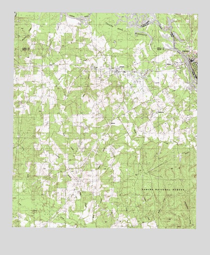
Logansport West, LA USGS Topographic Map
Click on map above to begin viewing in our Map Viewer.

This topographic map contains these locations and features:
Feature Name Type Latitude Longitude GNIS ID View Map
Brushy CreekStreamN31.8868°W94.1080°1353052View Map
Cedar BranchStreamN31.9721°W94.0721°1354034View Map
City of JoaquinCivilN31.9659°W94.0505°2410143View Map
Connell CreekStreamN31.9993°W94.0896°1373181View Map
Crystal LakeReservoirN31.9683°W94.0719°1355451View Map
Crystal Lake DamDamN31.9702°W94.0585°1864179View Map
De Soto Fire District 1BuildingN31.9757°W94.0032°2672810View Map
Doe CreekStreamN31.8768°W94.0794°1356110View Map
Family Worship CenterChurchN31.9713°W94.0024°545619View Map
FellowshipPopulated PlaceN31.9379°W94.0319°1379761View Map
First United Methodist ChurchChurchN31.9707°W94.0010°557909View Map
HaslamPopulated PlaceN31.9674°W94.0271°1379906View Map
Hewitt CampLocaleN31.9946°W94.0724°1359099View Map
JacksonPopulated PlaceN31.9341°W94.0599°1379994View Map
JoaquinPopulated PlaceN31.9657°W94.0538°1360274View Map
Joaquin City HallBuildingN31.9669°W94.0549°2753782View Map
Joaquin Post OfficePost OfficeN31.9653°W94.0508°2731882View Map
Joaquin Volunteer Fire DepartmentBuildingN31.9667°W94.0555°2655273View Map
Johnson CemeteryCemeteryN31.9452°W94.0102°1360321View Map
Jumping Branch CreekStreamN31.8768°W94.0791°1360467View Map
Logansport Town Police DepartmentBuildingN31.9734°W94.0051°2755325View Map
Lone Cedar ChurchChurchN31.8818°W94.0574°1361641View Map
Morris CreekStreamN31.9957°W94.0452°1363161View Map
Ox BranchStreamN31.9232°W94.0049°1364648View Map
Pine Ridge ChurchChurchN31.9182°W94.1021°1365306View Map
Tenaha-Joaquin DivisionCivilN31.9214°W94.1098°1939254View Map
Truitt CemeteryCemeteryN31.8977°W94.1041°1370159View Map
Whiddon Lake DamDamN31.9702°W94.0719°1854861View Map

Note: Coordinates in the location and feature list above are referenced to NAD83 datum.


Copyright (C) 2008-2025 Ryan Niemi / Sunset Dynamics ... All Rights Reserved