TopoQuest Logo
Do you find TopoQuest useful?
Help keep TopoQuest running and adding new maps/features by donating!
Bitcoin:  19c7KJd3qBynnjoSw5npx9KScwjBe4ifkT
Litecoin:  LXs6TkuXGGXo1vDsWCkWVdjQX94eUKd6ui
Home View Maps Find Maps Find Places Resources & Links


Lonoak, California Topographic Map

USGS Map Title: Lonoak, CA
USGS Map MRC: 36120C8
DRG (GeoTIFF) Download: o36120c8.tif


Neighboring USGS Topographic Map Quads:


  Topo Valley, CA  
36121D1
 

  Rock Spring Peak, CA  
36120D8
 

  Hernandez Reservoir, CA  
36120D7
 

  Pinalito Canyon, CA  
36121C1
 

  Lonoak, CA  
36120C8
 

  Hepsedam Peak, CA  
36120C7
 

  San Lucas, CA  
36121B1
 

  Nattrass Valley, CA  
36120B8
 

  Monarch Peak, CA  
36120B7


Map MRC Location:

N37°
W121°
N37°
W120°
H8 H7 H6 H5 H4 H3 H2 H1
G8 G7 G6 G5 G4 G3 G2 G1
F8 F7 F6 F5 F4 F3 F2 F1
E8 E7 E6 E5 E4 E3 E2 E1
D8 D7 D6 D5 D4 D3 D2 D1
C8 C7 C6 C5 C4 C3 C2 C1
B8 B7 B6 B5 B4 B3 B2 B1
A8 A7 A6 A5 A4 A3 A2 A1
N36°
W121°
N36°
W120°

Lonoak, CA USGS 1:24K Topographic Map Preview:
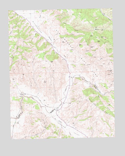
Lonoak, CA USGS Topographic Map
Click on map above to begin viewing in our Map Viewer.

This topographic map contains these locations and features:
Feature Name Type Latitude Longitude GNIS ID View Map
Bitterwater CreekStreamN36.3097°W120.9235°239369View Map
Bitterwater LakeLakeN36.3736°W120.9871°239370View Map
Bitterwater ValleyValleyN36.3111°W120.9241°239374View Map
Cholla CreekStreamN36.3330°W120.9416°240579View Map
De Alvarez CreekStreamN36.3164°W120.9277°241299View Map
De Alvarez RanchLocaleN36.3105°W120.9169°1670163View Map
Dixon CanyonValleyN36.3480°W120.9494°241519View Map
Eagle MountainSummitN36.3244°W120.9507°241710View Map
Fourth of July SpringSpringN36.3153°W120.8776°242418View Map
Fox SpringSpringN36.3546°W120.8875°242424View Map
Greentree SpringSpringN36.3377°W120.9033°243016View Map
Hidden SpringSpringN36.3430°W120.8908°243424View Map
Lake TanganyikaLakeN36.3549°W120.8979°250252View Map
Lewis CreekStreamN36.2805°W120.9641°244761View Map
Ligs SpringSpringN36.3429°W120.9369°244790View Map
LonoakPopulated PlaceN36.2775°W120.9430°1660942View Map
Morellini CreekStreamN36.3647°W120.9627°246187View Map
Peachtree ValleyValleyN36.2736°W120.9527°247328View Map
Sulphur SpringSpringN36.3473°W120.8902°250057View Map
Sulphur SpringsSpringN36.2932°W120.9846°1661520View Map
Trough SpringSpringN36.3492°W120.9001°250639View Map
Tully CreekStreamN36.3475°W120.9488°250688View Map
Tully HallLocaleN36.3089°W120.9252°250689View Map
Tully MountainSummitN36.3569°W120.8971°1661587View Map
Willow SpringSpringN36.3403°W120.9169°251649View Map
Yaqui CanyonValleyN36.3019°W120.9049°251842View Map

Note: Coordinates in the location and feature list above are referenced to NAD83 datum.


Copyright (C) 2008-2025 Ryan Niemi / Sunset Dynamics ... All Rights Reserved